| During the month of April, Mark Miller will donate $75 to the charity of your choice (5 to chose from, including the Utah Avalanche Center!) Mark Miller Subaru has raised over $300k in the previous 6 Do Good Feel Good events. More Info here |  |
| During the month of April, Mark Miller will donate $75 to the charity of your choice (5 to chose from, including the Utah Avalanche Center!) Mark Miller Subaru has raised over $300k in the previous 6 Do Good Feel Good events. More Info here | |
| Advisory: Logan Area Mountains | Issued by Toby Weed for Wednesday - December 17, 2014 - 7:08am |
|---|

|
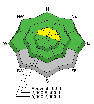
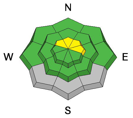
bottom line The danger is LOW and avalanches are unlikely on most slopes in the backcountry, but there are also pockets with a MODERATE (level 2) danger on drifted slopes at upper elevations. Heightened avalanche conditions exist and you could trigger wind slab avalanches in some areas.
|
 |
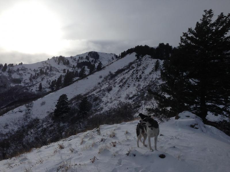
current conditions There's another inch of new snow at the 8400' Tony Grove Snotel from yesterday, with 35 inches of total snow containing 94% of average water for the date, and it's 23 degrees. The CSI Logan Peak weather station reports 10 mph southwest winds and 18 degrees. You'll find shallow fresh snow on hard crusts at lower and mid elevations, but sheltered shady slopes up high, especially those with soft re-crystallized underlying snow, offer reasonably nice, fast shallow powder conditions. Upper elevation terrain in the central Bear River Range has decent coverage and mostly supportable snow. Outlying terrain like the Wellsville Range and the Front Canyons have less coverage, with access issues due to lack of lower elevation snow. The Tony Grove and Franklin Basin Roads are not maintained for wheeled travel in the winter!
We found very shallow snow and difficult, brushy traveling in the Wellsville Mountain Wilderness yesterday. (12-16-14) Everyone needs to carry a shovel, probe, and transceiver. Be sure your rescue gear is functioning by practicing with it. You can bury your pack with your transceiver in it and have your partner find, probe, and excavate it. Then get them to do the same for you. Training your team is critical in this game. +++ Quick and Easy Avalanche Rescue Practice Video............... ***HERE
|
 |
recent activity A skier remote triggered a wind slab on a slope that had avalanched previously in the Central Wasatch, and a natural wind slab avalanche was spotted in the Western Uintas. Otherwise, it's been pretty quiet in the backcountry. Visit our Backcountry Observations Page for more information.....
|
| type | aspect/elevation | characteristics |
|---|

|
|
LIKELIHOOD
 LIKELY
UNLIKELY
SIZE
 LARGE
SMALL
TREND
 INCREASING DANGER
SAME
DECREASING DANGER
|
|
description
Avoid obvious and potential wind slabs at upper elevations on the lee side of major ridge-lines, in and around terrain features like gullies or rock outcroppings, below cliff-bands, or near cross-loaded sub-ridges. These should be shallow, in the foot deep or less range, and generally manageable. But, some could be harder and less forgiving, perhaps allowing you to get out on them before releasing. In shallow early season conditions like these, a ride in even a small avalanche could have a bad outcome.
|
 |
weather It'll be mostly cloudy today, with 8500' high temperatures around 30 degrees and moderate southwest wind. There's a chance for some light snow tomorrow, with calm to very light winds expected, but little in the way of accumulation. The weather pattern is showing sign of a change, and we could see some accumulations beginning Sunday, and there is potential for a White Christmas with a couple models hinting at a stronger Pacific Storm on Wednesday. Check out our one-stop weather page........HERE
|
| general announcements You can now receive advisories by email for each region in the state including Logan. Go here for details. Get your advisory on your iPhone along with great navigation and rescue tools....... Utah Avalanche Center mobile app Please submit snow and avalanche observations from your ventures in the backcountry HERE. You can call us at 801-524-5304 or email HERE, or include #utavy in your Instagram or Tweet us @UAClogan. To report avalanche activity in the Logan Area or to contact the local avalanche forecaster call me, Toby, at 435-757-7578. I'll regularly update this advisory on Monday, Wednesday, Friday, and Saturday mornings by about 7:30. This advisory is produced by the U.S.D.A. Forest Service, which is solely responsible for its content. It describes only general avalanche conditions and local variations always exist. |


_1.jpg)