| During the month of April, Mark Miller will donate $75 to the charity of your choice (5 to chose from, including the Utah Avalanche Center!) Mark Miller Subaru has raised over $300k in the previous 6 Do Good Feel Good events. More Info here |  |
| During the month of April, Mark Miller will donate $75 to the charity of your choice (5 to chose from, including the Utah Avalanche Center!) Mark Miller Subaru has raised over $300k in the previous 6 Do Good Feel Good events. More Info here | |
| Advisory: Logan Area Mountains | Issued by Toby Weed for Wednesday - December 3, 2014 - 6:49am |
|---|

|
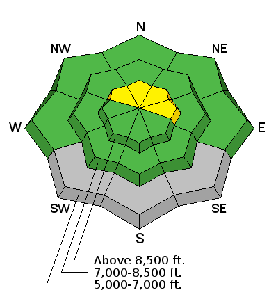
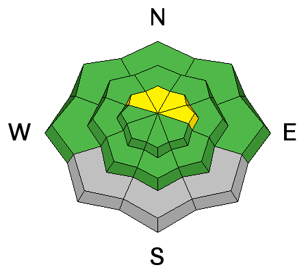
bottom line There's a LOW (level 1) danger and the snow is stable on most slopes in the Logan Zone. Exceptions and pockets of heightened or MODERATE (level 2) danger can be found on some drifted upper elevation slopes and in isolated or outlying areas with poor snow structure. Fresh accumulations and drifting may cause the danger to rise during the day today. Evaluate the snow and terrain carefully, continue to use safe travel protocols, and practice regularly with your rescue equipment.
|
 |
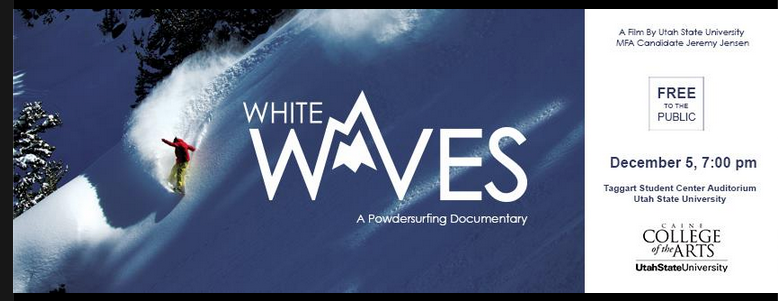
special announcement Come check out White Waves----A free screening for Jeremy Jensen's MFA Film Project. Friday 7:00 - 9:00 at the Taggart Student Center at Utah State University
|
 |
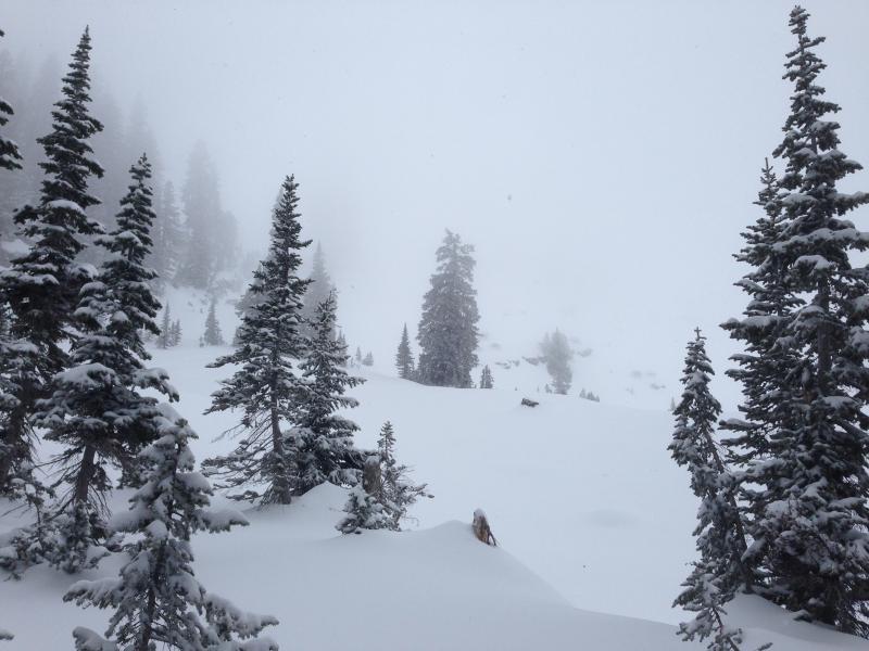
current conditions With an inch of new snow this morning at the 8400' Tony Grove Snotel, it's 29 degrees and there's 38 inches of total snow containing 147% of average water for the date. The 9700' CSI Logan Peak weather station is recording south winds averaging around 20 mph. We're seeing fairly good stability locally. There's a few inches of powder capping a widespread solid crust from the pre-Thanksgiving rime and warmth. The coverage is quite good above around 8000', with the heavy snows from November nicely filling in the rocky terrain... There's around three feet of fairly dense snow and then the solid and mostly supportable crust. You can ride just about anywhere without sinking in too deeply, but we found ascending difficult because of the slippery crust.
We found good coverage but poor visibility in Steep Hollow on Monday Be sure your rescue gear is functioning by practicing with it, and force your partners to join in. It is they who will be your best bet for survival if you get caught in an avalanche. The Tony Grove road is not maintained for wheeled travel in the winter!
|
 |
recent activity No recent avalanches to report in the Logan Zone.... Visit our Backcountry Observations Page for details
|
| type | aspect/elevation | characteristics |
|---|

|
|
LIKELIHOOD
 LIKELY
UNLIKELY
SIZE
 LARGE
SMALL
TREND
 INCREASING DANGER
SAME
DECREASING DANGER
|
|
description
Although certainly not widespread, pockets with heightened avalanche conditions exist, and triggered wind slab avalanches are possible in exposed upper elevation terrain. Avoid recent deposits of drifted snow on the lee side of major ridges and areas where snow has been deposited into gullies or below cliff bands by the recent strong winds. There also may be very steep isolated slopes on the highest peaks where one could trigger a deeper persistent slab avalanche. The highest smooth slopes with snow cover in early November are suspect, but we've found a few shallower areas at upper elevations with weak sugary or faceted snow.
|
 |
weather We'll see snow today, with 2 to 4 inches of accumulation, high temperatures around 8500' of 34 degrees, and 10 to 20 mph west-southwest winds on the ridges. Snow will resume overnight, with another inch or so possible. Expect mostly cloudy conditions and continuing snow showers tomorrow, but again only an inch or so forecast. Looks like the sun may poke out of the clouds for a bit on Friday. Check out our one-stop weather page........HERE
|
| general announcements Thanks for coming to our Pray for Snow fundraiser. You made the party a huge success! Backcountry 101 Avalanche Class coming up! Register now for our first on-snow class of the season. Thursday evening December 11 and all day Saturday December 13. The season is upon us and the time is now to learn how to stay safe in the backcountry. http://utahavalanchecenter.org/classes/backcountry-101-4 NEW THIS YEAR: You can now receive advisories by email for each region in the state. Go here for details. Utah Avalanche Center mobile app - Get your advisory on your iPhone along with great navigation and rescue tools. Follow us at UAClogan on Twitter Remember your information can save lives. If you see anything we should know about, please participate in the creation of our own community avalanche advisory by submitting snow and avalanche conditions. You can also call us at 801-524-5304 or 800-662-4140, email by clicking HERE, or include #utavy in your Instagram. To report avalanche activity in the Logan Area or to contact the local avalanche forecaster call me, Toby at 435-757-7578. I'll regularly update this advisory on Monday, Wednesday, Friday, and Saturday mornings by about 7:30.... This advisory is produced by the U.S.D.A. Forest Service, which is solely responsible for its content. It describes only general avalanche conditions and local variations always exist. |


_1.jpg)