| During the month of April, Mark Miller will donate $75 to the charity of your choice (5 to chose from, including the Utah Avalanche Center!) Mark Miller Subaru has raised over $300k in the previous 6 Do Good Feel Good events. More Info here |  |

For every car Mark MIller Subaru sells in April, they will donate $75 to the charity of your choice (5 to choose from). Who are you going to choose? Plus - you can vote for your favorite and the 3 groups receiving the most votes get an additional cash prize donated by Mark Miller Subaru. Details here

| During the month of April, Mark Miller will donate $75 to the charity of your choice (5 to chose from, including the Utah Avalanche Center!) Mark Miller Subaru has raised over $300k in the previous 6 Do Good Feel Good events. More Info here |  |
| Advisory: Logan Area Mountains | Issued by Toby Weed for Monday - November 17, 2014 - 5:56am |
|---|
 |
special announcement We look forward to seeing you at our annual fundraiser party at the Italian Place in Logan on December 3... We are offering a free "Know Before You Go" avalanche awareness talk Saturday, November 22 at 2:00 at Buttar's Tractor in Tremonton. |
 |
current conditions There's 24 inches of total snow this morning with a temperature of 7 degrees at the 8400' Tony Grove Snotel. There's a light north wind and it's 11 degrees ay 9700' atop Logan Peak. The fresh snow from Friday is sitting directly on cold dirt in most places, since there really wasn't any snow on the ground earlier last week. All elevations in the Central Bear River Range picked up a good bit of snow, and folks are finding pretty good early season riding conditions. The Tony Grove road is not maintained for wheeled travel in the winter, and numerous people got stuck in deep snow up there over the weekend. You can find good road and and open meadow riding up high, but remember the new snow is all we have, no base! We found good powder turning and sledding conditions up on Beaver Mountain yesterday, and I only hit one rock! Lyti found some good powder riding conditions at Beaver Mountain yesterday.
|
 |
recent activity No avalanches were yet reported this season in the Logan Zone, but it was active in the Wasatch over the weekend... A party triggered several audible collapses in the Tony Grove Area on Saturday, with new snow instability the likely culprit. Visit our Backcountry Observations Page for details
|
| type | aspect/elevation | characteristics |
|---|


|


|

LIKELIHOOD
 LIKELY
UNLIKELY
SIZE
 LARGE
SMALL
TREND
 INCREASING DANGER
SAME
DECREASING DANGER
|
|
description
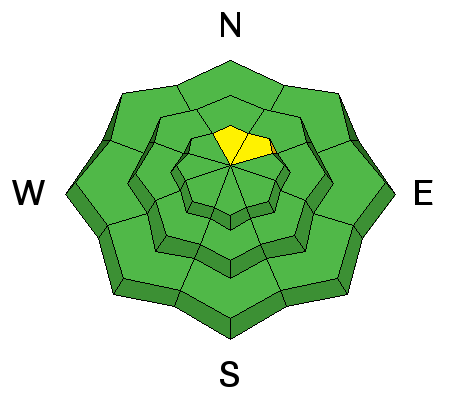
Persistent slab avalanches are possible on steep slopes with preexisting snow, especially in smooth upper elevation terrain. |
| type | aspect/elevation | characteristics |
|---|


|


|

LIKELIHOOD
 LIKELY
UNLIKELY
SIZE
 LARGE
SMALL
TREND
 INCREASING DANGER
SAME
DECREASING DANGER
|
|
description
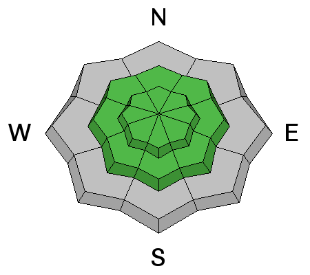
We all need an early season rescue equipment shakedown. Replace the batteries in your beacon and check to make sure your shovel and probe are operational. Practice simple rescue scenarios in the shallow snow and force your partners to partake. Practice is required and you can and should work training into early season snow play...
|
 |
weather Check out our one-stop weather page........HERE |
| general announcements We are offering a free "Know Before You Go" avalanche awareness talk Saturday, November 22 at 2:00 at Buttar's Tractor in Tremonton. Utah Avalanche Center mobile app - Get your advisory on your iPhone along with great navigation and rescue tools. Remember your information can save lives. If you see anything we should know about, please participate in the creation of our own community avalanche advisory by submitting snow and avalanche conditions. You can also call us at 801-524-5304 or 800-662-4140, email by clicking HERE, or include #utavy in your tweet or Instagram. Follow us at UAClogan on Twitter This advisory is produced by the U.S.D.A. Forest Service, which is solely responsible for its content. It describes only general avalanche conditions and local variations always exist. |
Advisory Hotline: (888) 999-4019 | Contact Information