
| During the month of April, Mark Miller will donate $75 to the charity of your choice (5 to chose from, including the Utah Avalanche Center!) Mark Miller Subaru has raised over $300k in the previous 6 Do Good Feel Good events. More Info here |  |
| During the month of April, Mark Miller will donate $75 to the charity of your choice (5 to chose from, including the Utah Avalanche Center!) Mark Miller Subaru has raised over $300k in the previous 6 Do Good Feel Good events. More Info here | |
| Advisory: Logan Area Mountains | Issued by Toby Weed for Sunday - April 6, 2014 - 7:01am |
|---|

|
bottom line Mostly stable conditions exist, avalanches are generally unlikely, and there's a LOW or level 1 danger in the backcountry this morning. Even so, triggered cornice falls and wind slab avalanches are possible on drifted upper elevation slopes. Sun and warming will create heightened conditions and the danger will rise to MODERATE or level 2 this afternoon. Wet avalanches will be possible during the warmth of midday. Evaluate the snow and terrain carefully.
|
 |
special announcement
|
 |
current conditions The Tony Grove Snotel at 8400' reports one inch of new snow from yesterday. It's 26 degrees and there's 109 inches of total snow, with 132% of average water content for the date. It's 19 degrees at the 9700' CSI Logan Peak weather station, and I'm currently reading 11 mph northwest winds.
|
 |
recent activity Observers on Wednesday spotted a small natural wind slab release in the Goalpost area in Upper Dry Canyon. No other avalanches were reported locally. Visit our Backcountry Observations Page for details on the season's activity.
|
| type | aspect/elevation | characteristics |
|---|

|
|
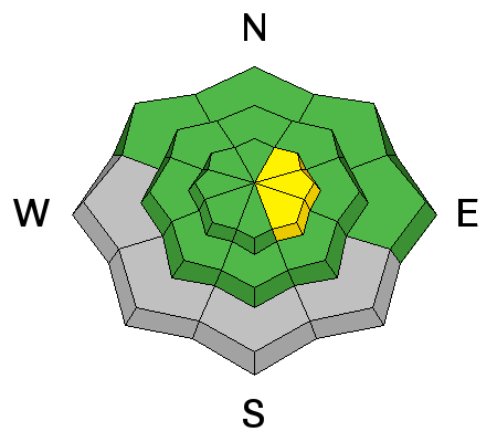
LIKELIHOOD
 LIKELY
UNLIKELY
SIZE
 LARGE
SMALL
TREND
 INCREASING DANGER
SAME
DECREASING DANGER
|
description
|
| type | aspect/elevation | characteristics |
|---|

|
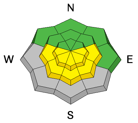
|
LIKELIHOOD
LIKELY
UNLIKELY
SIZE
LARGE
SMALL
TREND
INCREASING DANGER
SAME
DECREASING DANGER
|
|
description
Direct sun and warming will cause a heightened avalanche danger on steep slopes today. Avoid steep slopes with saturated surface snow.
|
 |
weather We'll see some snow in the mountains today, with increasing west winds and 8500' high temperatures pushing 33 degrees. 1 to 3 inches of accumulation is possible by evening. Snow showers are possible tonight, with low temperatures around 25 degrees and decreasing wind. Much warmer temperatures and lots of sunshine are expected in the next few days, with 41 degrees the high at 8500' tomorrow, and 51 degrees forecast for Tuesday. We will be monitoring this significant warm-up and expect an increasing avalanche danger in the backcountry. Check out our one-stop weather page........HERE |
| general announcements Utah Avalanche Center mobile app - Get your advisory on your iPhone along with great navigation and rescue tools. Remember your information can save lives. If you see anything we should know about, please participate in the creation of our own community avalanche advisory by submitting snow and avalanche conditions. You can also call us at 801-524-5304 or 800-662-4140, email by clicking HERE, or include #utavy in your tweet or Instagram. Follow us at UAClogan on Twitter I'll issue weekend and intermittent advisories through April. This advisory is produced by the U.S.D.A. Forest Service, which is solely responsible for its content. It describes only general avalanche conditions and local variations always exist. |


_1.jpg)
