| During the month of April, Mark Miller will donate $75 to the charity of your choice (5 to chose from, including the Utah Avalanche Center!) Mark Miller Subaru has raised over $300k in the previous 6 Do Good Feel Good events. More Info here |  |
| During the month of April, Mark Miller will donate $75 to the charity of your choice (5 to chose from, including the Utah Avalanche Center!) Mark Miller Subaru has raised over $300k in the previous 6 Do Good Feel Good events. More Info here | |
| Advisory: Logan Area Mountains | Issued by Toby Weed for Monday - March 3, 2014 - 5:44am |
|---|

|
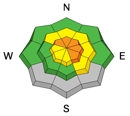
bottom line After picking up 2 to 3 feet of heavy new snow with strong winds over the weekend, there is a CONSIDERABLE or Level 3 danger on many steep slopes in the Logan Area backcountry. Dangerous deep slab avalanches, failing on weak persistent faceted layers near the bottom of the snowpack are possible in areas where the preexisting snow is shallow and weak. Triggered wind slab avalanches and large cornice falls are possible at upper elevations, and entraining wet sluffs are likely down lower. Careful snowpack evaluation, cautious route-finding, and conservative decision making will be essential for safe travel in the backcountry today.
|
 |
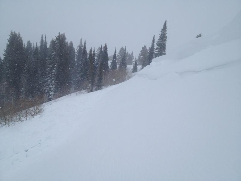
current conditions There is now more than ten feet of total snow at the 8400' Tony Grove Snotel, and the station picked up over three feet of snow and 6.2" of water equivalent since Thursday (2-27-2014). It's 30 degrees this morning, and with 5" of new snow overnight, there's 124 inches of total snow, containing 134% of average water content for the date. The 9700' CSI Logan Peak weather station reports 24 degrees and a rimed wind sensor. I'm reading westerly winds averaging in the teens and gusting into the twenties at the UDOT Hwy 89 Logan Summit, and overnight west-southwest winds on Mt. Ogden averaged in the mid 30s with gusts in the 40s. A couple feet of heavy snow fell over the weekend, and you can find pretty good powder conditions up high. The snow is quite moist and heavy down lower and in areas that heated up with brief sunny periods yesterday.
|
 |
recent activity
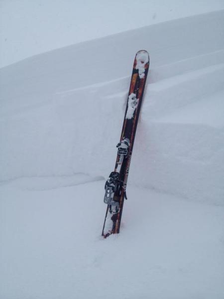
Unexpectedly large intentionally triggered avalanche on a small test slope in Franklin Basin, 3-1-2014. (Brodhead)
|
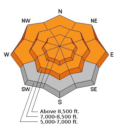
| type | aspect/elevation | characteristics |
|---|

|
|
LIKELIHOOD
 LIKELY
UNLIKELY
SIZE
 LARGE
SMALL
TREND
 INCREASING DANGER
SAME
DECREASING DANGER
|
|
description
Looks like the rapid accumulation of water weight (over 6" in some areas since Thursday locally) and significant drifting was enough to reactivate the dormant deeply buried persistent weak layers in some areas resulting in deep slab avalanche activity. The widespread weak snow is so deeply buried now in most areas that It would be difficult for us to trigger and avalanche, but there are some shallower areas where we might. Dangerous deep slab avalanches failing on faceted weak layers near the bottom of the snowpack are possible again today, especially on drifted upper and mid elevation slopes. Be especially cautious in shallow, rocky or previously wind scoured terrain. Deep slab avalanches might be triggered remotely, from a distance or below. Pay attention to potential red flags, especially whumpfing or audible collapses. |
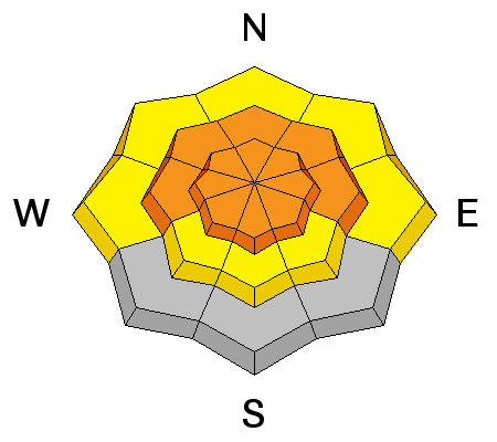
| type | aspect/elevation | characteristics |
|---|

|
|
LIKELIHOOD
 LIKELY
UNLIKELY
SIZE
 LARGE
SMALL
TREND
 INCREASING DANGER
SAME
DECREASING DANGER
|
|
description
Triggered wind slab avalanches, up to 2-feet-deep and large cornice-falls are possible in drifted terrain today. Watch for and avoid stiffer drifted snow or potential wind slabs on the lee sides of major ridge lines and in and around terrain features like rock outcroppings, sub-ridges and gullies. Avoid and stay out from under large and overhanging cornices along major ridge-lines, which are likely to break further back than you expect and might trigger avalanches on drifted slopes below.
|
| type | aspect/elevation | characteristics |
|---|

|
|
LIKELIHOOD
LIKELY
UNLIKELY
SIZE
LARGE
SMALL
TREND
INCREASING DANGER
SAME
DECREASING DANGER
|
|
description
Loose Wet Avalanches, entraining significant piles of saturated fresh snow are likely in steep mid and lower elevation terrain. Avoid and stay out from under steep slopes with saturated snow and be especially careful above trees, benches or other terrain traps that you could be dragged into. Easily triggered wet sluffs on mid-elevation test slopes in Providence Canyon. VIDEO |
 |
weather Snow showers are likely this morning and 8500' temperatures will climb to around 35 degrees. Expect west wind in the 15 to 20 mph range and 2 to 4 inches of accumulation is possible. It will snow tonight with 4 to 8 inches forecast, temperatures around 25 degrees. Expect continuing snow showers and perhaps a bit of thunder tomorrow with 20 mph west-northwest winds and 3 to 5 inches of accumulation forecast. We should see a bit of a break on Wednesday and another good shot of storminess on Thursday night. Check out our one-stop weather page........HERE |
| general announcements Campsaver and The Utah Avalanche Center in Logan are teaming up to give away a avalanche rescue kit - beacon, shovel and probe! Show Us You Know the Snow: US & Canadian avy groups have a challenge to sidecountry riders: Use your camera to tell a short video story about how your crew gets ready to safely ride beyond the resort boundary. Videos will be posted & promoted by GoPro & other partners. The contest will run till Mar 21. The winner will be determined by a combination of most views & an expert panel. Prizes include: 2 days at Monashee Powder Snowcats, 2 4-day Gold Passes to any US resort, a Backcountry Access Float 22 airbag, gear from Backcountry.com, editing help and support from Sherpas Cinema, & more. Winners will be announced in late March. . Details at knowthesnow.com Please share this with your friends A video look at a HUGE natural avalanche in the Wellsville Range, from 2-19-2014...........HERE Check out "Beaver Backside is the Backcountry," an Avalanche observation video from 2-16-2014 .....HERE A child's perspective on last week's natural wet avalanche above Zanavoo in Logan Canyon filmed on 2-17-2014 .......HERE Discount lift tickets are available at Backcountry.com - Thanks to Ski Utah and the Utah Resorts, including Beaver Mountain. All proceeds go towards paying for Utah Avalanche Center avalanche and mountain weather advisories. Utah Avalanche Center mobile app - Get your advisory on your iPhone along with great navigation and rescue tools. Remember your information can save lives. If you see anything we should know about, please participate in the creation of our own community avalanche advisory by submitting snow and avalanche conditions. You can also call us at 801-524-5304 or 800-662-4140, email by clicking HERE, or include #utavy in your tweet or Instagram. Follow us at UAClogan on Twitter I'll issue these advisories on Monday, Wednesday, Friday, and Saturday mornings. This advisory is produced by the U.S.D.A. Forest Service, which is solely responsible for its content. It describes only general avalanche conditions and local variations always exist. |


_1.jpg)