| During the month of April, Mark Miller will donate $75 to the charity of your choice (5 to chose from, including the Utah Avalanche Center!) Mark Miller Subaru has raised over $300k in the previous 6 Do Good Feel Good events. More Info here |  |
| During the month of April, Mark Miller will donate $75 to the charity of your choice (5 to chose from, including the Utah Avalanche Center!) Mark Miller Subaru has raised over $300k in the previous 6 Do Good Feel Good events. More Info here | |
| Advisory: Logan Area Mountains | Issued by Toby Weed for Thursday - February 27, 2014 - 3:23pm |
|---|

|
bottom line Heightened avalanche conditions exist and there's a MODERATE or Level 2 avalanche danger in the backcountry. You could trigger cornice falls and/or wind slab avalanches in drifted terrain at upper and mid elevations. It is still unlikely that you could trigger dangerous deep slab avalanches, but it's possible in steep terrain and deep slab avalanches might be triggered from shallower areas on the slab. Warming will create an increasing danger of wet avalanches in steep terrain where the surface snow becomes saturated. Evaluate the snow and terrain carefully, and continue to follow safe travel protocols.
|
 |
special announcement We have our last scheduled class of the season on Saturday March 1. "Essential Avalanche and Riding Skills for Snowmobilers" with the Utah Avalanche Center and ZBROS 9 am Providence Canyon snowmobile parking lot. Register online: http://utahavalanchecenter.org/classes/snowmobile-avalance-and-riding-skills-class or call 757-2794 for more info. |
 |
current conditions Overnight temperatures dropped to 29 degrees at the 8400' Tony Grove Snotel, and there's 97 inches of total snow, containing 118% of average water content for the date. The 9700' CSI Logan Peak weather station reports 26 degrees and average wind speeds in the lower to mid teens from the west this morning. You might find good powder riding conditions, especially up high on sheltered shady slopes, but sun and warmth in the past couple days damaged the powder in most areas. Relentless west southwest winds early in the week drifted lots of fresh snow into lee slope starting zones and formed some good sized cornices along the ridge tops.
|
 |
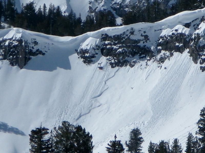
recent activity We observed a few natural wind slab avalanches and cornice falls in the backcountry in the past couple days, and a skier reports triggering 12-inch-deep wind slabs and sensitive cornice falls on test slopes in the Steam Mill Peak area yesterday.
A fresh natural wind slab avalanche off the south ridge of Magog on Monday 2-24-2014, likely triggered by cornice fall. Recent Videos: A video look at a HUGE natural avalanche in the Wellsville Range, from 2-19-2014...........HERE Check out "Beaver Backside is the Backcountry," an Avalanche observation video from 2-16-2014 .....HERE A child's perspective on last week's natural wet avalanche above Zanavoo in Logan Canyon filmed on 2-17-2014 .......HERE
|
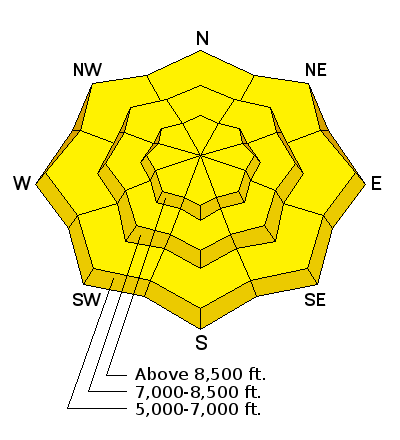
| type | aspect/elevation | characteristics |
|---|

|

|
LIKELIHOOD
 LIKELY
UNLIKELY
SIZE
 LARGE
SMALL
TREND
 INCREASING DANGER
SAME
DECREASING DANGER
|
|
description
Triggered wind slab avalanches and cornice falls are possible in upper elevation terrain exposed to drifting. Avoid recently formed cornices along ridge-lines, which are likely to break further back than you expect, and stiffer drifted snow or potential wind slabs on the lee sides of major ridge lines and in and around terrain features like rock outcroppings, sub-ridges and gullies.
It was still fairly easy to trigger wind slab avalanches on drifted upper elevation slopes yesterday. (Fels, 2-25-2014) |
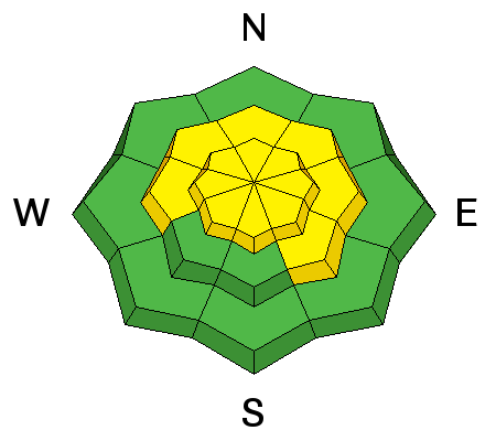
| type | aspect/elevation | characteristics |
|---|

|
|
LIKELIHOOD
 LIKELY
UNLIKELY
SIZE
 LARGE
SMALL
TREND
 INCREASING DANGER
SAME
DECREASING DANGER
|
|
description
Dangerous triggered deep slab avalanches failing on preexisting faceted weak layers at the bottom of the snowpack remain possible today, especially on drifted upper and mid elevation slopes that didn't naturally avalanche in the recent prolonged cycle. The deep slab instability associated with the weak faceted snow in the basal layers appears dormant currently, but warming temperatures and a bit of new load from the recent accumulations and sustained west winds could reawaken the dragon on some slopes. Be especially cautious in shallow, rocky terrain. Recently drifted and sun-warmed slopes with shallow overall snow cover are the most suspect, since shallow areas tend to harbor the weakest snow. You might trigger a deep slab from a shallower area on the slab.
|
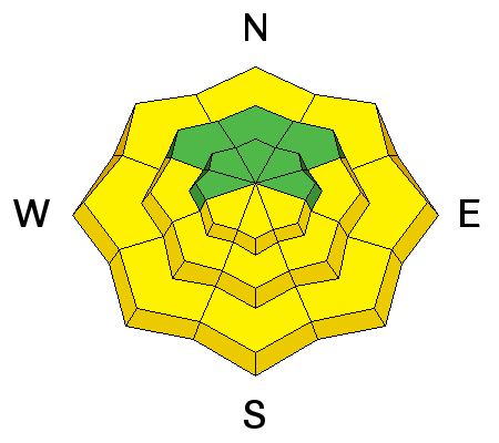
| type | aspect/elevation | characteristics |
|---|

|
|
LIKELIHOOD
 LIKELY
UNLIKELY
SIZE
LARGE
SMALL
TREND
 INCREASING DANGER
SAME
DECREASING DANGER
|
|
description
Wet avalanches, entraining significant piles of fresh snow, will again become increasingly likely as the day heats up, with solar warming and green-housing due to partial cloud cover the wildcard. Avoid steep slopes with saturated surface snow and be especially careful above trees or other terrain traps that you could be dragged into. |
 |
weather It'll be mostly sunny today with a chance of some snow in the afternoon. Expect moderate west winds and a high temperature at 8500' of around 36 degrees. It'll be mostly cloudy again tonight with a chance of some snow showers and low temperatures around 27 degrees. We'll see snowfall in the mountains tomorrow, with southwest winds, 8500' high temperatures around 34 degrees, and 1 to 3 inches of accumulation likely. Snow will continue Thursday night, with 3 to 5 inches of additional accumulation possible. Unsettled and showery weather is expected Friday, with a more powerful and productive storm expected on Saturday. Check out our one-stop weather page........HERE |
| general announcements Discount lift tickets are available at Backcountry.com - Thanks to Ski Utah and the Utah Resorts, including Beaver Mountain. All proceeds go towards paying for Utah Avalanche Center avalanche and mountain weather advisories. Utah Avalanche Center mobile app - Get your advisory on your iPhone along with great navigation and rescue tools. Remember your information can save lives. If you see anything we should know about, please participate in the creation of our own community avalanche advisory by submitting snow and avalanche conditions. You can also call us at 801-524-5304 or 800-662-4140, email by clicking HERE, or include #utavy in your tweet or Instagram. Follow us at UAClogan on Twitter I'll issue these advisories on Monday, Wednesday, Friday, and Saturday mornings. This advisory is produced by the U.S.D.A. Forest Service, which is solely responsible for its content. It describes only general avalanche conditions and local variations always exist. |


_1.jpg)