

| Advisory: Logan Area Mountains | Issued by Toby Weed for January 25, 2013 - 7:31am |
|---|


Above 8,500 ft.
7,000-8,500 ft.
5,000-7,000 ft.
|
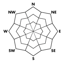
bottom line There is a CONSIDERABLE (or level 3) avalanche danger, dangerous avalanche conditions exist, and triggered wind slab avalanches are likely on drifted mid and upper elevation slopes in the backcountry. Storm snow avalanches are possible at all elevations, and you are also likely to trigger shallow soft slab avalanches on steep mid elevation slopes with very weak preexisting snow. Wet avalanches are possible at lower elevations on slopes with saturated snow. Careful snowpack evaluation, cautious route-finding, and conservative decision making are essential for safe travel in the backcountry today.
|
 |
special avalanche bulletin Watch for low elevation, wet avalanche activity today from the valley floor up to about 7,000'. Stay off of, and out from underneath, steep slopes. This includes the foothills and low elevation ice climbs. |
 |
current conditions The Tony Grove Snotel at 8400' reports 7 inches of snow from yesterday containing an even inch of water equivalent. It's 29 degrees this morning, there is 49 inches of total snow, and 65% of average water content for the date. The 9700' CSI Logan Peak weather station reports 24 degrees and overnight west-southwest winds averaging in the lower teens.. We'll find several inches of fresh moist and heavy snow on top of a variable base consisting of sun and/or wind crusts or very weak sugary faceted snow...
|
 |
recent activity An observer reported widespread natural shallow soft slab activity consisting of moist new snow off the cut banks of Hwy 89-91 near Mantua and the Sardine Summit yesterday. Snow Safety personnel from an Ogden Area resort reported good sized natural hard wind slab from yesterday on an east-northeast facing slope at around 9200' in elevation. The avalanche was reported to be around 150' wide and a foot deep. Here's a link to our updated avalanche list...
|
| type | aspect/elevation | characteristics |
|---|
 |


Above 8,500 ft.
7,000-8,500 ft.
5,000-7,000 ft.
|
|
|
description
Winds continued from the southwest during yesterday's snowfall, creating areas with dangerous avalanche conditions at upper and mid elevations... Triggered wind slab avalanches one to two feet deep are likely on drifted upper and mid elevation slopes. Watch for and avoid stiffer fresh wind slabs on the lee side of major ridges and in and around terrain features like cliff bands, sub-ridges, gullies, and scoops. Potential wind slabs are drifts that often appear smooth or rounded and chalky looking, and they sometimes sound rather hollow. Cracking and audible collapsing are red flags, and reevaluation of your route is recommended if you encounter these conditions.
|
| type | aspect/elevation | characteristics |
|---|
 |


Above 8,500 ft.
7,000-8,500 ft.
5,000-7,000 ft.
|
|
|
description
In many areas yesterday's heavy snow is not sticking well to the weak snow that was on the surface during the recent prolonged high pressure system. The preexisting snow on shady mid elevation slopes is especially weak, and triggered soft slab avalanches are likely on steep slopes with more than a couple inches of heavy new snow and possible at all elevations.... |
| type | aspect/elevation | characteristics |
|---|
 |


Above 8,500 ft.
7,000-8,500 ft.
5,000-7,000 ft.
|
|
|
description
Wet avalanches at lower elevations created quite a problem yesterday in the mountains to our south. Temperatures stayed a little cooler up north, but lower elevation snow that has been kept very cold by the long lasting temperature inversion is warming significantly and becoming saturated. If temperatures rise further than expected at lower elevations today, wet avalanches will become likely on steep slopes. Avoid steep lower elevation slopes with saturated snow and stay clear of potential terrain traps like gullies, creek beds, or trees below. |
 |
weather More light snow is expected on Saturday as another weak and moist storm dives mostly to our south. A more significant storm will impact the region on Sunday, with several inches of accumulation possible in the Bear River Range. A stormy pattern in a northwest flow should keep the inversions at bay and bring significant additional snow accumulations through most of next week..... Check out the new Logan Mountain Weather page...
|
| general annoucements Remember your information from the backcountry can save lives. If you see or trigger an avalanche, or see anything else we should know about, please send us your snow and avalanche observations. You can also call us at 801-524-5304 or email by clicking HERE. In the Logan Area you can contact Toby Weed directly at 435-757-7578. I will update this advisory on Monday, Wednesday, Friday, and Saturday mornings by around 7:30... This advisory is produced by the U.S.D.A. Forest Service, which is solely responsible for its content. It describes only general avalanche conditions and local variations always exist. |