

| Advisory: Logan Area Mountains | Issued by Toby Weed for January 15, 2013 - 6:53am |
|---|


Above 8,500 ft.
7,000-8,500 ft.
5,000-7,000 ft.
|
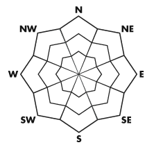
bottom line There is a MODERATE (or level 2) danger in the backcountry today. Heightened avalanche conditions exist in drifted terrain, and you could trigger wind slab avalanches on steep slopes. Stronger ridge-top winds from the northwest last night and continuing today will create pockets with a CONSIDERABLE (level 3) danger on drifted upper elevation slopes, where triggered wind slab avalanches are becoming more likely. Evaluate the snow and terrain carefully, avoid steep drifted slopes and terrain traps below, and continue to practice safe travel protocols...
|
 |
special announcement The friends of the Utah Avalanche Center in Logan is presenting a snowmobile avalanche safety clinic in Logan, with a classroom session on Thursday.January 17 and a field session up at Tony Grove on Saturday January 19. Save the date, call 435-757-2794 for more information, and visit our website to register..... HERE |
 |
current conditions You'll find nice shallow re-crystallized powder in many areas... Last week's rime crust is widespread across the area under the powder from late last week, but it affects powder riding conditions differently in different areas. In some areas you can hardly feel it, while in others it almost supports your weight and it sounds like breaking glass when you move through it. The Tony Grove Snotel at 8400' reports a couple inches of new snow and it's zero degrees this morning, there is 47 inches of total snow, and the station reports 69% of average water content for the date. The CSI Logan Peak weather station at 9700' reports 2 degrees below zero, and northwest winds, with speeds averaging in the twenties and gusting into the thirties.
|
 |
recent activity Locally; a few natural avalanches from Friday's storm were reported this weekend. Observers report a good sized hard slab, triggered by a cornice fall on a drifted slope at lower elevations on the west side of Cache Valley above Cutler Reservoir, and this is just one of several similar events that occurred in the Cache Valley foothills. Another observer reported seeing the blow-in evidence of a natural soft wind slab high in Logan Dry Canyon that was probably less than a foot deep when it occurred. There were a couple close calls, accidents with partial and full burials and injuries in the mountains near Salt Lake City over the weekend, and thankfully everyone survived. Drew and Brett visited the perspective sites on Sunday and updated the accident reports. West Porter and Depth Hoar Bowl Here's a link to our updated avalanche list...
|
| type | aspect/elevation | characteristics |
|---|
 |


Above 8,500 ft.
7,000-8,500 ft.
5,000-7,000 ft.
|
|
|
description
Stronger ridge-top winds overnight and today will cause the danger of wind slab avalanches to increase at upper elevations and on exposed slopes. Watch out for wind slabs on the lee side of major ridges and in and around terrain features like cliff bands, sub-ridges, gullies, and scoops. Fresh wind slabs could be around a foot deep and might be deeper in places. Drifts formed on weak sugary faceted surface snow, in many areas capped by a rime crust from early last week. Avoid wind drifts on steep slopes, which often appear smooth or rounded and chalky looking, and they sometimes sound rather hollow. Cracking and audible collapsing in drifted snow are red flags requiring reevaluation of your route...
|
 |
weather Expect sustained northwest winds along the highest ridge-lines today and decreasing clouds, becoming sunny in the afternoon. A strong high pressure system will move over the region this afternoon with significant warming aloft beginning. Mountain temperatures should rise into the mid teens today and the upper twenties tomorrow. The resulting temperature inversion will take hold and cold air and smog will be trapped in the valleys through the weekend and well into next week. We'll find fair weather in the mountains during this time.... Check out the new Logan Mountain Weather page...
|
| general annoucements Remember your information from the backcountry can save lives. If you see or trigger an avalanche in the backcountry or see anything else we should know about, please send us your snow and avalanche observations. You can also call us at 801-524-5304 or email by clicking HERE. In the Logan Area you can contact Toby Weed directly at 435-757-7578. I will update this advisory on Monday, Wednesday, Friday, and Saturday mornings by around 7:30... This advisory is produced by the U.S.D.A. Forest Service, which is solely responsible for its content. It describes only general avalanche conditions and local variations always exist. |