

| Advisory: Logan Area Mountains | Issued by Toby Weed for December 8, 2012 - 6:23am |
|---|


Above 8,500 ft.
7,000-8,500 ft.
5,000-7,000 ft.
|
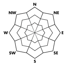
bottom line There is a MODERATE danger on drifted upper elevation slopes in the backcountry. Heightened avalanche conditions exist, and you could trigger fresh wind slabs on many drifted slopes or isolated persistent slab avalanches on steep slopes above around 8000' in elevation, most likely on slopes facing northwest through east. Evaluate the snow and terrain carefully and avoid steep drifted upper elevation slopes....
|
 |
current conditions The Tony Grove Snotel now reports 29 inches of total snow, 80% of normal for the date, and it's 21 degrees at 8400' this morning. You'll find much better coverage at upper elevations than last weekend. We found nice smooth shallow powder conditions yesterday, but sustained and increasingly strong west winds affected exposed terrain. Sheltered terrain will offer the best powder conditions today, with stiff scoured and re-deposited snow or wind crusts up higher. This week's dense snow and wind filled in the rocky terrain significantly, and you can now travel confidently in many areas where you would have hit rocks last weekend. The Tony Grove Road is not maintained for winter travel and conditions are always changing. Several parties including mine were able to park at the lake yesterday, but several vehicles also got stuck, requiring a good deal of hand excavation to be freed. Be sure you are prepared with shovels and other emergency supplies if you attempt the drive.
|
 |
recent activity Natural avalanches occurred last weekend in the steep terrain on the west side of Tony Grove Lake, and my party triggered a good sized wind slab on Tuesday at around 9400' on a drifted northeast facing slope off the South Ridge of Mt Magog, northwest of Tony Grove Lake. The avalanche was around a foot deep and 40' wide or so. Here's a link....Mt. Magog Avalanche. No other avalanche activity has been reported Locally...
|
| type | aspect/elevation | characteristics |
|---|
 |


Above 8,500 ft.
7,000-8,500 ft.
5,000-7,000 ft.
|
|
|
description
You could trigger fresh wind slab avalanches in steep drifted terrain at upper elevations today, so you should avoid steep slopes with recent accumulations of drifted snow. Slopes near ridge-tops with developing cornices are obvious ones to avoid, but wind slabs will also form in and around terrain features like gullies, scoops, sub-ridges, cliff bands, and rock outcroppings.. With very shallow snow cover still, this is not a good time to be taken for a ride through the sharp rocks or down trees and stumps that currently plague local avalanche run-out zones. |
| type | aspect/elevation | characteristics |
|---|
 |


Above 8,500 ft.
7,000-8,500 ft.
5,000-7,000 ft.
|
|
|
description
On some slopes, wind slabs built this week on top of weak sugary snow called near surface facets, and we can expect a lingering persistent danger in these areas. Dangerous avalanches up to around 2-feet-deep and 100-feet-wide or so are possible in steep upper elevation terrain, primarily on slopes facing north through east. Pay close attention to red flags like audible collapsing and cracking, avoid steep obviously drifted slopes, and make conservative decisions regarding your route... |
 |
weather A very cold but weak storm will cross the region today, and light snowfall is occurring in the mountains already this morning. 2 to 4 inches of accumulation is expected at upper elevations , with fairly strong west winds, gusting into the mid 40 mph range, and temperatures dropping into the lower teens. Temperatures will drop into the mid single digits tonight, winds will shift around from the northwest and diminish somewhat, and a couple more inches of light snow may accumulate. Another small storm will cross far northern Utah on Monday and Monday night, with light accumulations totaling only a few inches expected. Check out the Logan Mountain Weather page...
|
| general annoucements Donate to your favorite non-profit –The Friends of the Utah Avalanche Center. The UAC depends on contributions from users like you to support our work. The Friends of the Utah Avalanche Center in Logan are offering an avalanche 101 class next week. The class will include a classroom session on Thursday evening and a field day on Saturday. Check this link for more details,,,, Avalanche 101 class or call 435-757-2794. Remember your information can save lives. If you see anything we should know about, please participate in the creation of our own community avalanche advisory by submitting snow and avalanche conditions. You can also call us at 801-524-5304 or email by clicking HERE. In the Logan Area you can contact Toby Weed directly at 435-757-7578. This advisory is produced by the U.S. Forest Service, which is solely responsible for its content. It describes only general avalanche conditions and local variations always exist. |