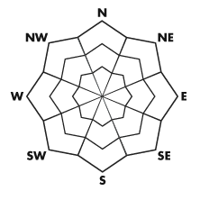


| Advisory: Logan Area Mountains | Issued by Toby Weed for November 24, 2012 - 7:07am |
|---|


Above 8,500 ft.
7,000-8,500 ft.
5,000-7,000 ft.
|
bottom line There is a LOW danger today, and avalanches are generally unlikely in the backcountry. Exceptions exist on steep drifted slopes at upper elevations and may develop on steep slopes where the surface snow is loose or becomes damp or saturated due to warming. Although rather unlikely, triggered avalanches are possible in steep terrain. Continue to use safe travel protocols, check your avalanche rescue equipment, and find the time to practice avalanche rescue scenarios with your partners....
|
 |
current conditions
The Tony Grove Snotel reports 14 inches of total snow, with 3.2 inches of water equivalent, and it's 35 degrees at the 8400' site. The 9700' CSI Logan Peak weather station reports southwest winds averaging in the thirties and already 29 degrees this morning. The Tony Grove Road is not maintained for winter travel and is very slick and icy on shady sections.. Be sure you are prepared with shovels and other emergency supplies if you attempt the drive. It is still quite possible to drive up to the parking lot at the lake, and this is where most people are parking. We've been finding very nice and smooth re-crystallized shallow powder conditions above around 8000' on smooth slopes where there is enough snow. It's still a bit shallow for me to ride my sled in the backcountry, but a few folks have been able to get out to test the tune-up... Several riders made it out onto Cornice Ridge yesterday, with no avalanches but some equipment damage noted...
|
 |
recent activity No avalanches have been reported in the Logan Area...... |
| type | aspect/elevation | characteristics |
|---|
 |


Above 8,500 ft.
7,000-8,500 ft.
5,000-7,000 ft.
|
|
|
description
Potential for triggering stiff wind slabs exists in some isolated upper elevation north and east facing terrain... Some of these slabs may be sensitive to your weight on very steep slopes, and some might fail on weak underlying October snow near the ground.... The surface snow is weakened by sublimation, and the snow is getting looser as facets develop. Loose snow sluffs are becoming more possible in steep terrain, and warm temperatures in the mountains may cause the surface snow on some steep slopes to become moist or saturated, and loose wet avalanches may become possible in the heat of midday... |
 |
weather High pressure will continue into the weekend, with mild temperatures and a fair amount of sunshine expected today.. Expect temperatures in the forties above 8000' and a sustained southwest breeze. We'll see cloudier conditions tomorrow., and a storm will pass well to our north and east late tomorrow, with a weak cold front passing through our area. The chance for any measurable snow from this is slim. Next week's weather looks pretty benign, with high pressure conditions dominating. Looks like good weather for facet growth and snowpack degeneration.
|
| general annoucements Check out our new video showcasing last year's (2011-2012) documented backcountry avalanche activity.... https://vimeo.com/52907979 Come join us for our annual "Pray for Snow" fundraiser dinner and party November 29 at The Italian Place! In addition to live music and entertainment we have lots of donated items to raffle off including OR outerwear, Marker A/T bindings and a brand new Voile Splitboard! Donate to your favorite non-profit –The Friends of the Utah Avalanche Center. The UAC depends on contributions from users like you to support our work. Remember your information can save lives. If you see anything we should know about, please participate in the creation of our own community avalanche advisory by submitting snow and avalanche conditions. You can also call us at 801-524-5304 or email by clicking HERE. In the Logan Area you can contact Toby Weed directly at 435-757-7578. |