

| Advisory: Logan Area Mountains | Issued by Toby Weed for November 20, 2012 - 6:39am |
|---|


Above 8,500 ft.
7,000-8,500 ft.
5,000-7,000 ft.
|
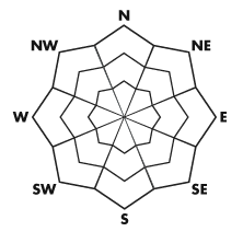
bottom line There is a MODERATE danger on steep upper elevation slopes, and you could trigger persistent slabs or wet avalanches today. These are most likely on steep northwest, north, and northeast facing slopes with preexisting snow at upper elevations. Continue to use safe travel protocols, check your avalanche rescue equipment, and find the time to practice avalanche rescue scenarios with your partners....
|
 |
current conditions The Tony Grove Snotel reports 8 or 9 inches of accumulation from Sunday's, with a bit over an inch of water equivalent. There is now 14 inches of total snow at the site. Southwinds are averaging in the 25 mph range at the 9700' CSI Logan Peak weather station where it is 28 degrees this morning. Even with the fresh snow from yesterday and overnight, you'll find very shallow early season snow cover in the Logan Zone. Recreation options are limited to a few north facing upper elevation slopes with smooth underlying ground. Keep the speed down and watch for shallowly buried rocks and stumps. It's still way too shallow for riding sleds in the backcountry without damaging equipment or the resource. Be sure to check your batteries in your transceiver and the working condition of your rescue equipment, practice rescue scenarios with your partners, and always follow safe travel protocols... Remember that the Tony Grove Road is not maintained for winter travel and is likely to present winter driving challenges... Be sure you are prepared with shovels and other emergency supplies.
|
 |
recent activity With very shallow early season snow, no avalanches have been reported yet in the Logan Area...... |
| type | aspect/elevation | characteristics |
|---|
 |


Above 8,500 ft.
7,000-8,500 ft.
5,000-7,000 ft.
|
|
|
description
.The potential of triggering persistent slabs exists in some exposed north facing terrain... Overloaded by the fresh moist snow, these slabs may be sensitive to your weight on very steep slopes, and might fail on weak underlying October snow near the ground.... Be very wary of any red flags indicating unstable snow like audible collapsing or shooting cracks, which are sure signs of lurking danger.... |
| type | aspect/elevation | characteristics |
|---|
 |


Above 8,500 ft.
7,000-8,500 ft.
5,000-7,000 ft.
|
|
|
description
Wet avalanches consisting of fresh storm snow are possible on steep slopes at upper elevations. Roller Balls and point-release sluffs are signs that the snow is warm and moist enough to avalanche. Wet surface slides could entrain a good deal of snow. If not enough to bury you, certainly enough to push you around. and you do not want to be taken for a potentially traumatic ride through shallowly buried rocks and dead-fall currently plaguing avalanche run-out zones. |
 |
weather Mountain temperatures will remain on the mild side as a southwest flow aloft continues to dominate the weather pattern. Expect mountain temperatures well into the 40s, mostly cloudy skis, and a southwest breeze along the ridges. Winds will increase tomorrow ahead of a mostly dry cold front that will clip far northern Utah on Wednesday night. High pressure will build into the zone for Thanksgiving and the remainder of the week. The next storm will move into the area Saturday night and linger through Monday.
|
| general annoucements Check out our new video showcasing last year's (2011-2012) documented backcountry avalanche activity.... https://vimeo.com/52907979 Come join us for our annual "Pray for Snow" fundraiser dinner and party November 29 at The Italian Place! In addition to live music and entertainment we have lots of donated items to raffle off including OR outerwear, Marker A/T bindings and a brand new Voile Splitboard! Donate to your favorite non-profit –The Friends of the Utah Avalanche Center. The UAC depends on contributions from users like you to support our work. Remember your information can save lives. If you see anything we should know about, please participate in the creation of our own community avalanche advisory by submitting snow and avalanche conditions. You can also call us at 801-524-5304 or email by clicking HERE. In the Logan Area you can contact Toby Weed directly at 435-757-7578. |