The final report for the Hoyt Peak avalanche accident on March 7th has been published and is available,
here.Nowcast Get it while you can! We received 2-6" of snow yesterday with under .5" of SWE across the range and the Mirror Lake Corridor taking the blue ribbon. Right now, winds are tempered blow from the southwest around 10 MPH. Temperatures at 10k' and above are reading in the teens while trailheads at 7k' are closer to 20℉.
Forecast For today, expect broken to sunny skies with mild temperatures maxing out in the high 20's. Winds will be from the west and stay consistent, averaging10-20 MPH near the high peaks and ridges. Although it could feel much warmer if the sun breaks clear through, today could start with a battle between winter and spring.
Futurecast Weather returns tomorrow and a larger storm impacts the range Monday evening bringing heavier snow and water totals than this weekends pinch, hopefully delivering 10-15" of new snow and potentially 1" of SWE.
Travel & Riding Conditions Low elevations have taken a hard hit, and transportation to recreation is becoming more challenging. Many trailhead elevations are melted out and mountain pass roads are becoming visible again, something to keep in mind when planning your travel. Riding quality was on the lower end of the spectrum yesterday, but should improve today. Upper elevation polars will hold cold snow the longest today while the sunnies could go off quick and turn manky in no time. Im heading for high north with reduced slope angles where I wont be feeling the bottom under my skies or track on every turn.
SR35 showing some skin and riders working the sidewalk to get back to their rigs at the lot. Many trailheads look no different, and remember even a thin skim of snow could melt off by the tim you return at the end of the day -- We're thinking sled care wellbeing here.
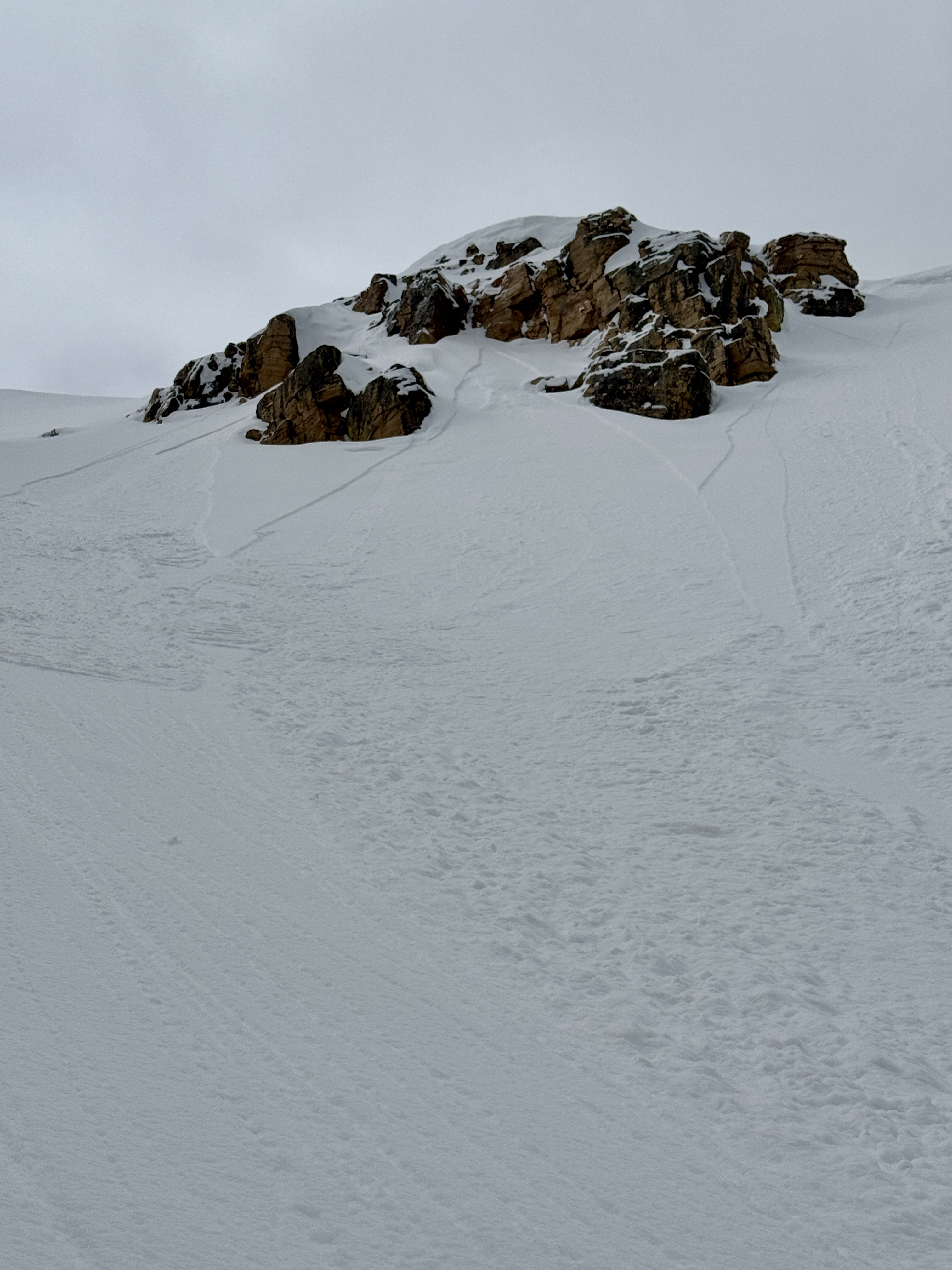
No significant avalanche activity has been observed in the past 24hrs and the last significant avalanche failing into old snow occurring over two weeks ago. Yesterday, Wes S reported small, point-release avalanches in upper-elevation, steep, rocky terrain. Check out all the action, info and intel for the Uinta range and beyond, here.
Wes was up in the high-country yesterday noting small point releases within the new snow. I'd keep an eye out for more of the same today, and pay attention for them to turn from dry to wet-loose's if the sun pops out in sustained fashion.


