The final report for the Hoyt Peak avalanche accident on March 7th has been published and is available,
here.Our Spring Campaign is in full swing, and there are two great ways to support forecasting, awareness, and education across Utah: Donate to our
Spring Campaign or bid on items in our
Spring Auction. Every dollar helps keep the backcountry community on top. Thank you for your support!
Nowcast- Cooler air settled into the Uinta region overnight delivering a trace of snow and more seasonal temperatures registering in the low to mid 20's. West and northwest winds blow in teens near the high peaks, while high clouds drift through the northern half of the state.
Forecast- Look for increasing clouds with scattered snow showers through late morning. A more organized, though relatively weak impulse slides through late in the day. I'm still cautiously optimistic this North Slope favored system delivers 3"-6" of snow, with about half that amount along the south half of the range. Westerly winds bump into the 20's, while temperatures climb into the mid 30's. Skies clear overnight and the mercury dives into the upper teens and low 20's.
Futurecast- A beautiful Sunday is on tap with mostly sunny skies, light winds, and temperatures climbing into the 40's. Increasing clouds Monday with a colder, more potent storm expected to kick off the workweek. We could see a nice shot of snow materializing for Tuesday... stay tuned for more deets!
Travel & Riding Conditions- Until we stack up some cushion, today's snow surface is gonna be a bit on the rugged side. Perhaps get a few projects off your plate this morning and consider a dusk patrol.
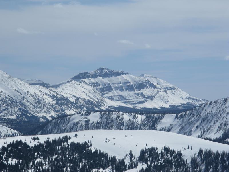
Hayden Peak, looming large and keeping a watchful eye on Upper Moffit Basin.
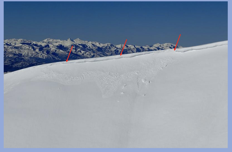
Pretty quiet recently, though Trevor spotted this couple day old, natural cornice release in Upper Weber Canyon. After trundling onto the slope below, this piece of corni released a small, damp avalanche.
Check out all the action, info and intel for the Uinta range and beyond, here.