

Greg Gagne
Forecaster
Our Week in Review highlights significant snowfall, weather, and avalanche events of the prior week. (Review the archived forecasts for the Salt Lake mountains.)
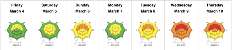
The danger roses for the Salt Lake mountains from Friday, March 4 through Thursday, March 10:
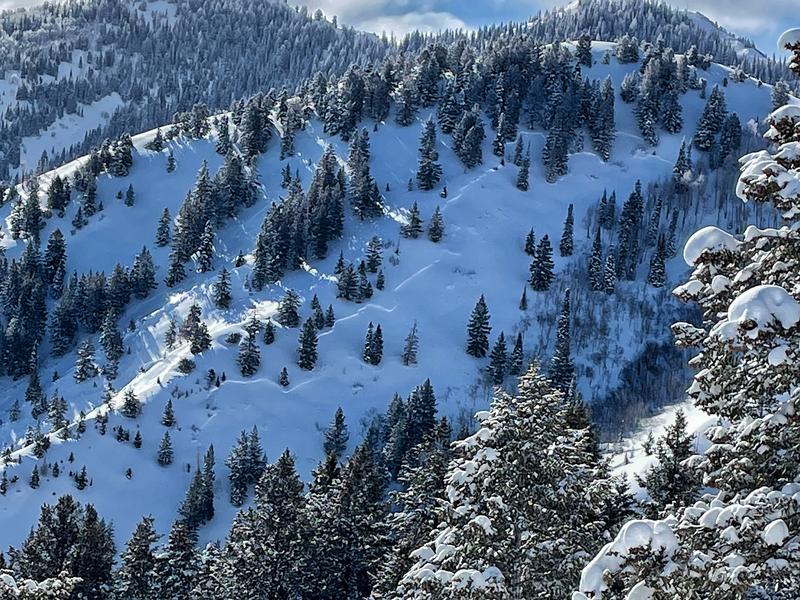
Summary: The storminess week since December! Several human-triggered avalanches with a few near-misses. Most avalanche activity involved the weak layer of faceted snow from the January-February drought; Drew Hardesty's blog describes the formation of this weak layer and the avalanche activity failing on this layer through the first week of March.
A listing of all avalanches reported to the UAC.
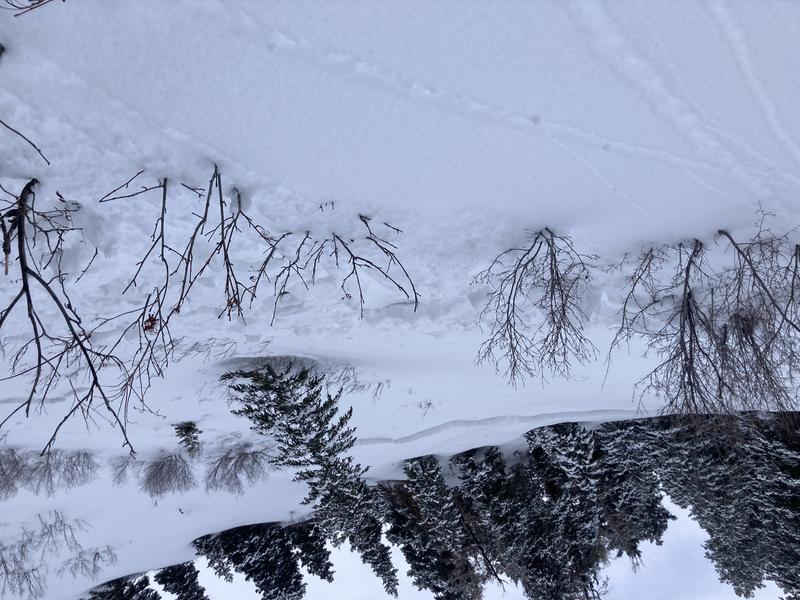
Friday, March 4: Trace amounts of new snow and increasing winds from the south/southwest. No backcountry avalanches are reported.
Saturday, March 5: Snowfall commences with 2-6" by the end of the day. Gusty south/southwest winds. Avalanche activity is limited to sluffing on steep, upper-elevation northerly slopes and a few small pockets of wind-drifted snow. Reports of instabilities on the layer of faceted snow from Jan/Feb as well as two avalanches breaking down on this layer:
Sunday, March 6:
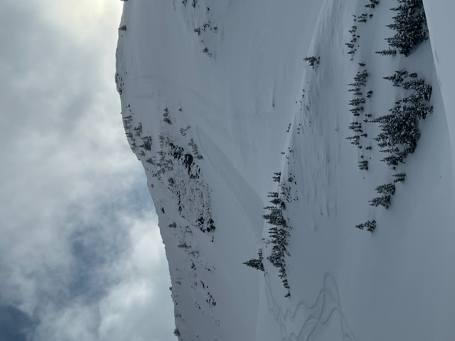
- Memorial Couloirs on Mount Olympus
Although neither of these avalanches were large, they did signal how the persistent weak layer will react to additional snowfall.
Monday, March 7:
Backcountry avalanches include:
Santiago Ridge (Mineral Fork) Catch and carry with airbag deployed
Shingle Mill Peak in Provo mountains Caught but not carried)
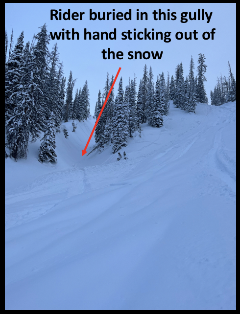
The most serious avalanche incident occurred in the Westerm Uintas where a snowmobiler was caught, carried, and buried in a terrain trap. Fortunately, their hand was sticking out and the rider was quickly rescued by other members in the party.
Tuesday, March 8: Snowfall on a cold, unstable northwest flow. By sunset, up to 6" of snow is recorded. Backcountry avalanches failing on Jan/Feb facets include:
- Silver Fork Headwall Rider caught and carried
Wednesday, March 9: Impressive snowfall amounts include
Little Cottonwood Canyon 24-48" containing up to 2.6" snow water equivalent (SWE)
Big Cottonwood Canyon 14-44"" (up to 2.75" SWE)
Park City Ridgeline 12-16" (up to 1.2" SWE)
Backcountry avalanches include
Mineral Fork 2' deep 100' wide 2 caught and 1 carried
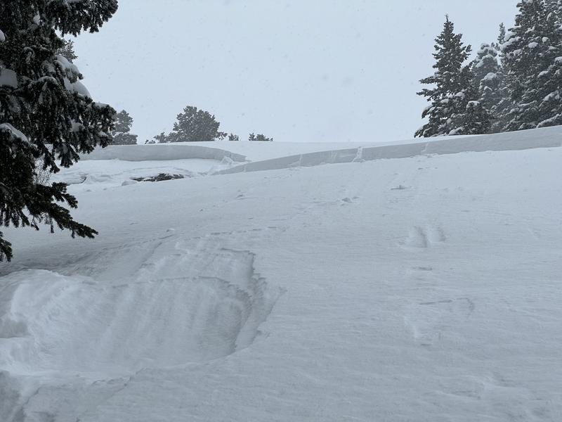
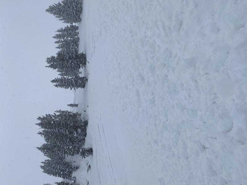
Low elevation slopes (below 8,000' also have weak facets on northerly/shady aspects. This natural avalanche in Lambs Canyon occurred on a northerly slope at 7,600'
Thursday, March 10: Cold and clear with blustery northwest winds. No backcountry human-triggered avalanches are reported, but with clearing skies additional natural avalanches that occurred overnight Tuesday or during the day on Wednesday are reported.


