Sign Up for the Utah Snow and Avalanche Workshop (USAW) on December 7th!

Forecast for the Salt Lake Area Mountains

Greg Gagne
Issued by Greg Gagne on
Friday morning, January 29, 2021
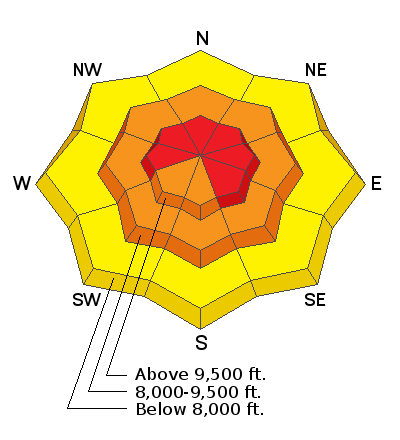
The avalanche danger is HIGH on upper elevation aspects facing west, through north, and southeast. Upper elevation aspects facing south and southwest - and all mid-elevation aspects - have a CONSIDERABLE danger. Strong southerly winds have created dense slabs of fresh wind-drifted snow that have overloaded the snowpack on many slopes at the mid and upper elevations. Any natural or human-triggered avalanche can be 3-4' deep and over a few hundred feet wide. There is a Moderate danger at the low elevations.
Traveling on, underneath, or adjacent to slopes steeper than 30° at the mid and upper elevations is not recommended. Fortunately, there are excellent riding conditions on lower-angled slopes outside of wind-affected terrain.

If you're leaving a resort boundary through an exit point, you are stepping into CONSIDERABLE or HIGH avalanche danger.
Low
Moderate
Considerable
High
Extreme
Learn how to read the forecast here
Special Avalanche Bulletin
SPECIAL AVALANCHE BULLETIN
ISSUED
What
THE AVALANCHE DANGER IS CONSIDERABLE TO HIGH IN MANY AREAS.
When
IN EFFECT FROM 6 AM MST THIS MORNING TO 6 AM MST SATURDAY
Where
FOR THE MOUNTAINS OF NORTHERN UTAH INCLUDING THE WASATCH RANGE...BEAR RIVER RANGE...UINTA MOUNTAINS...
Impacts
DANGEROUS AVALANCHE CONDITIONS EXIST. NATURAL AND HUMAN TRIGGERED AVALANCHES ARE EXPECTED. AVOID BEING ON OR BENEATH STEEP TERRAIN.
Special Announcements
SPECIAL NOTE: HALF OF ALL SKIER/SNOWBOARDER FATALITIES SINCE 99/00 HAVE OCCURRED WITH PEOPLE GOING OUT OF BOUNDS AT A SKI AREA.
Do you have the essential avalanche rescue gear (transceiver, probe, and shovel) and do you know how to use them? Watch this video to see how the three pieces of equipment work together.
Weather and Snow
This morning temperatures range through the low to mid 20's F, and the southerly winds (shifting between southwest and southeast) continue to blow moderate to strong. At the mid elevations winds are averaging in the teens and 20's mph, with gusts in the 30's mph. Along upper elevation ridges, averages are in the 20's with gusts in the 50's mph.
For today increasing clouds with light snow developing later this afternoon. Temperatures will be in the 20's and low 30's F and the southerly winds will continue to drift snow, averaging in the teens's with gusts in the 30's and 40's mph at mid elevations while averaging in the 20's with gusts in the 50's mph at upper elevations.
We may pick up a few inches of snow by late in the day, and a better chance for snowfall overnight as the flow switches to the northwest. Favored areas (such as the Cottonwoods) may pick up 8-12" by later Saturday.
High pressure moves in by Sunday, but it may be short-lived with a potentially larger storm forecasted by midweek.

Week in Review: This past week has been active with lots of (1) snow, (2) wind, and (3) avalanches. Catch up by reading our latest Week in Review.
Recent Avalanches
Six avalanches were reported from the backcountry on Thursday, three natural and three skier-triggered. Skier-triggered slides include
- Willow Knob (N aspect at 9,300' 2.5' deep 40' wide)
- Powder Park (3.5' deep over 150' wide) Wind-loaded northerly slope at 9,400'
And it only took one day for South Monitor to naturally avalanche once again. The slope naturally avalanched on Wednesday, but strong southerly winds quickly overloaded the slope and it ran again on Thursday, 2' deep and up to 500' wide, running on Nov/Dec facets.
Special Public Announcement: IF you trigger an avalanche near one of the resorts - even if no one is involved - please call it into the ski patrol so they don't have to put themselves in harm's way to conduct a meaningless rescue.

As always, you can find all observations and recent avalanches HERE.
Ad
Avalanche Problem #1
Wind Drifted Snow
Type
Location
Likelihood
Size
Description
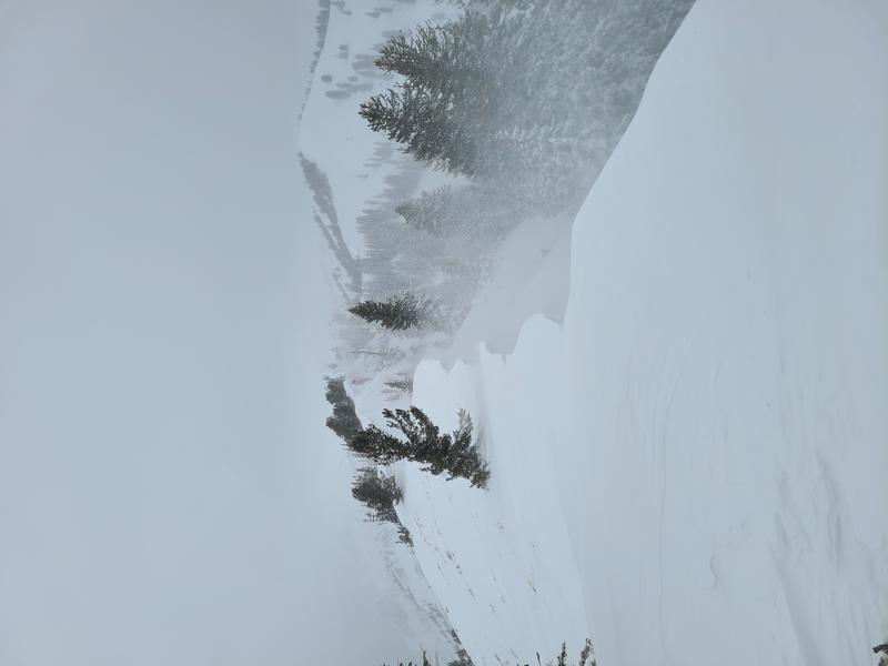
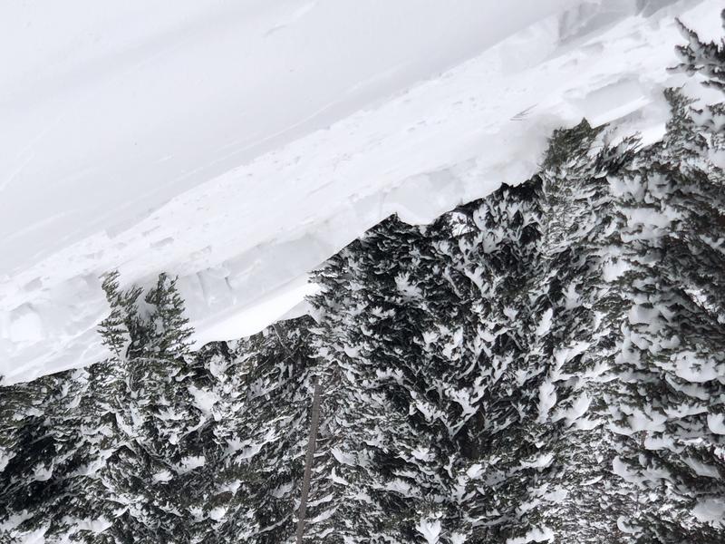
Moderate to strong sustained southerly winds have drifted snow on all aspects at the mid and upper elevations, and even into some of the upper reaches at the lower elevations. These winds have created dense slabs that were very reactive on Thursday, with both natural and human-triggered avalanches reported. These drifts may be over 3' deep in places, and any avalanches may propagate over several hundred feet wide. In addition, cornices are beginning to grow quite large and were sensitive on Thursday. The West Desolation natural avalanche was possibly triggered by a natural cornice fall. One party remotely triggered a slide just above East Pass in Silver Fork, and also noted several natural avalanches from cornice falls. [Joey Manship photo]
Avalanche Problem #2
Persistent Weak Layer
Type
Location
Likelihood
Size
Description
Our buried weak layers of faceted snow and depth hoar are only being further stressed by recent storm snow and especially wind-transported snow, and some of the recent avalanches have been failing in these deeply-buried (2-4' deep) layers. Yesterday's South Monitor repeater is primary evidence. It is also likely yesterday's Willow Knob avalanche which appeared to run on a layer of near-surface facets down 2.5' was a slab of recent storm snow, and perhaps not wind-loaded.
Additional forecasted snowfall and wind adds additional stress to these deeply-buried weak layers. Look at the locator rose for this persistent weak layer problem which can be found at the mid and upper elevations on aspects facing west, through north, and east, as well as upper-elevation aspects facing southeast.
Additional Information
Find the podcast HERE....or find the Utah Avalanche Center podcast wherever you get your favorite podcasts.
General Announcements
Please visit this website with information about Responsible Winter Recreation by the Utah Office of Outdoor Recreation.

This information does not apply to developed ski areas or highways where avalanche control is normally done. This forecast is from the U.S.D.A. Forest Service, which is solely responsible for its content. This forecast describes general avalanche conditions and local variations always occur.