UDOT PLANNED AVALANCHE CLOSURES!!

Forecast for the Uintas Area Mountains

Mark Staples
Issued by Mark Staples for
Friday, April 15, 2022
Today the avalanche danger is MODERATE above treeline where winds from the southwest have formed slabs of wind drifted snow that will be the main avalanche problem.
On slopes without wind drifted snow and slopes near and below treeline, the avalanche danger is LOW and human triggered avalanches are unlikely.
Low
Moderate
Considerable
High
Extreme
Learn how to read the forecast here
Special Announcements
Sunday, April 17th is the last of our regularly scheduled daily forecasts for the western Uinta mountains. But, don't let your heart be troubled... I'll continue to update this page with intermittent forecasts if Mother Nature decides to keep the winter switch turned on.
Weather and Snow
NOWCAST-
It's snowing a little bit this morning. Temperatures are 20 degrees F at upper elevations and closer to 30 degrees at trailheads (11 degrees warmer than yesterday morning). Winds from the southwest are blowing 15-28 mph at upper elevations with gusts up to 36 mph. Storm totals over the last few days are 14 inches of new snow which has settled into dense, creamy powder. The new snow became damp yesterday and should have a thin ice crust this morning mostly below 9000 ft.
FORECAST-
An inch of snow could fall this morning under mostly cloudy skies. Clouds should thin throughout the afternoon and the sun may pop out here and there this afternoon. Temperatures should rise to near 30 degrees and winds will continue as they are this morning, perhaps easing some this afternoon.
FUTURECAST-
Unsettled weather with some clouds and a few inches of snow Saturday afternoon/evening followed by clearing skies for Sunday and warmer temperatures.
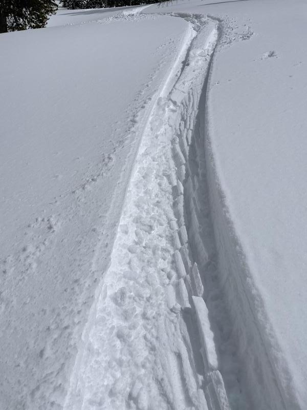
Photo from upper Weber Canyon yesterday. Note the snow getting a touch damp and sticking to itself in the ski tracks.
Trip reports and snowpack observations are found HERE.

Looking for real-time temps, snow, or wind? Click HERE and then on the "western Uinta" tab for western Uinta specific, weather station network.
Recent Avalanches
No avalanche activity to report.
An archive of recent slides is found HERE.

Your input is vital and we're interested in what you're seeing. Please contribute to this great community resource and go here to fill out an observation.
Ad
Avalanche Problem #1
Wind Drifted Snow
Type
Location
Likelihood
Size
Description
Gusty southwest winds have had plenty of snow to transport and form soft slabs of wind drifted snow. These wind slabs began bonding yesterday with warm spring weather and moments of sunshine that added heat.
Today, the most likely place to trigger a fresh wind slab will be above treeline where winds have been the strongest and the snow has remained the coldest.
Additional Information
Your observations are important, so please let me know what you're seeing... click HERE and contribute to this amazing community based program
General Announcements
The information in this forecast expires 24 hours after the day and time posted, but will be updated by 07:00 Saturday, April 16th.
Before it gets too crazy, now is the time to book an avalanche awareness presentation for your group, club, or posse. You can reach me directly at 801-231-2170 or [email protected]
This forecast is from the U.S.D.A. Forest Service, which is solely responsible for its content. This forecast describes general avalanche conditions and local variations always occur.