Forecast for the Uintas Area Mountains

Craig Gordon
Issued by Craig Gordon for
Saturday, April 16, 2022
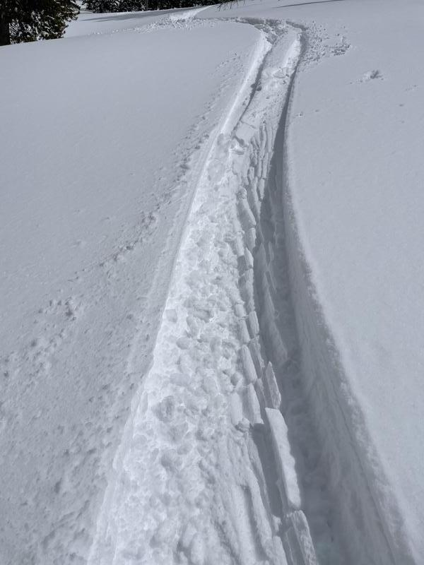
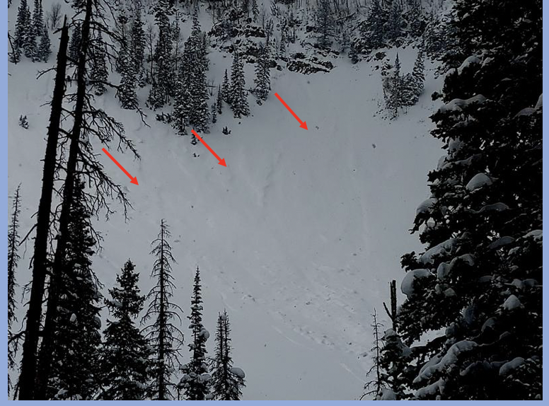
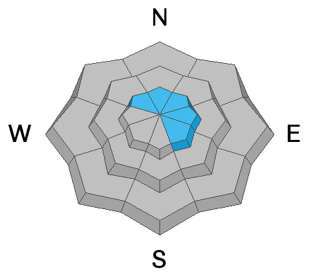
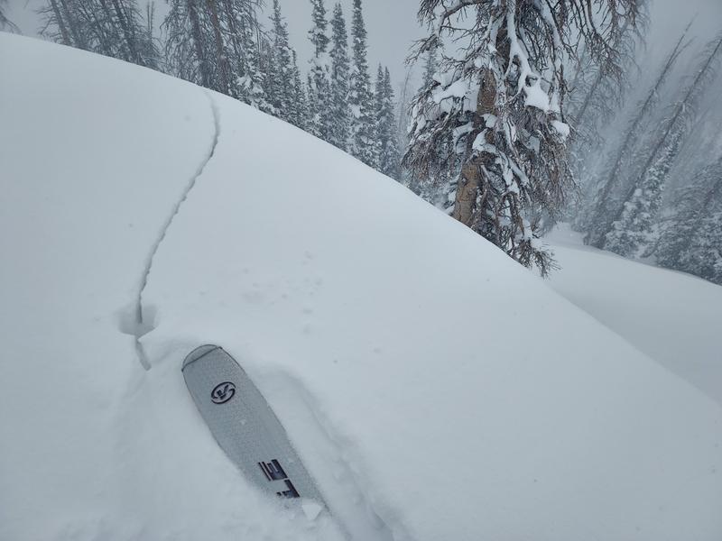
While not particularly widespread, pockets of MODERATE avalanche danger exist on leeward slopes, above treeline, in the wind zone. Human triggered avalanches are possible on steep, wind drifted slopes, especially those facing the north half of the compass. Straight-forward enough, but remember... if you're tagging a big committing line, think about the consequences of triggering even a small avalanche that can knock you off your skis, board, or sled and throw an unexpected curve ball at your day.
Lose the wind and you lose the problem... slopes near and below treeline, offer LOW avalanche danger and human triggered avalanches are UNLIKELY.
Low
Moderate
Considerable
High
Extreme
Learn how to read the forecast here
Special Announcements
Tomorrow, Sunday April 17th is the last of our regularly scheduled daily forecasts for the western Uinta mountains. But, don't let your heart be troubled... I'll continue to update this page with intermittent forecasts if Mother Nature decides to keep the winter switch turned on.
Weather and Snow
NOWCAST-
High, thin clouds offer splintered moonlight, casting a curious glow on our mountains this morning along with relatively mild temperatures registering in the upper 20's. The warm before a little storm has southerly winds bumping into the 20's and 30's at the turn of the new day. The midweek storm was good to the eastern front, delivering 14" of medium density snow to the high country. However, recent warm temperatures and a bit o' sun have transformed all but the highest north facing terrain into a variety of breakable sun crusts with some wind funk thrown in just to keep you on your toes.
FORECAST-
Look for increasing clouds, gusty southwest winds, and a scattered snow shower or two that deliver a couple inches of snow overnight. High temperatures climb into the mid 30's with overnight lows dipping into the 20's.
FUTURECAST-
A mostly sunny Easter Sunday is on tap with tranquil weather slated through mid week. A stormy pattern rounds out the work week.
Photo from upper Weber Canyon Thursday. Note the snow getting a touch damp and sticking to itself in the ski tracks.
Trip reports and snowpack observations are found HERE.

Looking for real-time temps, snow, or wind? Click HERE and then on the "western Uinta" tab for western Uinta specific, weather station network.
Recent Avalanches
Yesterday, MJ spotted this pocket that was triggered by snow cascading out of the steep rockband above.
No other avalanche activity to report.
An archive of recent slides is found HERE.

Your input is vital and we're interested in what you're seeing. Please contribute to this great community resource and go here to fill out an observation.
Ad
Avalanche Problem #1
Wind Drifted Snow
Type
Location
Likelihood
Size
Description
Micheal J was in Lower Weber Canyon yesterday and found a tender wind drift or two and shooting cracks (a clue to unstable snow) on steep, wind drifted slopes. More on MJ's travels and a great trip report found HERE.
A few lingering wind drifts along the leeward side of upper elevation ridges in the alpine are about the only avalanche game in town. The good news is... they're not widespread, they're easy to detect by their fat, rounded appearance, and they're easy to avoid. I think most recent drifts are pretty welded in place and not particularly reactive. But if you're tagging a big committing line, think about the consequences of triggering even a small avalanche that can knock you off your skis, board, or sled and throw an unexpected curve ball at your day.
Additional Information
Your observations are important, so please let me know what you're seeing... click HERE and contribute to this amazing community based program
General Announcements
The information in this forecast expires 24 hours after the day and time posted, but will be updated by 07:00 Sunday, April 17th.
Before it gets too crazy, now is the time to book an avalanche awareness presentation for your group, club, or posse. You can reach me directly at 801-231-2170 or [email protected]
This forecast is from the U.S.D.A. Forest Service, which is solely responsible for its content. This forecast describes general avalanche conditions and local variations always occur.