Thank you to everyone who supported our spring fundraiser. We reach and exceeded our goals. The UAC could not exist without your support.
Tomorrow.... Sunday, April 14th will be the last of our regularly scheduled Uinta forecasts.
Yesterday's early morning storm instantly blossomed right around 4:30 AM, rapidly laying down 4" of medium density snow in about 90 minutes. With a moist northwest flow overhead, yet another fast moving system is materializing as I type this forecast and should produce a couple additional inches of snow before dawn. Currently, temperatures are in the teens and winds are light and northerly, blowing less than 20 mph. On a phat, white, go-anywhere base, riding and turning conditions remain quite good, especially on mid elevation wind sheltered slopes.
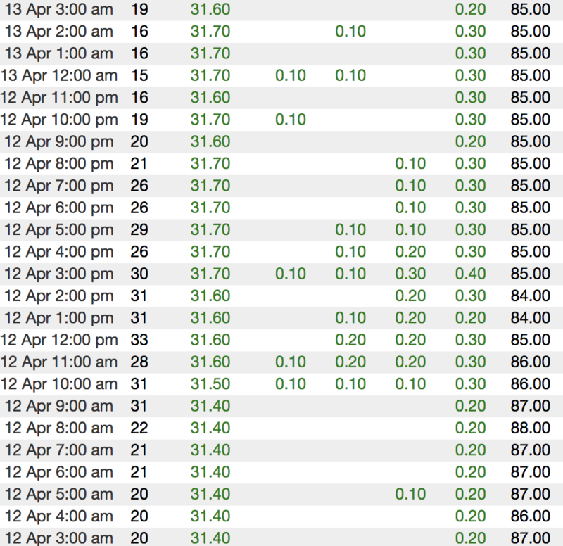
Above... hourly temps, snow, and water totals from Chalk Creek (9,169')
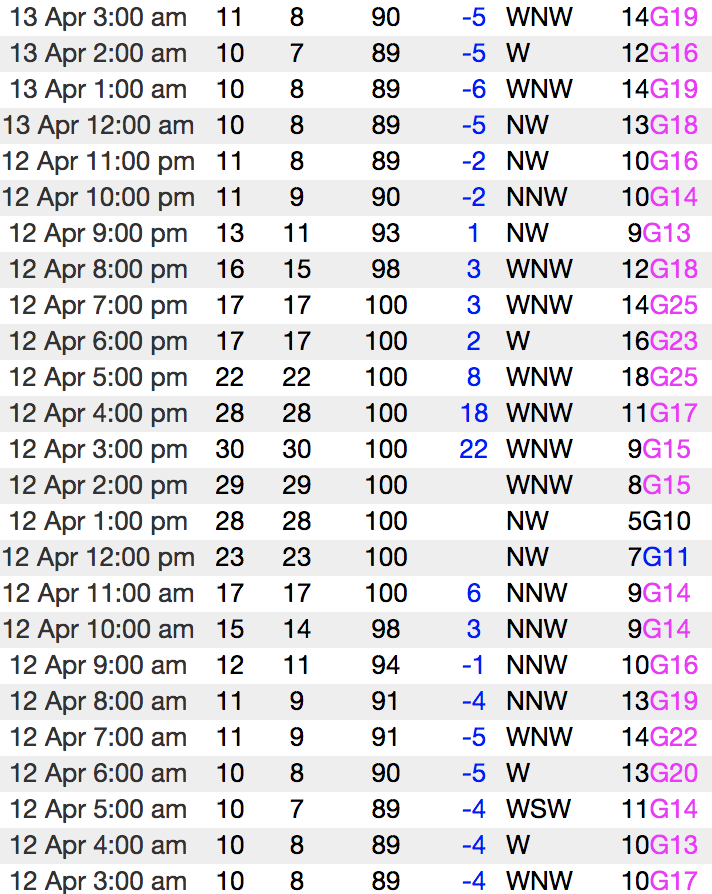
Looks like some network issues, so... no updated winds from the Uinta's. Above is representative wind data from our nearby neighbors in the Wasatch.
To view more regional weather stations click
here.
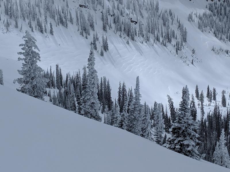
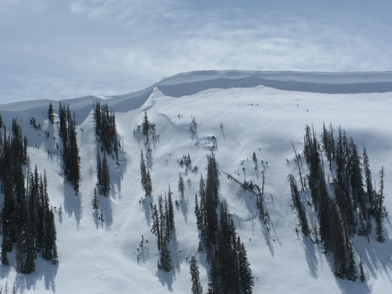
Northerly winds blew upslope on Thursday, essentially throwing a cargo net over large swaths of open terrain like in the image above.
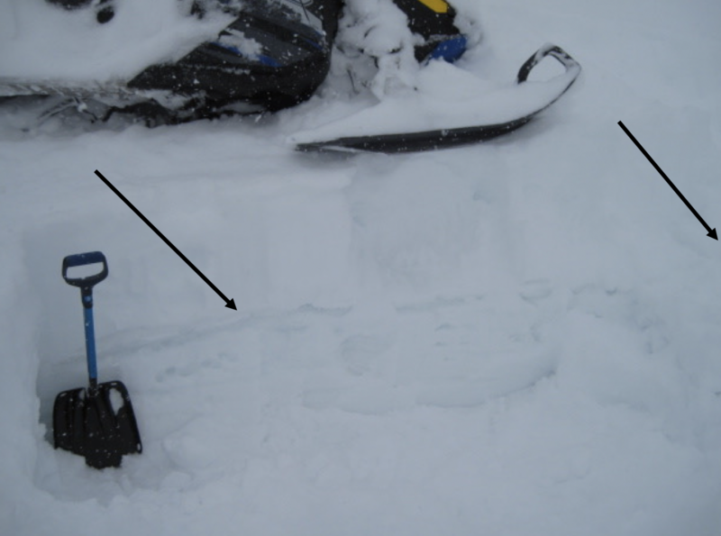
While not particularly widespread, on Thursday Michael J noted.... "My stability tests showed a weak layer about 4 inches below the melt-freeze crust but my ECT failed to propagate. On my way out I was kicking some new snow off a cornice and was caught by surprise when the old snow failed behind my feet." More on Micheal's travels in Weber Canyon are found
here.
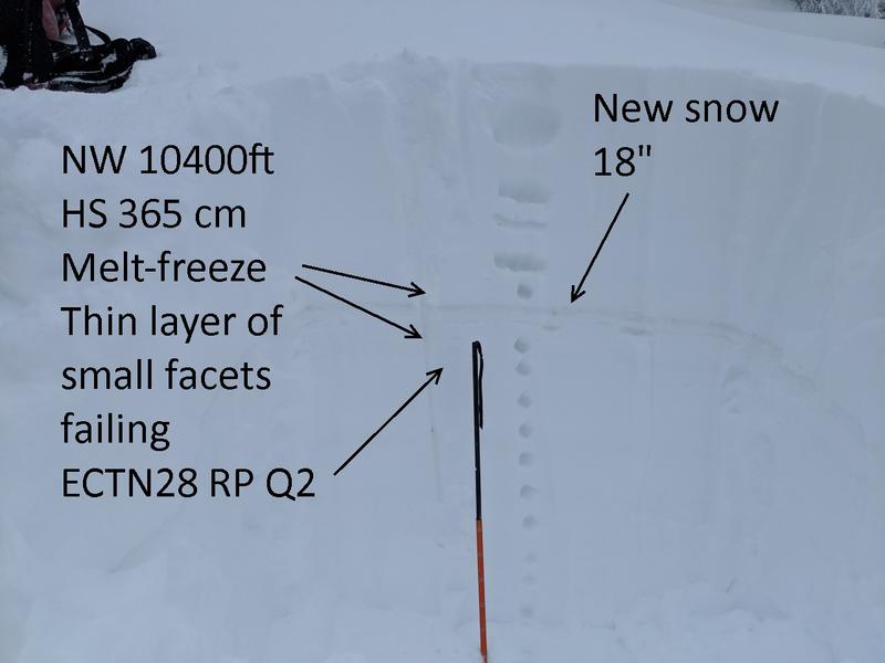
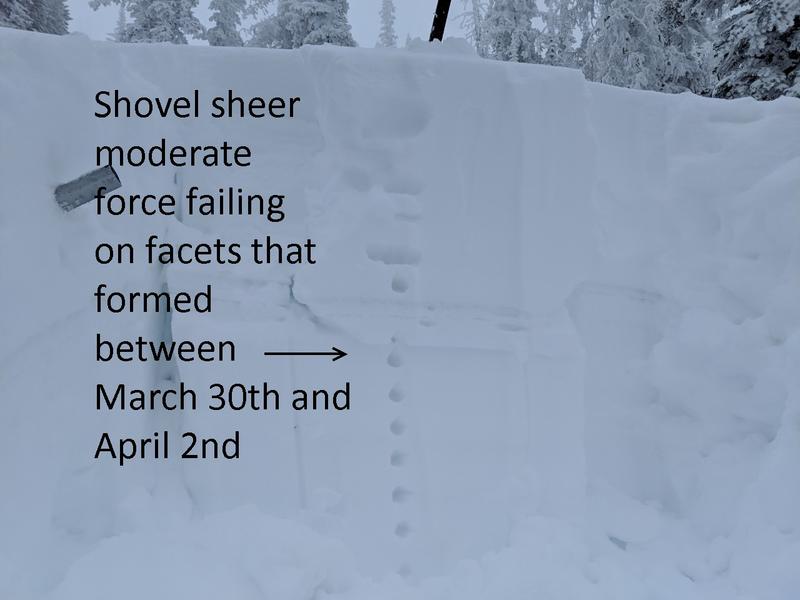
No significant avalanche activity to report from yesterday, but visibility was hit or miss. The image above illustrates the new snow/old snow layering Ted found during the storm on the North Slope in wind sheltered terrain.
Recent trip reports and avy activity found
HERE.