Thank you to everyone who supported our spring fundraiser. We reach and exceeded our goals. The UAC could not exist without your support.
Today.... Sunday, April 14th will be the last of our regularly scheduled Uinta forecasts.
Currently-
Under mostly cloudy skies a stray snow shower or two is developing over the region and temperatures are cool, hovering in the mid 20's. West and southwest winds ramped up around dinner time last night and are blowing in the 30's and 40's along the high peaks. A couple inches of dense, surfy snow fell early Saturday morning and the snow surface remained cool. On a phat, white, go-anywhere base, riding and turning conditions remain quite good, especially on mid elevation wind sheltered slopes.
For this week-
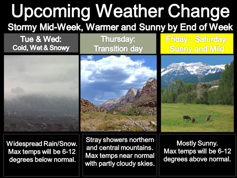
A series of weather disturbances slide through northern Utah today and tomorrow. A strong system is slated to impact the region late Monday, lingering through midweek. Strong high pressure builds late in the week.
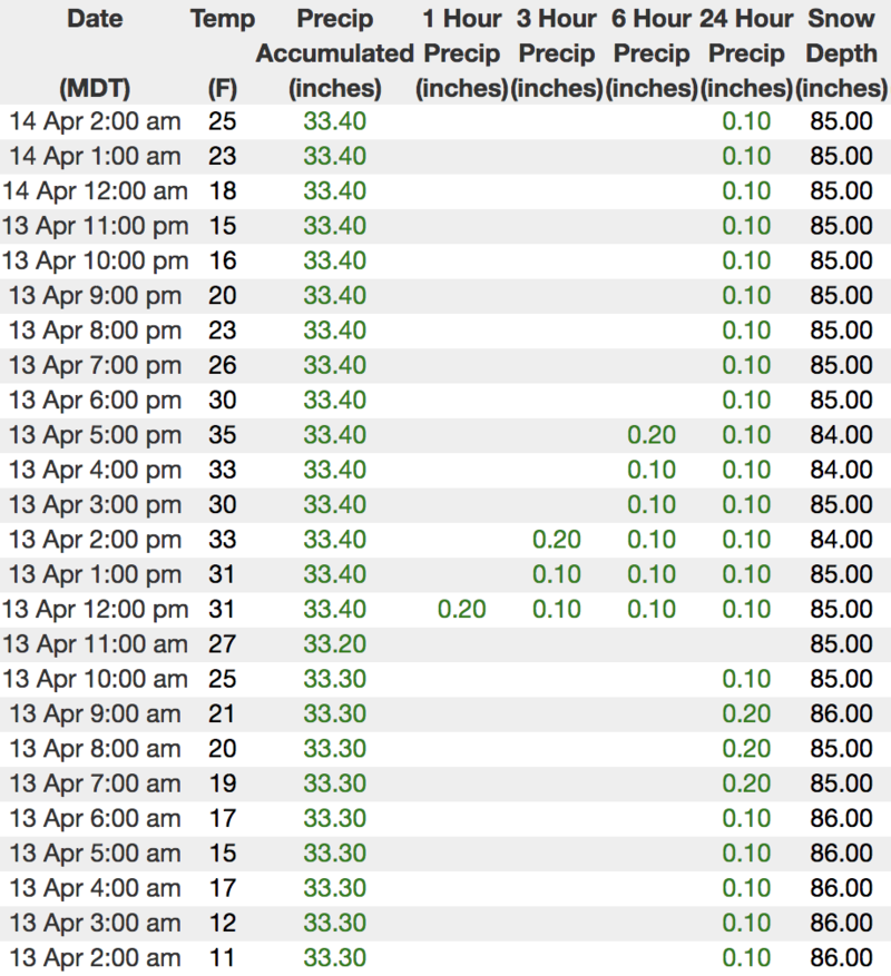
Above... hourly temps, snow, and water totals from Trial Lake (9,945')
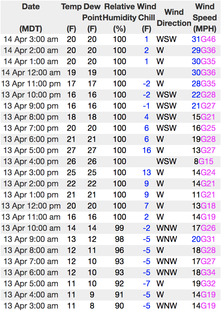
Looks like some network issues, so... no updated winds from the Uinta's. Above is representative wind data from our nearby neighbors in the Wasatch.
To view more regional weather stations click
here.
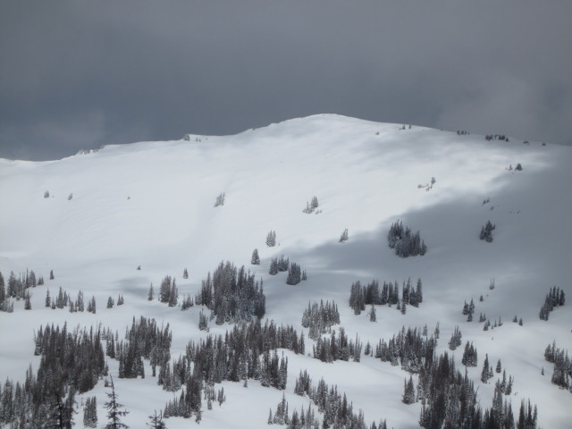
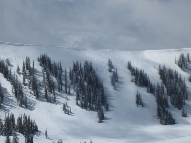
Ted was in Whitney Basin yesterday and noted.... "Took this photo of a south facing slope in upper Whitney Basin and normally this time of year it would be full of brush and dirt patches." More on his travels are found
here.
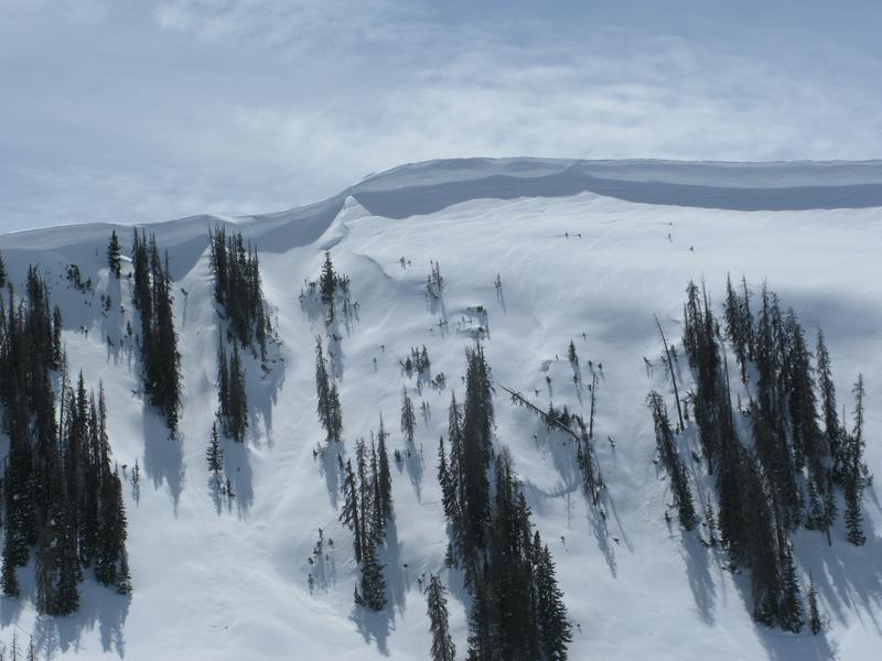
Other than a little sluffing within the new storm snow, no significant avalanche activity to report from yesterday.
Recent trip reports and avy activity found
HERE.