Forecast for the Uintas Area Mountains

Mark Staples
Issued by Mark Staples for
Tuesday, April 11, 2023
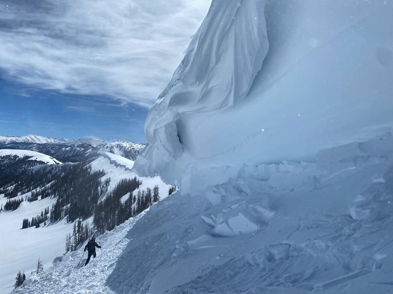
The avalanche danger today is HIGH at all elevations facing east, south, and west where wet loose avalanches will be likely. There's a good chance of some large, destructive wet slab avalanches happening as well.
Northerly facing slopes have a CONSIDERABLE danger with less heating from direct sunshine.
These dangerous avalanche conditions are the result of the rapid shift from cold winter conditions to hot spring weather. Liquid water will be running through the snowpack today as strong sunshine and very warm temperatures melt and destabilize the snow. Avoid being on or under all avalanche terrain today.
Low
Moderate
Considerable
High
Extreme
Learn how to read the forecast here
Avalanche Warning
The avalanche danger for the warning area will rise to HIGH with daytime heating.
In effect from 6 am MST Sunday April 9 to 6 am MST Thursday April 13.
For the mountains and foothills of Northern Utah, including the Wasatch Range...Bear River Range...Wellsville Range...Oquirrh Mountains...Stansbury Range...Cache Valley...Ogden Valley...Skyline...Uinta Mountains
Warm temperatures and the intense sun will create widespread areas of unstable wet snow. Natural and human-triggered cornice falls and wet avalanches are certain. People should avoid being in avalanche terrain (off of and out from under slopes steeper than 30° and stay clear of avalanche runouts on all aspects and elevations.
Special Announcements
The final UAC report for the Upper Weber Canyon avalanche accident on March 9 has been published and is available HERE. The UAC would like to thank Park City Powder Cats for sharing information about the timeline of the accident and allowing UAC staff access to the avalanche after the incident.
Weather and Snow
This morning temperatures are above freezing at all weather stations ranging from 34-43 degrees F after high temperatures yesterday approaching 60 degrees. Winds from the south increased overnight and are blowing 25-45 mph at upper elevations (like a hair dryer in the mountains).
Today will have more intense sunshine and high temperatures easily climbing into the 50s F. Winds will blow 25-35 mph gusting to 50 mph at upper elevations from the southwest

I can't imagine there is any good snow left for riding today. It will all be wet and mushy today.
Recent Avalanches
There has been plenty of wet loose avalanche activity. Nearby mountain ranges have had wet slab avalanches which are a warning that similar slides may happen in the Uintas.
Ad
Avalanche Problem #1
Wet Snow
Type
Location
Likelihood
Size
Description
The snow on all slopes will quickly become very wet today. As it does wet loose avalanches will happen naturally and most will happen on slopes receiving direct sunshine. Northerly facing slopes will warm and melt as well but not as much.
We haven't seen an evidence of big wet slab avalanches in the Uintas, but they could happen today. They have happened in the Wasatch range which experienced a more rapid warm up. A good example of a massive wet slab avalanche happened in the Provo area mountains on Saturday.
Avalanche Problem #2
Cornice
Type
Location
Likelihood
Size
Description
Large cornices exist throughout the Uintas. With the heat, they are curling further downhill and many should break today if they haven't already. Avoid being underneath this hazard.
Additional Information
Observations-
Your observations are important, so please let us know what you're seeing... click HERE and contribute to this amazing community-based program
General Announcements
This forecast is from the U.S.D.A. Forest Service, which is solely responsible for its content. This forecast describes general avalanche conditions and local variations always occur.