March Kicks Off Our Spring Campaign- Donate Now to Support Forecasting

Forecast for the Uintas Area Mountains

Andrew Nassetta
Issued by Andrew Nassetta on
Sunday morning, March 9, 2025
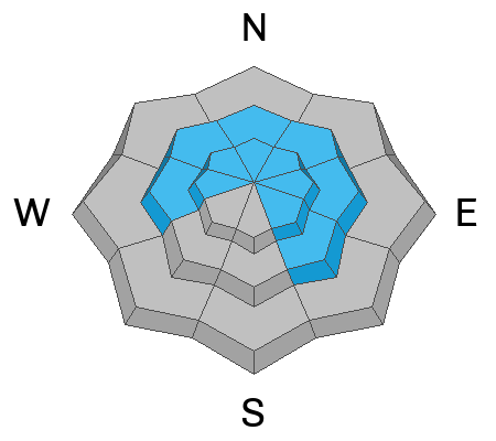
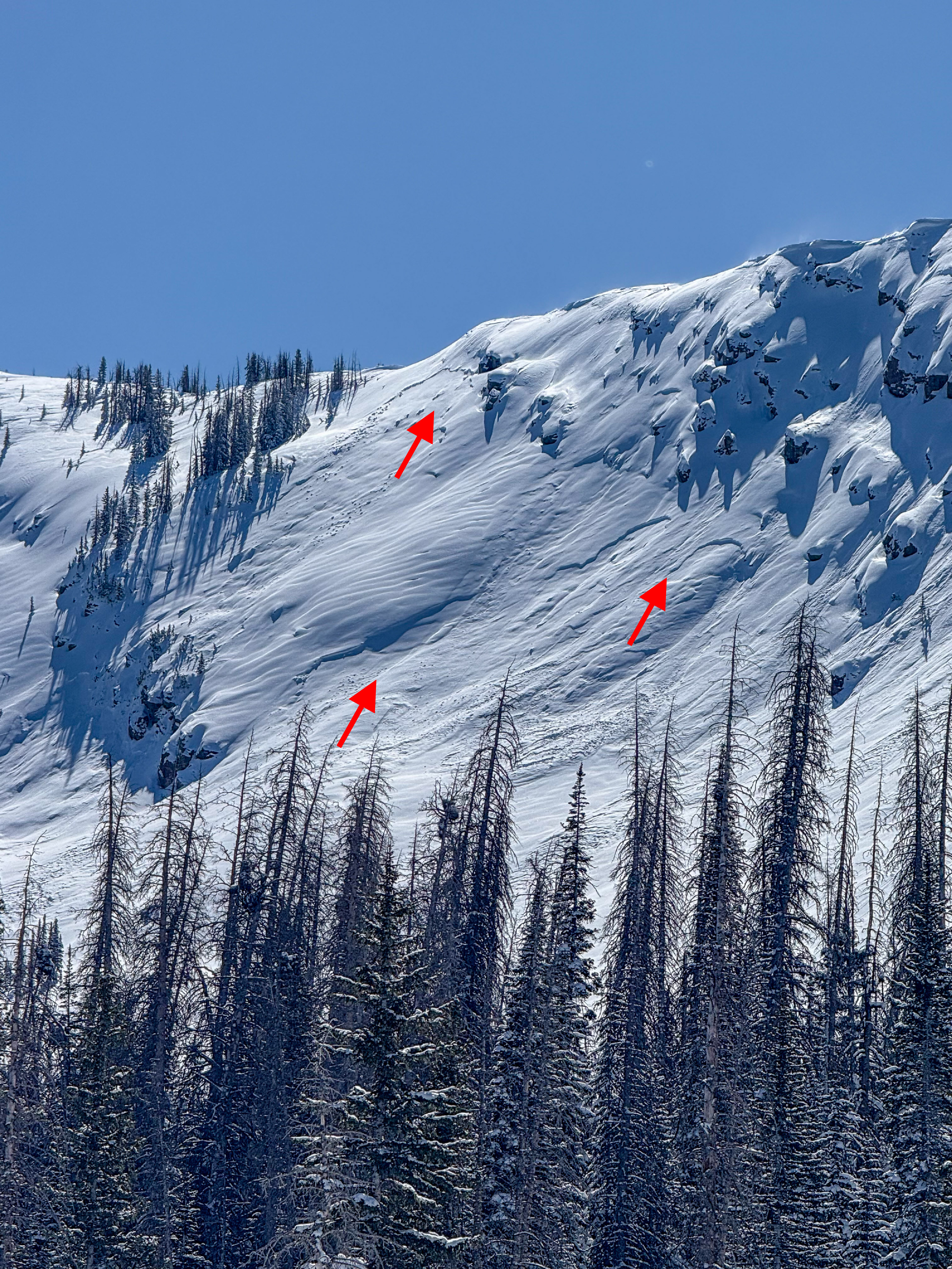
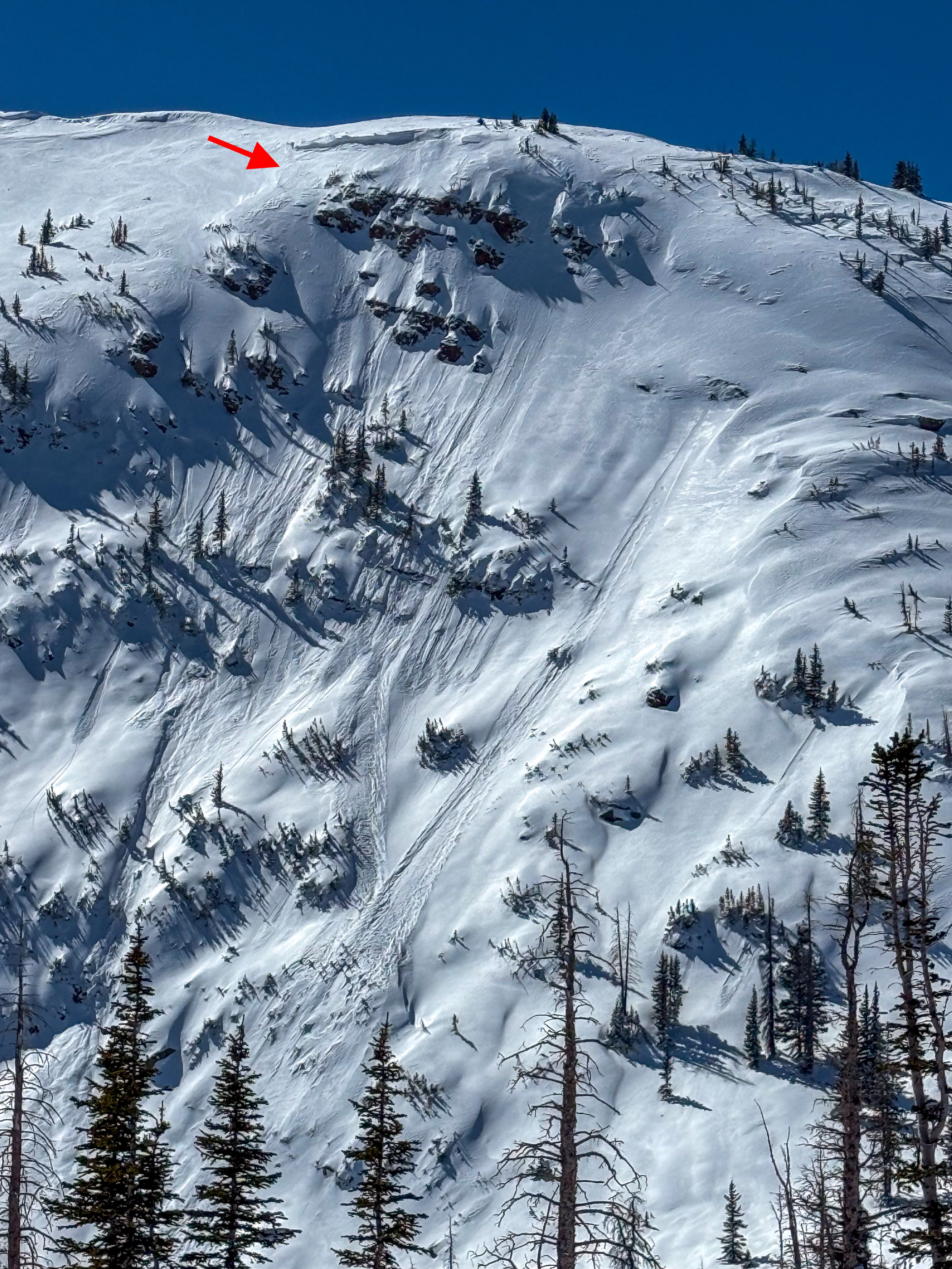
Today, CONSIDERABLE avalanche danger exists on mid and upper elevation slopes facing the north half of the compass, where human-triggered avalanches are LIKELY failing on facets up to 4’ deep. Additionally, it's POSSIBLE we can trigger an old lingering wind drift or a loose snow sluff during spring-esque days, like today.
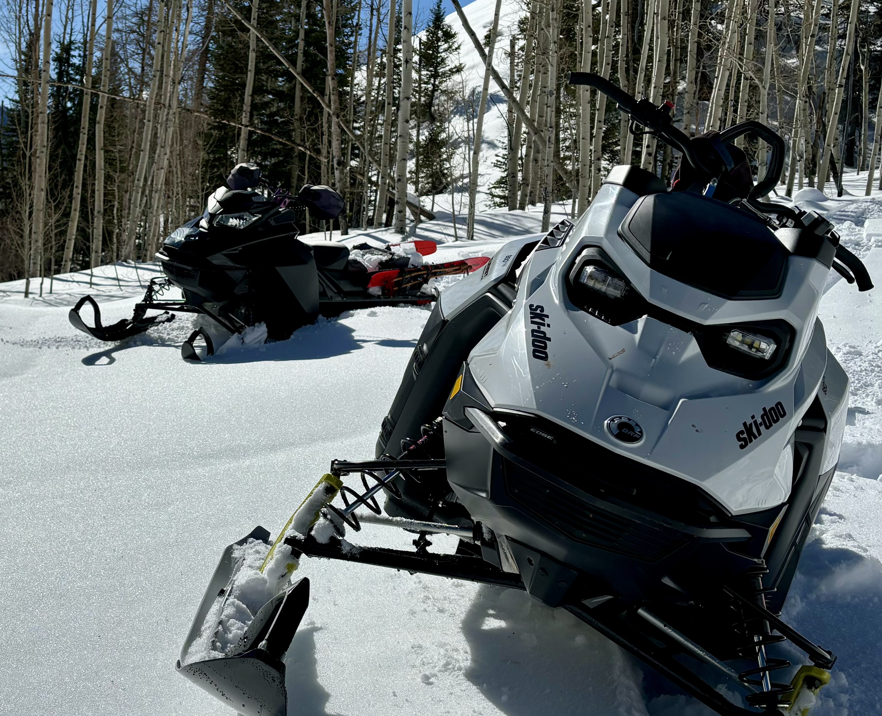
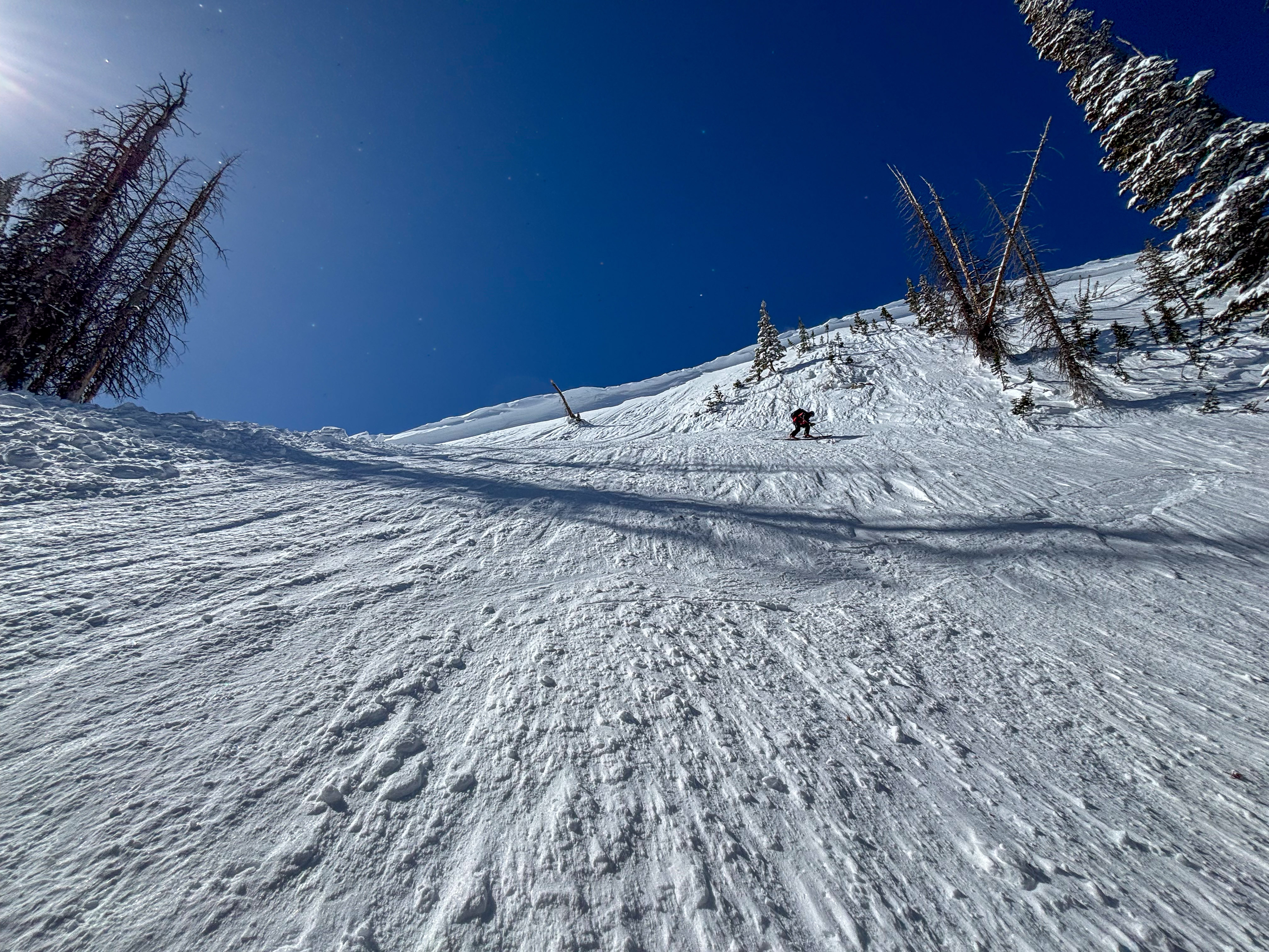
Keep your eyes open and be on your game, especially during the hottest part of the day when things could become more sensitive. For now, I'm hunting cold, creamy pow on the north half of the compass and continuing to steer clear of slopes where persistent weak layers live.
Low
Moderate
Considerable
High
Extreme
Learn how to read the forecast here
Special Announcements
  • We come to you with heavy hearts and great sadness this morning to confirm an avalanche accident on Friday, March 7th near Hoyt Peak, involving 51 year old Micheal Janulaitis from Marion, Utah. Micheal used a snowbike to access the terrain, but was caught, carried, and killed in an avalanche while skiing a steep, northeast facing run on Hoyt Peak.
    Huge thanks to the Department of Public Safety, Park City Mountain Resort and Canyons Village Snow Safety and Ski Patrol teams, along with Wasatch Backcountry Rescue for the hard work recovering Micheal and returning him to his family. Micheal was a friend of Utah Avy and we feel privileged for the time we got to spend together. This is a tremendous loss for our backcountry family and we will miss him deeply. We are compiling accident details and a preliminary report is available here.
  • Did you know.... March kicks off our Spring Campaign? Well, if everyone in Utah’s backcountry community donates the cost of something they regularly enjoy on an adventure—like a dawn patrol burrito, we could fund not just one but two forecasters for the entire season! More information here.
Weather and Snow
Nowcast As of 0500 AM, upper elevation temperatures are currently in the single digits with trailheads at 8,000’ nearing 20℉. Clear skies are paired with light winds from the north around 10MPH with gusts into the 20's.
Forecast For today, another stunning day is on tap with temperatures climbing to the 30’s and clear skies. Ridgeline winds, around 10-20MPH will shift towards the southwest and increase into the afternoon and evening with gusts closer to 30MPH.
Futurecast March is roaring in like a lion, and an active pattern has its sights set on Utah, staged to roll in on Wednesday night and carry on through the weekend.
Travel & Riding Conditions
Yesterdays northeast winds were only put up a good battle but did not win the fight against a strong march sun. By days end many solar aspects had taken on heat and hot pow turned to crust as the sun set. Cold, protected and recycled powder is hanging around on the north half of the compass and is riding like mid-winter if your nose can sniff it out!
Recent Avalanches
Today's avalanches could look like this persistent slab triggered on Friday, March 7th. For all your info, travel obs, and avalanches from the range visit, here!
Looking up at the crown of a recent fatal avalanche near Hoyt Peak (10,200') that broke 2-4' deep and 150' wide in a thinner area of the snowpack on an extremely steep, and consequential slope.
Ad
Avalanche Problem #1
Persistent Weak Layer
Type
Location
Likelihood
Size
Description
It feels like spring, but the snowpack has remained thin and sugary all year and continues to present challenges heading into the change of seasons. The problem is, everything looks white and uniform and feels super solid under our sled, board, or skis, but if you trench down, you will still find weak, sugary facets that are the culprit of recent avalanche activity breaking deep into old snow.
At a time when I am usually stepping out and getting after it, I'm keeping it tight and simply avoiding shallower areas of the snowpack like steep, rocky terrain where I'm more likely to trigger an avalanche into an old persistent weak layer. If I decide to step out, I'm sure slopes I'm choosing don't have any overhead hazards above me or consequences in the runout below. And, of course, Im bringing the right gear and a dialed partner with me as always to help get the job done!
Above, near 11,000' on a northeast slope around Anchor Lake, is an example of a repeater slope... meaning it's avalanched several times and left behind a shallow, weak snowpack. These areas, steep and rocky, are where you are most likely to trigger today's persistent slab avalanche.
Avalanche Problem #2
Wind Drifted Snow
Type
Location
Likelihood
Size
Description
Unusual northeast winds drifted snow onto windward slopes and a-typical places over the past 48hrs. Keep an eye out for a rounded, old pillows of wind-drifted snow and trailer sized cornices that linger above avalanche paths and steep slopes. Look for drifts in peculiar locations and aspects with a westerly component to their orientation that are resting on a variety of old snow surfaces.
Remember 40% of us are killed by trauma in avalanche accidents, so we don't always have to be buried by a big avalanche. As we step out into bigger terrain, whether it is into the alpine of a more slope-by-slope micro approach, keep in mind the consequences of the slope you are entering and be prepared for the risks you are taking.
In this photo, easterly winds moved snow upslope and filled in cornice scarps and old crown lines.
General Announcements
We are always looking for snow and avalanche observations or just general riding conditions. In the meantime reach out to us with questions, concerns, or if you see anything in your travels! Contact us directly through the info below:
This forecast is from the U.S.D.A. Forest Service, which is solely responsible for its content. This forecast describes general avalanche conditions and local variations always occur. This forecast was issued on Sunday, March 9th at 05:30 AM and expires 24 hours after it was issued.