Forecast for the Uintas Area Mountains

Issued by Craig Gordon on
Saturday morning, March 8, 2025
Saturday morning, March 8, 2025
Heads up.... recent storm snow gets a blast of warmth and strong spring sunshine today and that one-two punch may help reactivate several weak layers now buried deeply in our snowpack-
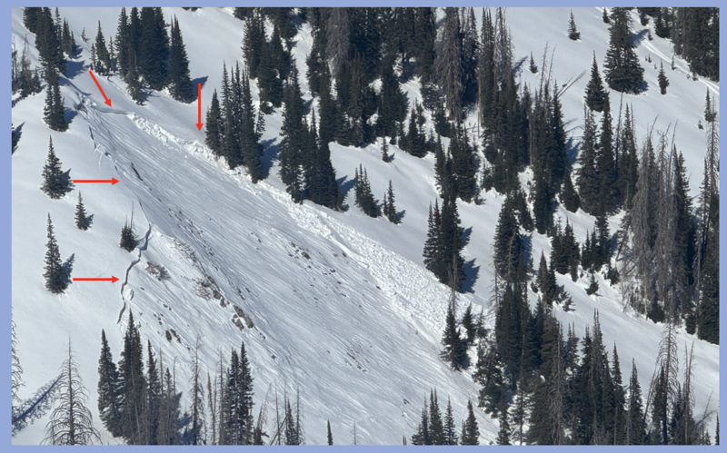
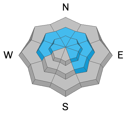
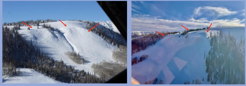
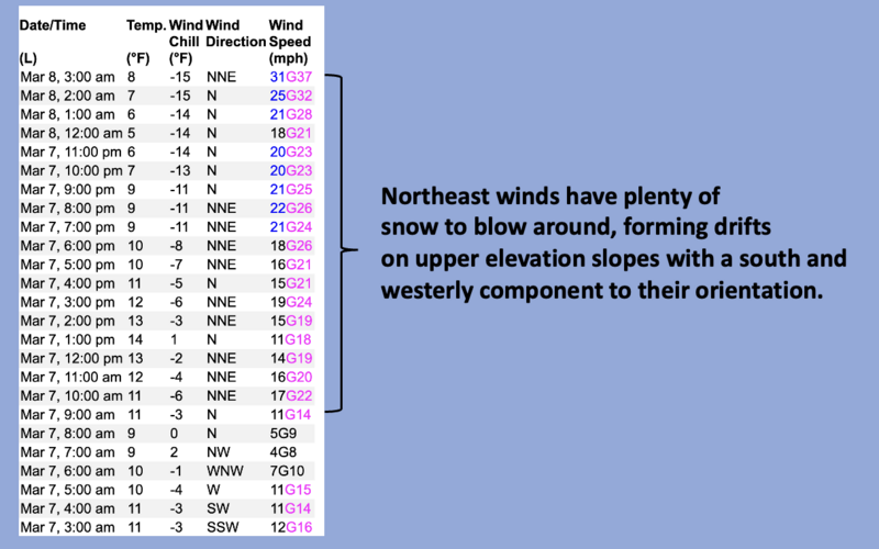
In the wind zone at and above treeline, CONSIDERABLE avalanche danger exists on leeward slopes, especially those facing the north half of the compass where human-triggered, storm snow and wind-drifted avalanches are LIKELY. Remember... any slide triggered in steep, rocky terrain with a weak, shallow snowpack will result in a deep, dangerous avalanche.
In addition, significant amounts of storm snow blankets our mountains from tip to tail, offering a slightly more straightforward and predictable avalanche dragon and MODERATE avalanche danger. But don't let your guard down... human triggered avalanches packing a punch are POSSIBLE, especially on sustained, steep slopes.

Low
Moderate
Considerable
High
Extreme
Learn how to read the forecast here