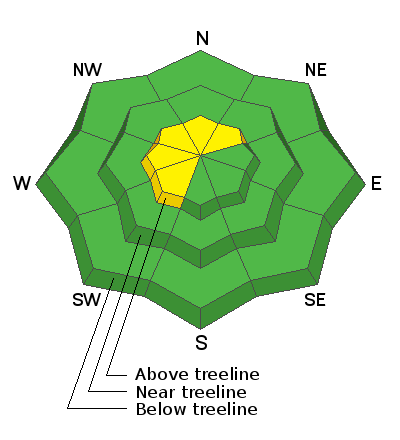
Clouds began streaming in from the south overnight ahead of a stretch of unsettled weather slated to impact the region the next few days. Currently, temperatures are in the mid 20's and total settled snow depths hover right around seven feet. East and southeast winds bumped into the 30's and low 40's right around dinnertime last night and have blown steadily since. Riding and turning conditions took a bit of a hit overnight and it's gonna be sorta rugged out there this morning. But fear not.... a reset is on the way. So have a little patience, get your projects done today, and we'll have some shallow fresh snow on tap for your Friday morning ride.
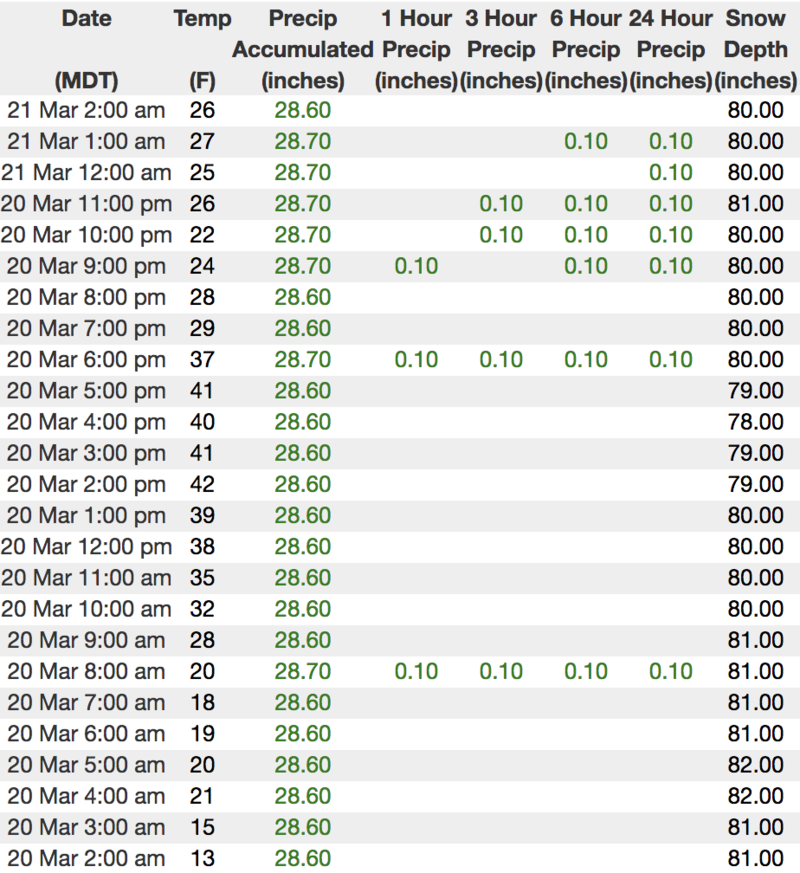
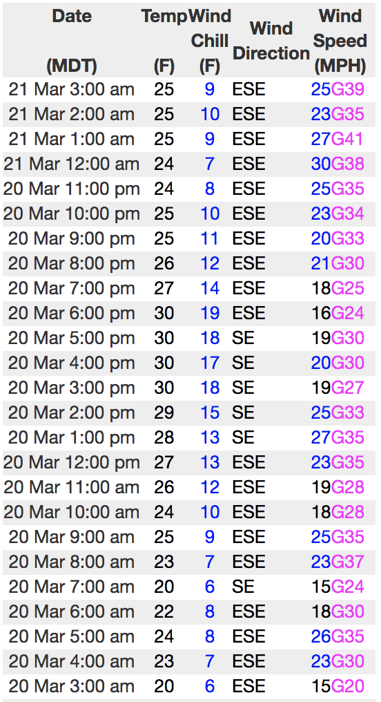
Above is hourly data from Trial Lake (9,945') and Windy Peak (10,662'). To view more regional weather stations click
here.
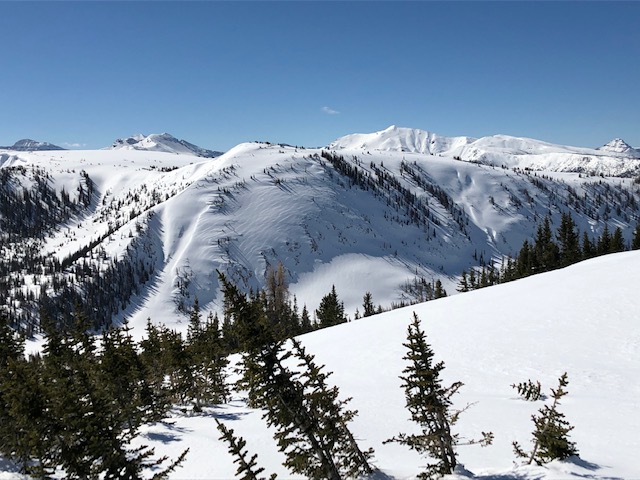
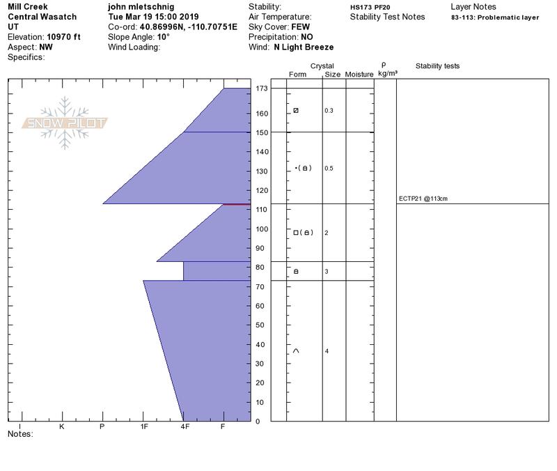
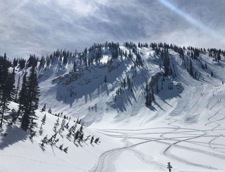
John Mletschnig was in the Millcreek zone yesterday and found stunning views, and not surprising, a slightly weaker snowpack than in some of our deeper areas found in the central core of the range. More on John's travels found
here.
Dave Kikkert was near Moffit Peak yesterday and was able to trigger shallow sluffs in steep sustained terrain. More on Dave's travels
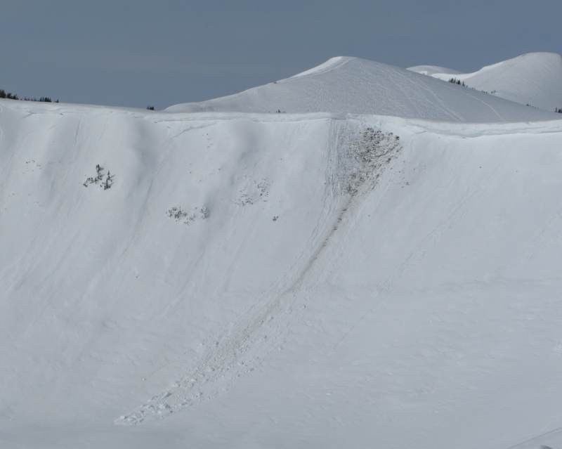
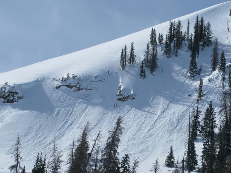
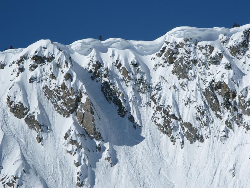
here.Occurring naturally, a piece of cornice peeled off this ridgeline in upper Weber Canyon sometime late Sunday afternoon. The bus sized piece of snow crashed onto the slope below, triggering a shallow wet slab which gouged into weak snow near the ground. Of note... a repeater, the snowpack was already shallow in this zone from an avalanche triggered earlier this year.
Recent trip reports and avy activity found HERE.