Forecast for the Uintas Area Mountains

Craig Gordon
Issued by Craig Gordon on
Thursday morning, March 19, 2026

Heads up... unusually warm weather is gonna deliver unusually large and unpredictable avalanches-

CONSIDERABLE avalanche danger exists in mid and upper elevation polar terrain, especially steep, rocky, and complex slopes facing northwest through southeast where both natural and human-triggered avalanches are LIKELY. Any avalanche triggered can fail on our mid January problem child (weak, sugary, PWL), resulting in a deep and very dangerous, bone snapping, tree splintering slide that stacks up multiple yards of cement-like debris.

The Uinta's are going through their first significant rapid warm-up of the season and if you're feeling like and ant under a magnifying glass... so is the snowpack. And please don't forget... wet slides breaking to weak layers are gonna wake up a rowdy, unpredictable, and impossible to manage avalanche dragon.

Low
Moderate
Considerable
High
Extreme
Learn how to read the forecast here
Special Avalanche Bulletin

What-

A Special Avalanche Advisory is issued for all mountain regions across Utah beginning Thursday, March 19, through Sunday, March 22, as avalanche danger is expected to rise in the coming days.

When-

In effect from 6 AM MST Thursday to 6 AM MST Monday.

Where-

The mountains of Utah and southeastern Idaho.

Impacts-

Record-breaking warm temperatures will rapidly destabilize the snowpack across the state, increasing the likelihood of widespread, spontaneous, destructive wet avalanches. Wet avalanches could occur on all aspects and at all elevations, including places that typically stay colder this time of year. Avoid travel on and below steep slopes, including avalanche runout zones and terrain traps.

Special Announcements

After a difficult week in February that included four avalanche fatalities, UAC forecasters will host a community debrief to discuss the conditions surrounding these accidents. We will review the weather and snowpack patterns, share observations from the field, and discuss lessons learned. This event will not be live but include time for questions and discussion, with the goal of learning together as a community. Please use the form below to submit questions for review-

Link: https://docs.google.com/forms/d/e/1FAIpQLSeiQYtJ7T-4mM2D-bm57JhHJR9kiFkC...

Weather and Snow

Nowcast - Clear skies and high pressure overhead deliver a slight temperature inversion this morning with the mercury registering in the upper 30's F° across mountain valley bottoms and mid 40's F° along the ridges. Winds blow from the west, gusting 20-30 mph near the high peaks.

Forecast - March Madness is in full court stride as a robust ridge of high pressure delivers abundant sunshine and very warm, early summer-like temperatures with highs soaring into the mid 60's F°. Westerly winds hum along in the 20's and 30's near the high peaks.

Futurecast - Sweltering heat through Saturday.

Travel Conditions - North and south side gates are open on HW150, plowed from the north to Whitney and from the south to Spring Canyon, and of course SR35 remains open over the pass. Solars are melted out up to 9,000' and many windward slopes are scoured and worked to the dirt. Acceptable riding is still found in upper elevation alpine terrain.

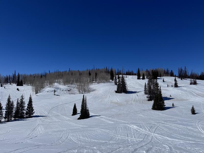
Local snow-pros, Dave and Johanna Kelly, found mostly fun riding in the Soapstone area yesterday. You can explore their detailed trip report here.

Recent Avalanches

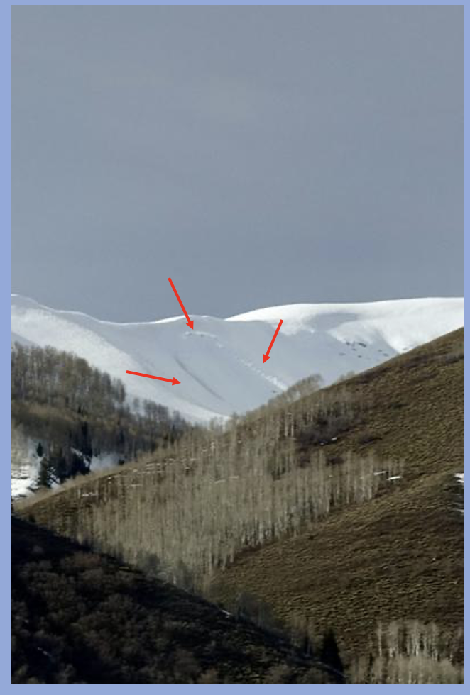
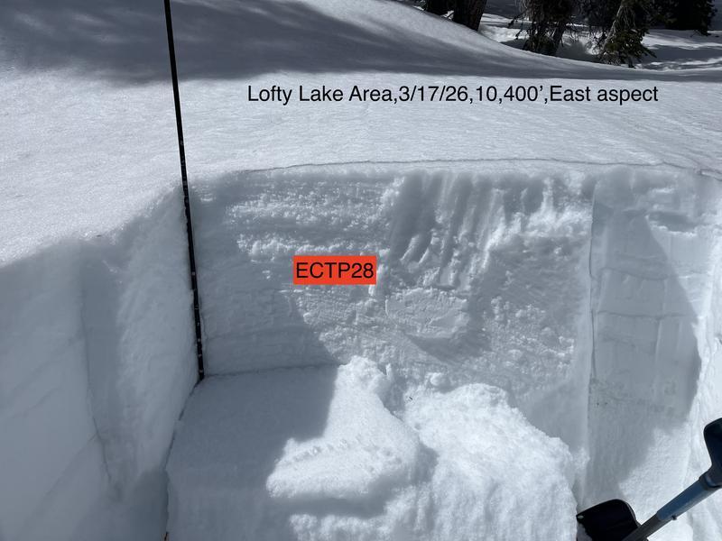
Peeling out naturally on Tuesday morning, this piece of east facing real estate in Upper Weber Canyon harbors very weak and well preserved January near surface facets and is similar to many slopes waiting to come to life. Thanks to snow-pro extraordinaire Trevor Katz for this great piece of info and all his insight and input this season. We 'preciate you Amigo!

Click below for any recent slides that have been observed, or for travel and condition reports from across the range.

Avalanche Problem #1
Wet Snow
Type
Location
Likelihood
Size
Description

Ted Scroggin, our main man with the Uinta plan, was in the Lofty Peak zone Tuesday and notes... "On an east aspect at a little over 10,000' I was able to get an ECTP score of 28. While the column did crack and propagate it was not super energetic." Ted goes on to say... "Will water move down through the pack and weaken the strength and does the snow go through a rapid settlement and put additional stress on the slab and weak layer interface?"

Let's explore that notion... I suspect it's about to get weird and here's why-

Weak, sugary facets formed during the mid January drought are buried 1'-4' below the snow surface and have been largely partying without a care in the world for the past two months, protected under a dense, cohesive slab... our February and March storm snow. However, these actors of questionable integrity (you know who you are :) have overstayed their welcome, outlasted the curfew, and are now gonna go through a rapid change, have their worlds rocked by sky-rocketing temperatures and get the bums rush treatment on many steep slopes throughout the range.

General Announcements

We are always looking for snow and avalanche observations or just general riding conditions. Reach out to us with questions, concerns, or if you see anything in your travels! Contact us directly through the info below:

Craig Gordon -- [email protected] -- 801 203 2170

This forecast is from the U.S.D.A. Forest Service, which is solely responsible for its content. This forecast describes general avalanche conditions, and local variations always occur. This forecast was issued on Thursday, March 19, at 04:00 and expires 24 hours after it was issued. We'll update this information by about 7:00 AM tomorrow.