Forecast for the Uintas Area Mountains

Craig Gordon
Issued by Craig Gordon on
Wednesday morning, March 18, 2026

Heads up... unusually warm weather is gonna deliver unusually large and unpredictable avalanches-

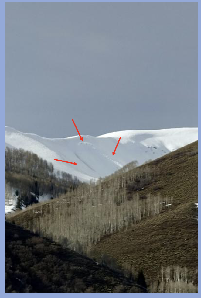
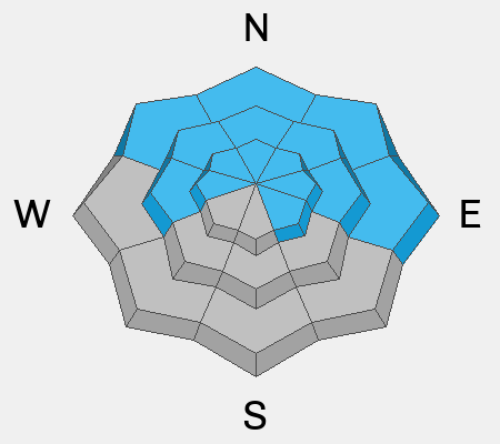
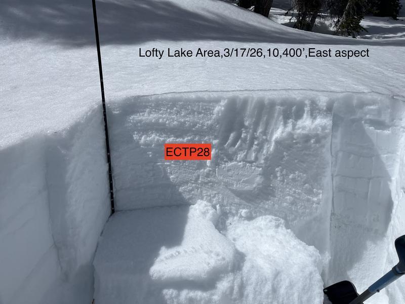
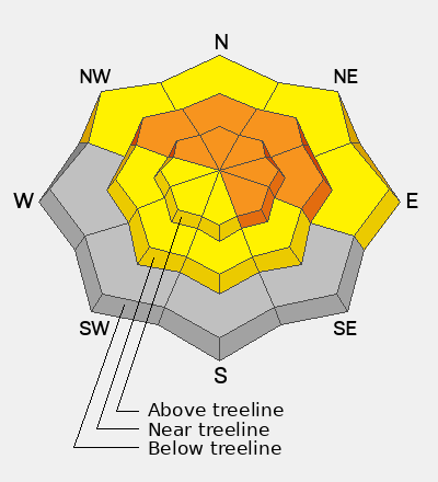
CONSIDERABLE avalanche danger exists in mid and upper elevation polar terrain, especially steep, rocky, and complex slopes facing northwest through southeast where both natural and human-triggered avalanches are LIKELY. Any avalanche triggered will fail on our mid January problem child (weak, sugary, PWL), resulting in a very dangerous, bone snapping, tree splintering slide that stacks up deep piles up cement-like debris.

The next couple days are gonna be weird and the snowpack is gonna get cranky as it experiences skyrocketing temperatures, heat shock, and rapid change.

Low
Moderate
Considerable
High
Extreme
Learn how to read the forecast here
Special Announcements

Each spring, we ask for your continued financial support to fund our forecasting programs. We hope you will consider supporting our mission by checking out our campaign and auction, live and available.

Weather and Snow

Nowcast - High pressure builds overhead, delivering severe clear skies and steamy temperatures, which, at o'dark thirty, start their day hovering right around 40 F°. Winds blowing from the west in the 20-30 mph range take a little bit of the edge off, especially near the high peaks.

Forecast - Make sure to lather up with your tanning oil (message me for my own personal recipe :) as mostly sunny skies and record breaking high temperatures soaring into the upper 50's F° are gonna make it feel downright tropical today. Winds remain in the obnoxious category and don't vary much from where we're at this morning. Overnight lows barely dip into the upper 30's F°.

Futurecast - Sweltering heat through Saturday.

Travel Conditions - North and south side gates are open on HW150, plowed from the north to Whitney and from the south to Spring Canyon, and of course SR35 remains open over the pass. Solars are melted out up to 9,000' and many windward slopes are scoured and worked to the dirt. The best riding exists above 11,000' on the northerlies, in protected and sheltered terrain.
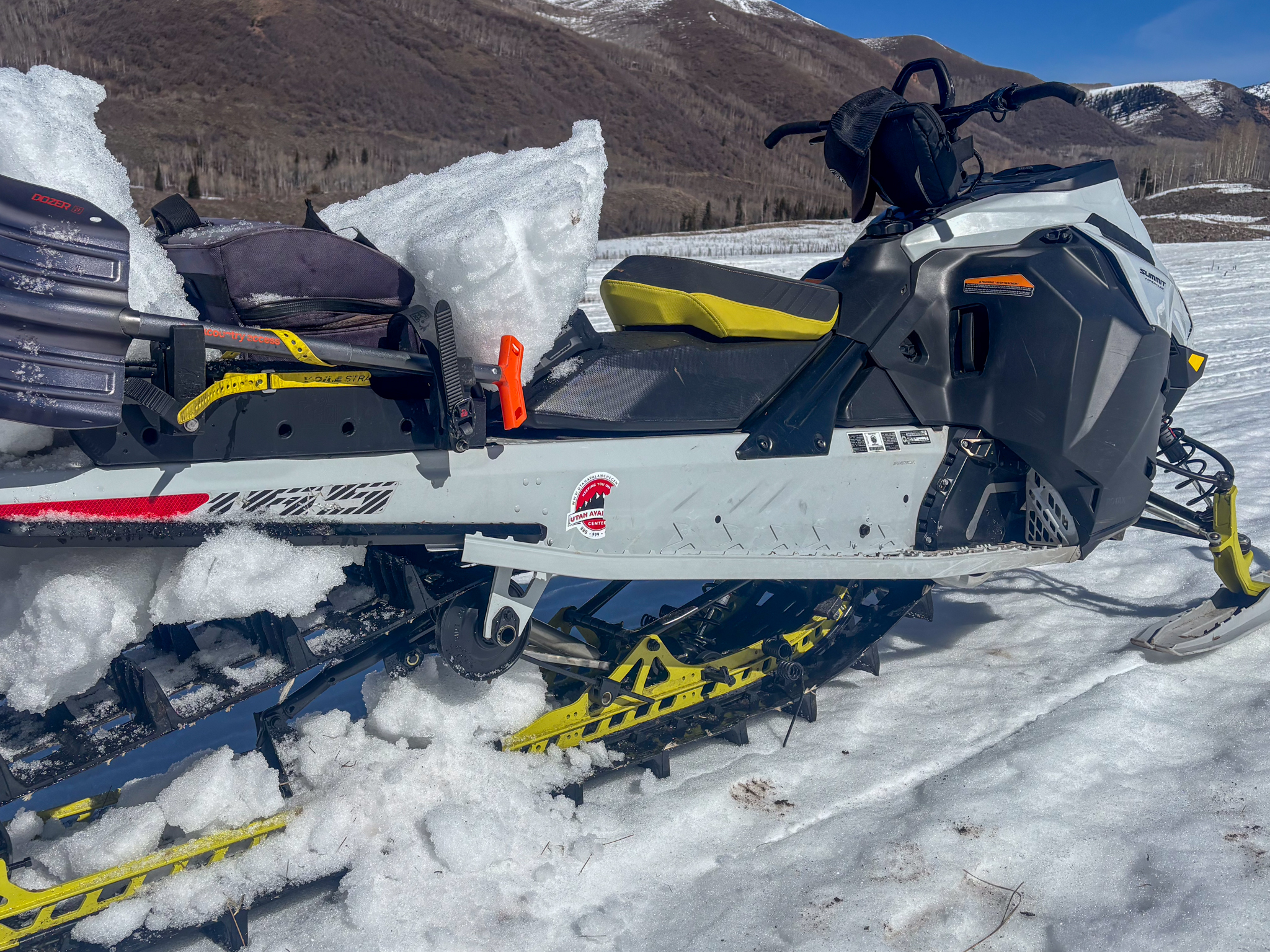
The price of admission is getting higher by the day and there's less, loose snow to keep your rig cool. A message from The Boss himself suggests... "You've got to learn to live with what you can't rise above, If you want to ride on down... down in through this tunnel of love."

Recent Avalanches

Yesterday's all you can eat Feast of St. Patrick kicked off mid morning in Upper Weber Canyon with a nice slice peeling off right out of the gates. This piece of upper elevation, east facing real estate harbors very weak and preserved Jan. NSF and is similar to many slopes waiting to come to life. Thanks to snow-pro extraordinaire Trevor Katz for this great piece of info and all his insight and input this season. We 'ppreciate you Amigo!

Click below for any recent slides that have been observed, or for travel and condition reports from across the range.

Avalanche Problem #1
Wet Snow
Type
Location
Likelihood
Size
Description

Ted Scroggin, our main man with the Uinta plan, was in the Lofty Peak zone yesterday and notes... "On an east aspect at a little over 10,000' I was able to get an ECTP score of 28. While the column did crack and propagate it was not super energetic." Ted goes on to say... "Will water move down through the pack and weaken the strength and does the snow go through a rapid settlement and put additional stress on the slab and weak layer interface?"

Let's explore that notion... I suspect it's about to get weird and here's why-

Weak, sugary facets formed during the mid January drought are buried 1'-4' below the snow surface and have been largely partying without a care in the world for the past two months, protected under a dense, cohesive slab... our February and March storm snow. However, these actors of questionable integrity... you know who you are, have overstayed their welcome, outlasted the curfew, and are now gonna go through a rapid change, have their worlds rocked by sky-rocketing temperatures and get the bums rush treatment on many steep slopes throughout the range.

Don't forget... the Uinta's are going through their first significant rapid warm-up of the season and this avalanche dragon is rowdy, unpredictable, and hard to manage. If you're feeling like and ant under a magnifying glass... so is the snowpack.

General Announcements

We are always looking for snow and avalanche observations or just general riding conditions. Reach out to us with questions, concerns, or if you see anything in your travels! Contact us directly through the info below:

Craig Gordon -- [email protected] -- 801 203 2170

This forecast is from the U.S.D.A. Forest Service, which is solely responsible for its content. This forecast describes general avalanche conditions, and local variations always occur. This forecast was issued on Wednesday, March 18, at 04:00 and expires 24 hours after it was issued. We'll update this information by about 7:00 AM tomorrow.