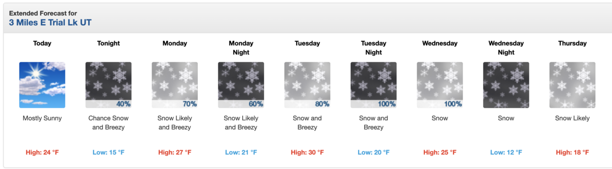
Forecast for the Uintas Area Mountains

Mark Staples
Issued by Mark Staples for
Sunday, February 4, 2024
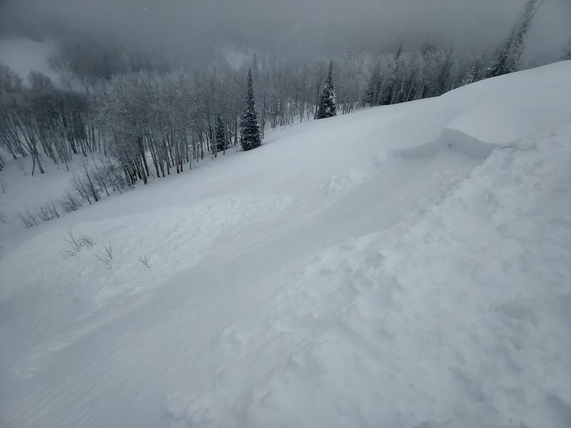
HEADS UP - there are two distinctly different avalanche problems to deal with today even though the danger levels are mostly yellow. Soft slabs of wind drifted snow about 1-2 feet deep will be the most likely avalanche to trigger today. Large hard slab avalanches breaking on weak, faceted layers deep in the snowpack are unlikely but the consequences are deadly.
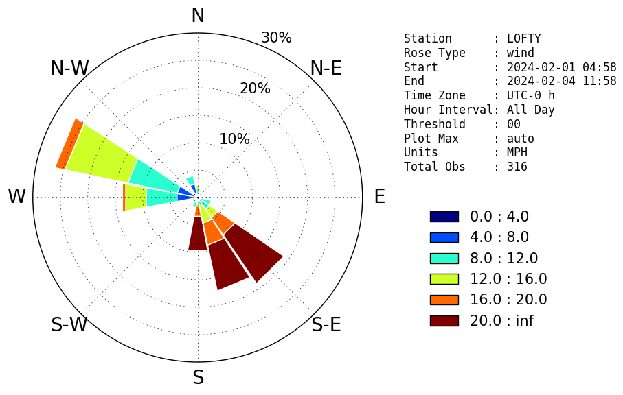
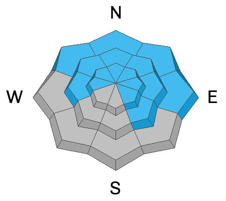
Today, the avalanche danger is MODERATE on most slopes, but the danger will be more acute on any slope loaded by recent winds which have blown from a wide variety of directions.
Below treeline on west and south facing slopes, the danger is LOW.
Low
Moderate
Considerable
High
Extreme
Learn how to read the forecast here
Weather and Snow
Snowfall yesterday delivered 3-6 inches of new snow in the northern parts of the Uintas with just a dusting further south near Currant Creek and Strawberry Reservoir. Storm totals since Thursday evening across the Uintas are 7-12 inches of snow (0.7-1.0" of water). Get ready! Today will be the only sunny day followed by snowfall for the rest of the week. Snowfall amounts by the end of the week should be around 2 feet....maybe more.
Winds have been interesting. Thurs/Friday winds came from the S and SE which created some odd loading patterns. Then winds shifted and blew from the west and north. This morning they have calmed and are barely blowing. Today, winds will be light but begin increasing late this afternoon with the approaching storm. Winds will really ramp up and blow from the S and SW on Monday and Tuesday.
Temperatures were near freezing and the weather felt very coastal on Friday. As winds came from the north, cold air arrived dropping temps into the upper teens F this morning (single digits at upper elevations). Today temperatures should warm into the low 20s F.
Here comes the snow! Image of a point forecast from the National Weather Service for the Trial Lake area along the Mirror Lake highway
Recent Avalanches
Regular observer Mike J was able to trigger soft slabs of wind drifted snow (photo below) on "both sides of the compass" yesterday. What was notable was the loading from SE winds that he found on NW facing slopes. Mike's ob mirrors what ski patrols in the Wasatch reported where there were numerous soft slabs they could easily trigger yesterday.

Read more Uinta observations and avalanches HERE.
Ad
Avalanche Problem #1
Wind Drifted Snow
Type
Location
Likelihood
Size
Description
Soft slabs of wind drifted snow were very easy to trigger yesterday 1-2 feet deep and triggering them today remains very possible. The challenge with this problem is that it exists around the compass near and above treeline. The diagram below illustrates winds on Lofty Lake Peak and shows winds from the SE.
Wind rose diagram for winds at the Lofty Lake Peak weather station (11,186'). This image shows the direction winds blew from. Colors indicate wind speeds. Wind rose from the University of Utah.
Avalanche Problem #2
Persistent Weak Layer
Type
Location
Likelihood
Size
Description
It's no secret that the snowpack has been plagued by a persistent weak layer of faceted snow that has produced hard slab avalanches 2-4 feet deep. There were two general layers - one from November snow and another that formed during dry weather in the last several weeks of December. Most steep slopes have avalanched several times.
What makes this problem especially tricky is that avalanches on most slopes left behind a highly variable mix of faceted layers. This variability makes assessing this avalanche problem very difficult.
What we know - Areas that are steep and rocky have some of the weakest snow and will be the most likely places to trigger these avalanches. In general the likelihood of triggering one of these avalanches has slowly gone down since mid January, but snowfall this week may be enough to raise the likelihood again.
Additional Information
The Uinta weather station network was upgraded this summer and all that real-time info is found HERE. Simply click on "western Uinta" tab and then "weather stations" tab.

We are always looking for snow and avalanche observations or just general riding conditions. So... if you see something, say something. You can reach me directly at [email protected] or 801-231-2170.
Also, if you're looking for more avy education opportunities for yourself, your crew, or your club please don't hesitate to reach out to me and we'll find a presentation, class, or clinic for ya!
General Announcements

Issued at 0700 on Sunday, February 4th this forecast will be updated by 0700 Monday, February 5th, 2024.
This forecast is from the U.S.D.A. Forest Service, which is solely responsible for its content. This forecast describes general avalanche conditions and local variations always occur.