Forecast for the Uintas Area Mountains

Craig Gordon
Issued by Craig Gordon for
Monday, February 28, 2022
MODERATE avalanche danger is found at and above treeline, especially on slopes facing the north half of the compass where both new and older wind drifts rest on top of weak, sugary snow. Human triggered avalanches are POSSIBLE and may break deeper and wider than you might expect. Lose the wind and you lose the problem. In terrain where last weeks winds haven't drifted snow, especially at mid and lower elevations, the avalanche danger is LOW and human triggered avalanches are UNLIKELY.

Low
Moderate
Considerable
High
Extreme
Learn how to read the forecast here
Special Announcements
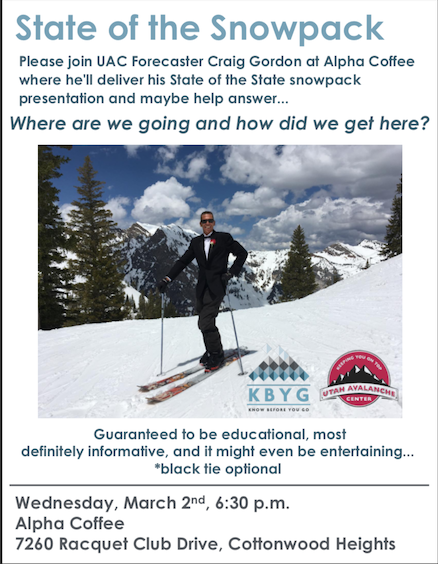
Wanna share a cuppa, interested in the this years snowpack trends, or maybe just NSF curious? Well then, you came to the right place... please join me at 6:30, Alpha Coffee on Wednesday March 2nd and we can discuss the future of snowpack satiability trends together. Save the date, take a date, and I look forward to seeing you there :)
Weather and Snow
NOWCAST-
High clouds drifting into the region late yesterday, decided... nothing to see here, moved along and have been replaced with nothing but clear skies. Indeed it's a beautiful morning in the mountains with a slight temperature inversion developing, which means it's in the teens at the trailheads and low to mid 20's on the ridges. West and northwest winds blow just 10-20 mph even near the high peaks. Dribs and drabs of new snow trickling in last week added up and it's starting to feel deep, especially on wind-sheltered, shady slopes where the new snow rests on soft, faceted snow.
FORECAST-
Expect another stunning day in the mountains as building high pressure delivers light winds and nothin' but blue skies along with high temperatures climbing into the mid and upper 30's. Overnight lows dip into the teens.
FUTURECAST-
Clouds drift in and out of the region through midweek, but no big changes in the pattern until perhaps Thursday. Details for more stormy weather is still being sifted through and I'll keep you updated as details develop.
Trip reports and current state of the snowpack observations are found HERE.

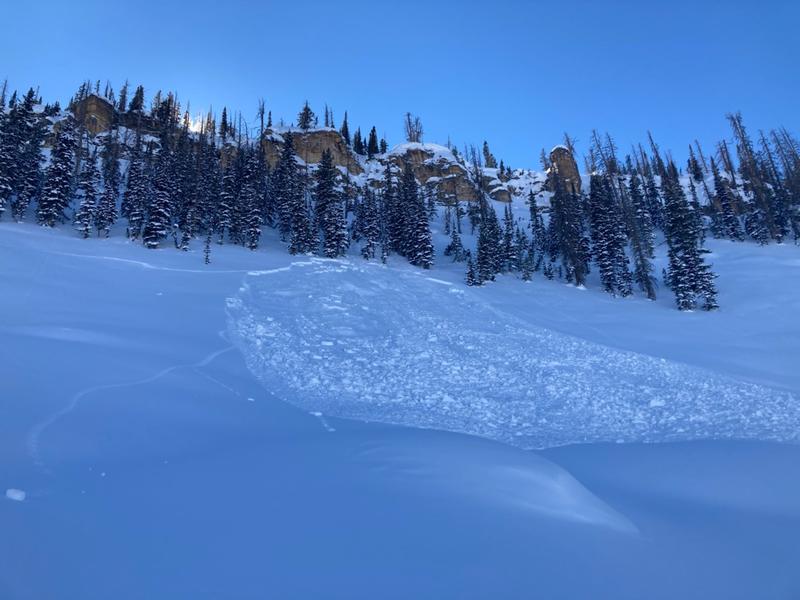
Over-the-head and over-the-hood.... looks like Dan G found a honey hole yesterday.
Looking for real-time temps, snow, or wind?
Click HERE and then on the "western Uinta" tab for western Uinta specific, weather station network.
Recent Avalanches
Reported Saturday, coyote tracks were spotted near this small slide on a steep, shady slope near Hoyt Peak. Not particularly large, just 10" deep and 100' wide, but this pockety slab is breaking on weak January snow and is a good indicator for the type of avalanche problem we're dealing with today.

Your input is vital and we're interested in what you're seeing. Please contribute to this great community resource and go here to fill out an observation.
Ad
Avalanche Problem #1
Persistent Weak Layer
Type
Location
Likelihood
Size
Description
As temperatures continuing warming today and the last weeks cold snow begins to settle, pockety slabs will become touchy, reactive to our additional weight, and may break deeper and wider than you might expect.
Last week's storm snow is settling, becoming more cohesive and beginning to bring the weak, sugary, near surface facets (NSF) formed during the January dryspell out of its dormancy. I spent the past couple days stomping around Upper Weber/Chalk Creek in an attempt to get a 30,000' view of weak layer distribution. Even though old snow surfaces vary greatly it's really the same story snowpack-wise. The weakest snow I've found is on east, north, and northeast aspects, especially on mid and upper elevation wind sheltered slopes. Here's where it gets tricky... large swaths of upper elevation terrain facing the north half of the compass were blasted by the winds prior to our recent storms and weak snow distribution is spotty at best. That means you'll need to evaluate each slope on an individual basis.

A sidebar HEADS UP - It's easy to be complacent because conditions aren't too dangerous, and avalanches may not be too big. HOWEVER, an avalanche fatality earlier this month in Montana near West Yellowstone is an example of how a relatively small avalanche can be deadly. That avalanche was 4-11 inches deep and 75 feet wide. Read more HERE.
Additional Information
Your observations are important, so please let me know what you're seeing... click HERE and contribute to this amazing community based program
General Announcements
The information in this forecast expires 24 hours after the day and time posted, but will be updated by 07:00 Tuesday, March 1st.
Before it gets too crazy, now is the time to book an avalanche awareness presentation for your group, club, or posse. You can reach me directly at 801-231-2170 or [email protected]
This forecast is from the U.S.D.A. Forest Service, which is solely responsible for its content. This forecast describes general avalanche conditions and local variations always occur.