Forecast for the Uintas Area Mountains

Craig Gordon
Issued by Craig Gordon for
Thursday, February 24, 2022
A MODERATE avalanche danger is found on all aspects above treeline. Human triggered avalanches are possible, especially in steep, wind drifted terrain facing the north half of the compass.
Lose the wind, you lose the problem, and you find LOW avalanche danger on mid and lower elevation slopes.
Low
Moderate
Considerable
High
Extreme
Learn how to read the forecast here
Weather and Snow
NOWCAST-
Light snow continued overnight adding an additional 2" of cold smoke to our growing storm totals which now stack up to 6" snow with .40" H2O across the range. Clouds drape our mountains and some of the coldest air of the winter filters in from the northwest with all remote weather stations reporting diesel gelling temperatures in negative territory. Along the high ridges, winds blow 10-20 mph, which creates nearly hat wearing weather windchill values clocking in at -23 degrees... ouch. Not quite over the hood or over the head, but riding and turning conditions continue to improve with each little shot of snow.
FORECAST-
Expect mostly cloudy skies with scattered snow showers throughout the day which slowly pile up an additional inch or two of snow. It'll be cold with high temperatures barely cracking into the single digits. West and northwest winds bump into the upper 20's along the high ridges as the day wares on.
FUTURECAST-
A trailing system clips the region late this afternoon and evening, bringing another shot of snow with minor accumulations. Expect rebounding temperatures for Friday with beautiful weather on tap for the weekend.
Trip reports and current state of the snowpack observations are found HERE.

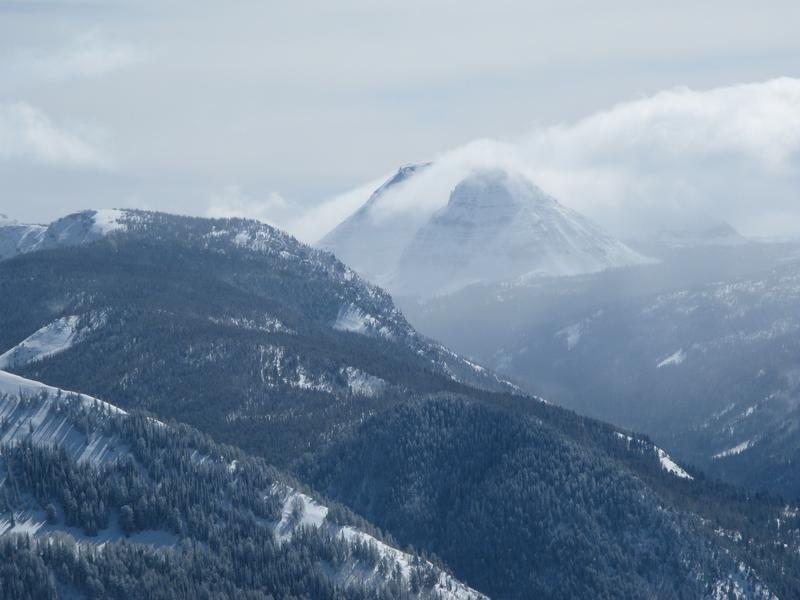
Clouds parted long enough for me to capture this image of an Everest-esque looking Reids Peak staring back at me.
Looking for real-time temps, snow, or wind?
Click HERE and then on the "western Uinta" tab for western Uinta specific, weather station network.
Recent Avalanches
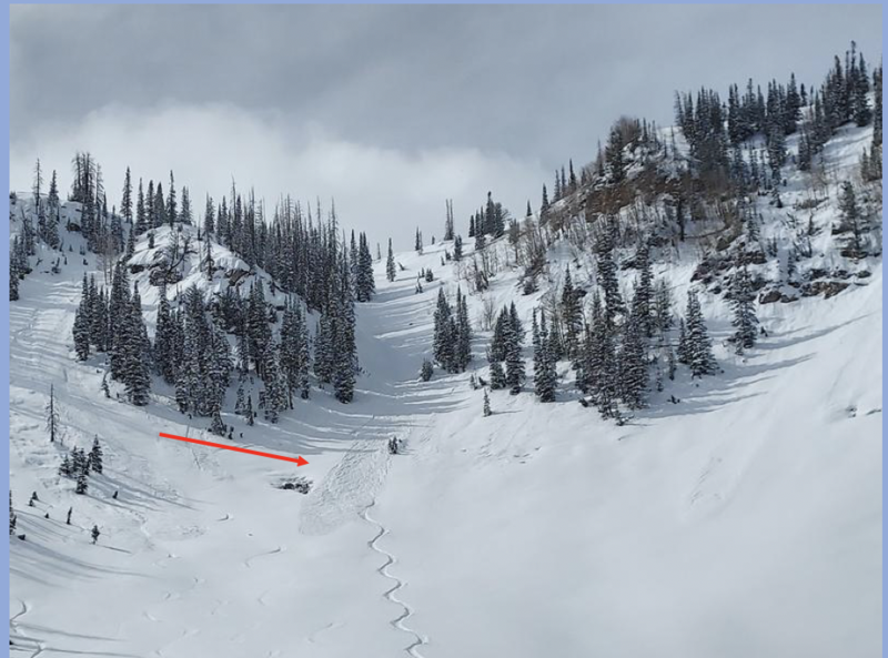
Micheal J was in the lower Weber Canyon drainage Tuesday practicing his sluff management skills and says... "In steep north facing terrain the snow is easily sluffing but is manageable by just getting out of the way and letting the snow fly by." Michaels travels, insight, and trip report is found HERE
No other significant avalanche activity to report.

Your input is vital and we're interested in what you're seeing. Please contribute to this great community resource and go here to fill out an observation.
Ad
Avalanche Problem #1
Wind Drifted Snow
Type
Location
Likelihood
Size
Description
Our recent round of snow is about as light as it gets and there's been just enough wind near the high peaks to whip up a fresh round of shallow drifts. Not particularly wide-spread and easily manageable in depth, today's wind drifts may be just large enough to knock you off your feet in sustained steep terrain. As today's snow continues piling up, some drifts will get camouflaged under fresh snow, while others are easier to spot. Sounds deceptively complex, but we can keep things simple because the vast majority of today's avalanche problem is found on steep, leeward, upper elevation slopes, especially those in the wind zone facing the north half of the compass. So here's your exit strategy... lose the wind and you lose the problem. Yeah, simply lose some elevation and you find great riding with straight-forward avy danger. So, the key to riding safely today is to avoid fat rounded pillows of snow, especially if they appear chalky or sound hollow like a drum... done and done.
Additional Information
Your observations are important, so please let me know what you're seeing... click HERE and contribute to this amazing community based program
General Announcements
The information in this forecast expires 24 hours after the day and time posted, but will be updated by 07:00 Friday, February 25th.
Before it gets too crazy, now is the time to book an avalanche awareness presentation for your group, club, or posse. You can reach me directly at 801-231-2170 or [email protected]
This forecast is from the U.S.D.A. Forest Service, which is solely responsible for its content. This forecast describes general avalanche conditions and local variations always occur.