Nowcast - Yesterday, the south half of the range was the winner. But overnight, a nice wave of moisture focused its efforts on the Mirror Lake Corridor where remote weather stations register 8" of snow with .90" of H2O. In other words... in the past 24 hours we've stacked up an evenly distributed heavy, dense coat of white paint... just what we needed. With temperatures hovering right around freezing, mostly cloudy skies overhead deliver a soggy start to the day with white rain falling at our trailheads. Gain some elevation and it'll feel more winter-like and in the mid 20's °F, along with a legit shot of snow. Winds blowing from the west and southwest are well-behaved, spinning ridgetop anemometer propellers just 10-20 mph.
Forecast - A good slug of morning snow tapers to scattered snow showers, before getting reinvigorated and gaining some steam late this afternoon. Winds blowing from the southwest remain reasonable through much of the day, whispering in the 15-25 mph range near the high peaks, while temperatures climb into the mid 30's °F. Cooler air and a couple inches of lower density snow filters into the region late tonight as temperatures dip into the low 20's °F.
Futurecast - Expect a lull in the action to wrap up the workweek and slide into the weekend followed by an active pattern for early next week. It looks promising especially for Tuesday and beyond... we'll keep ya posted.
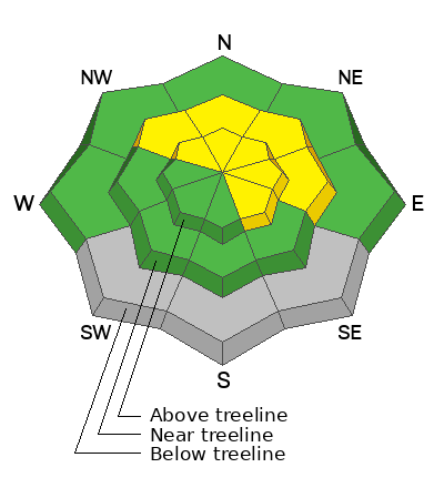
Travel Conditions - Yesterday's storm is just eyewash at the lower elevations where access has taken a hard hit. Snow depths vary quite a bit, from dirt to a couple inches, but get above 9,000' and swing over to the north half of the compass and you'll find a mostly right-side up snowpack averaging 1-4' deep. In general, protected polars are riding in the glass half full category, while above treeline the snow surface has been worked by the elements and yeah... we are long overdue for a thick coat of white paint.
Yesterday, I took a quick rip around Wolf Creek Pass prior to a Summit County SAR presentation, ran into fellow snow-pro Trevor Katz, and shared thoughts and notes about the storm and current hazard. I couldn't top Trev's succinct observation, so take a look at his musings HERE.
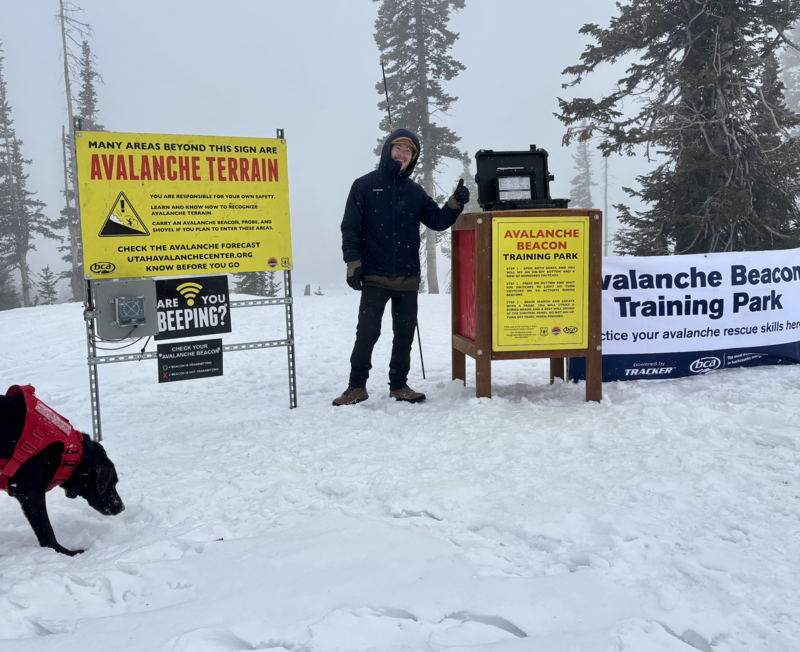
On Monday... Andy, Liam, and Juniper (the dog) installed a beacon training park near Wolf Creek Summit. It's super straight-forward and intuitive, and all the instructions are at the control center. Next time you see Liam or Andy, hit 'em up with a high-five for all the hard work. Truth be known... Juniper was only onboard because she thought the crew kept saying "bacon training park." So in lieu of a high-five, a back scratch or an Andy approved meat treat acknowledging Juniper's moral support will probably suffice :)
No significant avalanche activity reported yesterday.