Forecast for the Uintas Area Mountains

Craig Gordon
Issued by Craig Gordon for
Sunday, February 12, 2023
It's time to get out and get after it-
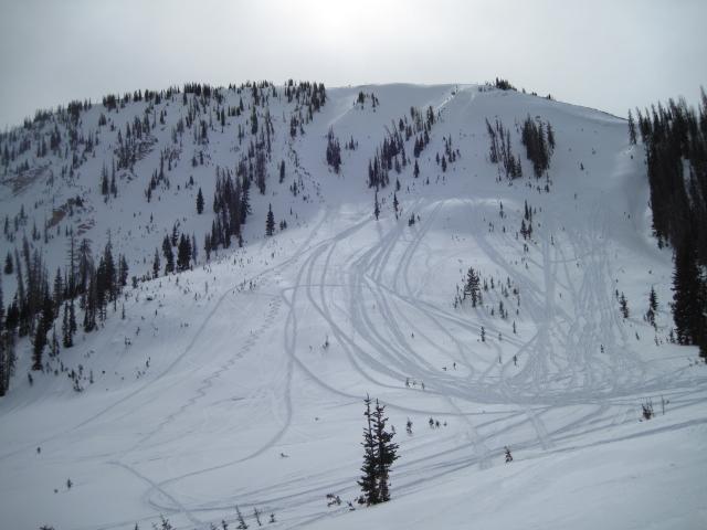
The snowpack is solid and happy in its own skin, offering generally LOW avalanche danger. Even though human triggered avalanches are UNLIKELY, if your travels take you into big, steep, committing terrain have an exit strategy in place should a rogue wind drift throw a curve ball your way.

Low
Moderate
Considerable
High
Extreme
Learn how to read the forecast here
Weather and Snow
Nowcast- High clouds slide through the eastern front early this morning as temperatures register in the teens across the board. West and northwest winds are light, blowing just 5-15 mph even near the high peaks. Riding and turning conditions are slightly elusive with heat crusts making their presence known on the solars and wind jacked snow on the polars in the alpine. However, somewhere in-between is a sweet spot, especially in mid elevation, wind sheltered terrain where you'll find soft, creamy snow.
Forecast- A quiet day is on tap with mostly sunny skies, light winds, and temperatures climbing into the 30's.
Futurecast- A storm on the doorstep of the working week ushers in clouds late Monday afternoon with snow developing overnight. While this looks more like a central and southern Utah storm, I'm cautiously optimistic we get in on the action with storm totals in the 4"-6" range.

Yesterday, Ted got a glimpse of recent crop circles during his travels in Moffit Basin, while Micheal J stomped around Smith-Moorehouse, and I slid through Upper Chalk Creek.
Huge thanks for all the great obs streaming in from the eastern front. Even more detailed trip reports and recent obs are found HERE.
Recent Avalanches
No significant avalanche activity to report, but if ya wanna geek out, click HERE to track this years slide activity throughout the range.
Ad
Avalanche Problem #1
Normal Caution
Type
Location
Likelihood
Size
Description
A solid snowpack, a go-anywhere base, green light avy danger, and sunny skies... yep, a quad-zilla of a day awaits your arrival. And while everything is lining up for a near perfect day of riding, there may still be a rogue wind drift or two out there that could catch you by surprise, especially in the wind zone above treeline. So... if you're tagging a big, steep, committing line you'll definitely want to have an exit strategy in the cerebral queue.

Additional Information
Weather stations-
And... rime events have severely crippled the Uinta weather station network. I'm working to get it back up and running, but a few stations are found HERE (click weather stations, and then on the Western Uinta tab)
Observations-
Your observations are important, so please let me know what you're seeing... click HERE and contribute to this amazing community-based program
General Announcements
Issued at 03:22 on Sunday February 12th, this forecast expires 24 hours after the date and time posted, but will be updated by 07:00 Monday February 13th 2023.
Before it gets too crazy, now is the time to book an avalanche awareness presentation for your group, club, or posse. You can reach Craig directly at 801-231-2170 or [email protected].

This forecast is from the U.S.D.A. Forest Service, which is solely responsible for its content. This forecast describes general avalanche conditions and local variations always occur.