Forecast for the Uintas Area Mountains

Craig Gordon
Issued by Craig Gordon for
Monday, February 13, 2023
Roses are... green in the western Uinta's-
The snowpack is strong, solid, and happy in its own skin, offering generally LOW avalanche danger. Even though human triggered avalanches are UNLIKELY, if your travels take you into big, steep, committing terrain have an exit strategy in place should a rogue wind drift throw a curve ball your way.

Low
Moderate
Considerable
High
Extreme
Learn how to read the forecast here
Weather and Snow
Nowcast- With clear skies overhead, a setting moon cast beautiful light on our mountains early this morning. Temperatures are strongly inverted with the high peaks registering in the low 20's whilst the trailheads are clocking in closer to the mid teens. Southeast winds blow less than 10 mph, barely spinning high ridgetop anemometers. Riding and turning conditions are slightly elusive with heat crusts making their presence known on the solars and wind jacked snow on the polars in the alpine. However, somewhere in-between is a sweet spot, especially in mid elevation, wind sheltered terrain where you'll find soft, creamy snow.
Forecast- As a storm churns to our south a quiet morning is on tap with mostly sunny skies, light winds, and temperatures climbing into the 30's. Clouds and wind increase late in the day.
Futurecast- Look for a quick hitting storm to roll through the region late tonight delivering strong winds, much colder temperatures, and 3"-5" of low density snow for Tuesday morning.

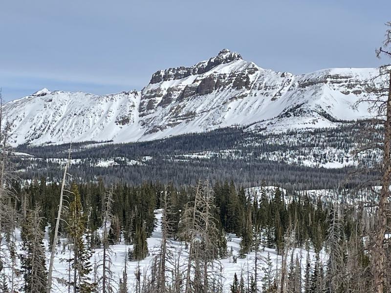
I know you came for the snow, but I hope you'll stay for the views... Hayden Peak looking mighty whitey these days :)
John Climaco was in Blacks Fork yesterday and reports excellent coverage and riding.
On Saturday, Ted cruised into Moffit Basin, while Micheal J stomped around Smith-Moorehouse, and I slid through Upper Chalk Creek.
Huge thanks for all the great obs streaming in from the eastern front. Even more detailed trip reports and recent obs are found HERE.
Recent Avalanches
No significant avalanche activity to report, but if ya wanna geek out, click HERE to track this years slide activity throughout the range.
Ad
Avalanche Problem #1
Normal Caution
Type
Location
Likelihood
Size
Description
A solid snowpack, a go-anywhere base, green light avy danger, and sunny skies... yep, a quad-zilla of a day awaits your arrival. And while everything is lining up for a near perfect day of riding, there may still be a rogue wind drift or two out there that could catch you by surprise, especially in the wind zone above treeline. So... if you're tagging a big, steep, committing line you'll definitely want to have an exit strategy in the cerebral queue.

Additional Information
Weather stations-
And... rime events have severely crippled the Uinta weather station network. I'm working to get it back up and running, but a few stations are found HERE (click weather stations, and then on the Western Uinta tab)
Observations-
Your observations are important, so please let me know what you're seeing... click HERE and contribute to this amazing community-based program
General Announcements
Issued at 03:22 on Monday February 13th, this forecast expires 24 hours after the date and time posted, but will be updated by 07:00 Tuesday February 14th 2023.
Before it gets too crazy, now is the time to book an avalanche awareness presentation for your group, club, or posse. You can reach Craig directly at 801-231-2170 or [email protected].

This forecast is from the U.S.D.A. Forest Service, which is solely responsible for its content. This forecast describes general avalanche conditions and local variations always occur.