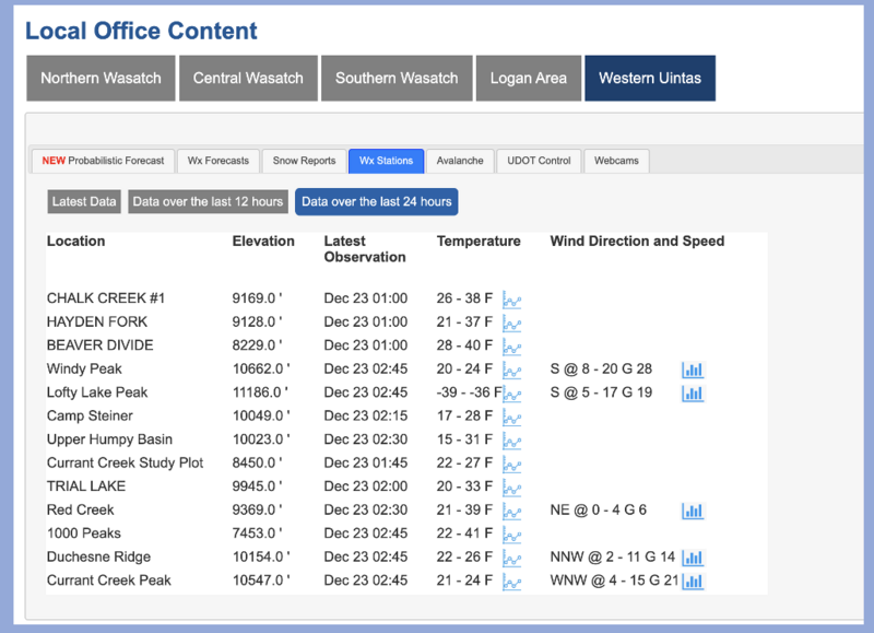
Yesterday's much needed storm dropped 2-5 inches of snow (0.1-0.4 inches of water) across the Uintas in the morning. Flurries continued through the day. North winds in the afternoon brought very cold air and temperatures began plummeting. This morning, temperatures at upper elevations are hovering around 0 degrees F and in the low teens F at trailheads. Winds are fairly light for the Uintas, averaging 10-15 mph gusting to 26 from the north and northwest.
Today will be mostly sunny and cold with temperatures at upper elevations struggling to get into the low teens F. Winds from the north will blow 10-15 mph which will be especially noticeable with such cold temperatures.
Moving into this week, the weather will generally be cold and dry as winds from the north continue for a few days. By mid week, a ridge of high pressure moves overhead with some warmer temperatures.
The new snow is generally resting on an ice crust on south-facing slopes. The snow surface on northerly and easterly facing slopes became somewhat weak and faceted last week, but that creates a soft layer underneath yesterday's snow. Dense snow from the first weekend of December found in the middle of the snowpack provides some supportability. Under that layer is old November snow which is weak and faceted, but shouldn't be stressed by the recent snow.
Generally there's about two feet of snow in the Uintas although you can find a few places at upper elevations with closer to three feet.
Photo below of the snow at Gold Hill, 2 feet deep, NW facing at 9800 ft from Tuesday, Dec 19.
No avalanches were reported in the Uintas, but yesterday some shallow slabs of wind drifted snow were triggered by backcountry travelers and ski patrols in the Wasatch Range.
Trip reports and the latest observations are found
HERE.


