Forecast for the Uintas Area Mountains

Craig Gordon
Issued by Craig Gordon on
Tuesday morning, January 27, 2026

In the windzone at and above treeline, expect MODERATE avalanche danger on steep, drifted, polar slopes, especially those with an easterly component to their aspect. Human triggered wind drifts, breaking a foot or so deep, are POSSIBLE in terrain with these characteristics. Don't forget... today's drifts rest atop a variety of old snow surfaces, including sugary facets, and once initiated, may break a bit deeper and wider than you might expect.

Note to self... if I lose the wind, I lose the problem and score a great day of riding to boot. Thanks for the inside line, self... sounds pretty straight-forward :)

Low
Moderate
Considerable
High
Extreme
Learn how to read the forecast here
Weather and Snow

Nowcast - A band of thin clouds whisk through the region, sliding through Vernal by about sunrise. Temperatures clawed their way out of the deep freeze overnight, bumping nearly 20 degrees, and currently register in the upper teens and low 20's °F. Near the high peaks, winds blow 20-30 mph from the west, so yeah, the windchill clocking in at -2 degrees °F is sure to catch your attention.

Forecast - Look for clear skies and brilliant sunshine with highs reaching into the low and mid 30's °F. Winds blowing in the 20's from the west are gonna be slightly irritating, but if that's my biggest worry of the day, I think I got it pretty good. Overnight lows dip into the teens and low 20's °F.

Futurecast - Clouds increase by Wednesday afternoon and a bump in the road ushers in a slight chance for a trace to a couple o' traces of snow for late Wednesday into Thursday, though I wouldn't burn a hall pass for a midweek call into work sick day. High pressure builds to wrap up the workweek and kick off the Month of Love. Peering into next week, there's a notion for some midweek storminess, but right now, it's merely a suggestion. In other words... "There's an old magic eight ball next to my plate, and I ask it a question regarding my fate, it says... reply hazy, please try again... It won't say where I'm goin', it don't know where I've been."

Travel Conditions -Since Friday we piled up 3"-7" of low density snow across the range favoring the North Slope and eastern fringes of the Uinta's. Settled snow depths clock in at 1'-4' and are quite elevation dependent. On the north half of the compass, fresh snow on top of seven day old, faceted, recycled powder, delivers some of the finest riding of the season! On the solars, a few inches helps cover variable old crusts, creating fantastic, albeit slightly shallower travel, along with late in the day, hot pow snow surface conditions.
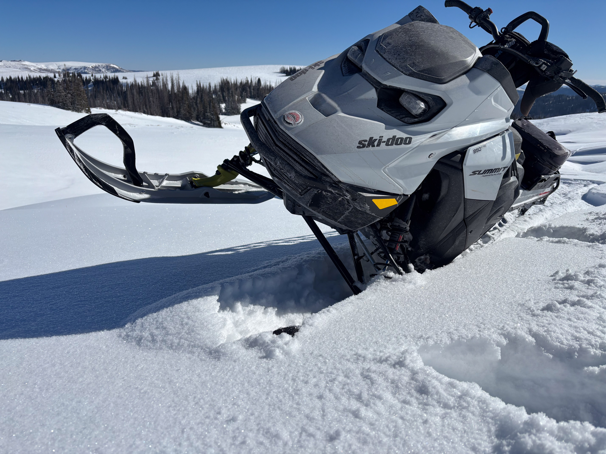
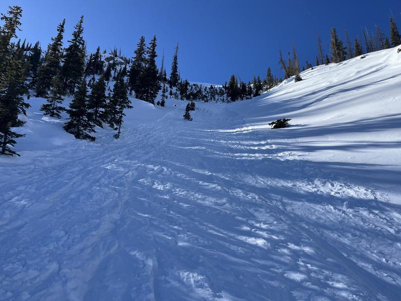
It sure is amazing what a few inches can do for moral. Conditions on the South Slope near the West Fork significantly improved over the past few days, and even the riding on solar aspects was manageable and pleasant.
Recent Avalanches

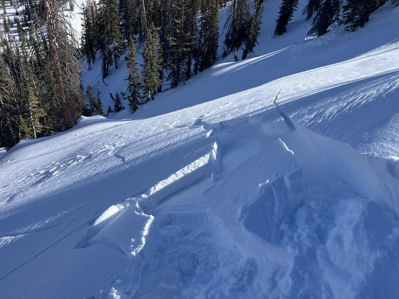
Ted stomped around the Gold Hill zone yesterday and discovered this day old windslab that ran naturally, most likely cornice initiated.


Avalanche Problem #1
Wind Drifted Snow
Type
Location
Likelihood
Size
Description

Shooting cracks in front of your skis, board, or sled are red flags to unstable snow. While manageable in size, don't forget a triggered wind slab could surprise us, and knock our ride out from underneath our legs, throwing a wicked curve ball in steep, committing terrain.

Since Friday afternoon, the range stacked up 3"-7" of uber-light fluff and coupled with moderate westerly winds blowing 20-30 mph, whipped up a batch of fresh drifts. Found on upper elevation slopes with an easterly component to its aspect and formed on a variety of snow surfaces, including faceted snow, recent wind drifts will react to our additional weight. Today's wind slabs are gonna be big enough to pack a punch, letting me know who the boss really is. So, I remind myself... even a small slide in consequential terrain could ruin my winter season if it strains me through rocks, cliffs, or trees.

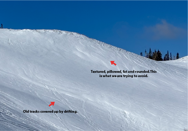
Fortunately, we can steer clear of this problem today... lose the wind and you lose the problem. Simply lose some elevation and hone in on wind sheltered terrain. In addition, look for and avoid fat, rounded pillows of snow on the leeward side of ridges, gully's, and cut banks, particularly if they look textured or sound hollow like a drum. And finally, stomp around on small test slopes like road cuts similar to what you wanna ride and see how they're reacting before pulling the trigger on a big slope.

Above is an example of a leeward slope that has been previously wind loaded and has all the right visual warning signs to observe.

General Announcements

We have some upcoming classes and events that we'd be stoked to see you at -- Please reach out with any questions and check out below for more details!

We are always looking for snow and avalanche observations or just general riding conditions. Reach out to us with questions, concerns, or if you see anything in your travels! Contact us directly through the info below:

This forecast is from the U.S.D.A. Forest Service, which is solely responsible for its content. This forecast describes general avalanche conditions, and local variations always occur. This forecast was issued on Tuesday, January 27th at 0300 AM and expires 24 hours after it was issued. We'll update this information by 07:00 AM tomorrow