Forecast for the Uintas Area Mountains

Craig Gordon
Issued by Craig Gordon on
Wednesday morning, January 28, 2026

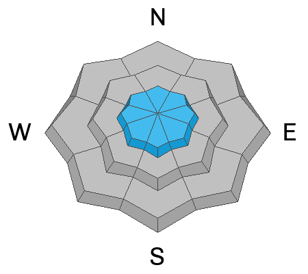
In the windzone at and above treeline, expect MODERATE avalanche danger on steep, drifted slopes around the compass, particularly those with an easterly component to their aspect. Human triggered wind drifts, breaking a foot or so deep, are POSSIBLE in terrain with these characteristics. Don't forget... today's drifts rest atop a variety of old snow surfaces, including sugary facets, and once initiated, may break a bit deeper and wider than you might expect.

Note to self... if I lose the wind and tone down my slope angle, I lose the problem and score a great day of riding to boot. Hmmm, thanks for the inside line, self... sounds pretty straight-forward :)

Low
Moderate
Considerable
High
Extreme
Learn how to read the forecast here
Weather and Snow

Nowcast - Most mid and upper elevation thermometers start their day off in the low 20's °F, with a few low-lying rebels reporting single digits where cold air likes to settle. Winds blowing from the southwest ramped up at the turn of the new day, continuing in that spirit at o'dark thirty and currently blow 20-30 mph near the high peaks. A weak storm is on the doorstep, but I wouldn't rush out the door for this one, maybe let some snow stack up and hit it late this afternoon. In other words... "clouds so swift the rain fallin' in, gonna see a movie called Gunga Din, pack up your money pull up your tent Mcguinn, you ain't goin' nowhere."

Forecast - Look for increasing clouds with high temperatures a bit cooler than yesterday, climbing into just the low 30's °F. Winds blowing from the west and southwest, ramp into the 30's and 40's and then shift to the northwest and remain steady as cold air and moisture slide into the Uinta zone shortly after suppertime. This is a quick hitter, but we might be able to squeak out a couple inches of low density snow. Essentially a shallow coat of white paint... but really just eyewash.

Futurecast - A clearing trend develops in the wake of todays storm and stretches its wings into the weekend. A glimmer, a suggestion, or perhaps a notion of another small storm is slated for early next week. We'll keep ya posted.

Travel Conditions -The weekend storm piled up 3"-7" of low density snow across the range, favoring the North Slope and eastern fringes of the Uinta's. Settled snow depths clock in at 1'-4' and are quite elevation dependent. On the north half of the compass, fresh snow on top of seven day old, faceted, recycled powder, delivers some of the finest riding of the season! On the solars, a few inches helps cover variable old crusts, creating fantastic, albeit slightly shallower travel, along with late in the day, hot pow snow surface conditions.
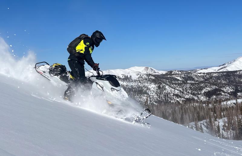
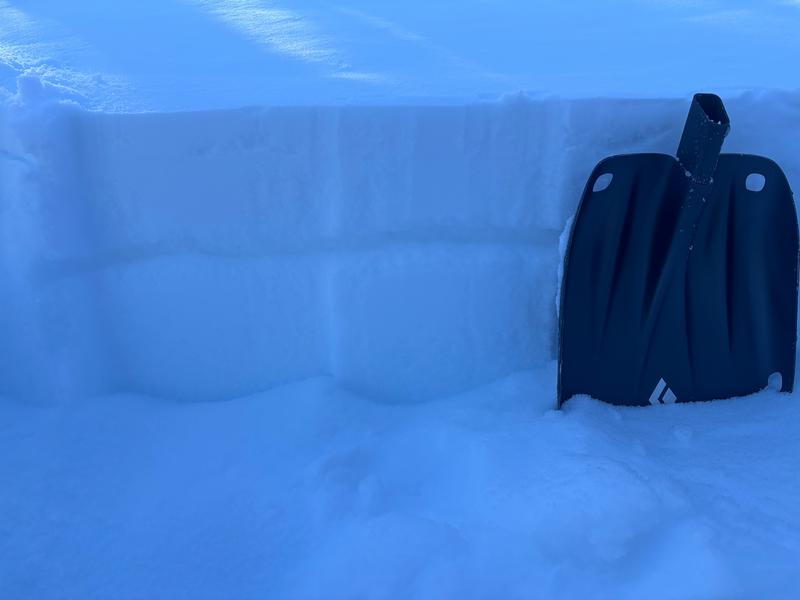
Andy and Bo took advantage of the sunshine, got after it, and found great riding in Gardner Fork yesterday, commenting... "the light density snow that fell this past weekend in cooperation with cold temperatures and clear nights this week has seriously weakened the snow surface, which is now turning into sugary facets."
Recent Avalanches

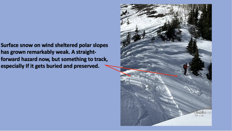
TK was in Weber Canyon and found the surface snow on mid elevation, protected polars has grown remarkably weak and very reactive to slope cutting. I found the same thing in my travels on the North Slope. Facet-lanches are a thing on sustained, steep slopes.


Avalanche Problem #1
Wind Drifted Snow
Type
Location
Likelihood
Size
Description

Andy and Bo noted.... "recent wind drifted snow sitting on top of the old, faceted snow surface. This was where we noticed todays avalanches failing on ridges and exposed ridgelines. Easy to manage, and even easier to avoid!"

Winds are gonna help change the landscape and add a little spice to steep drifted slopes around the compass. Don't forget, fresh drifts will form on a variety of snow surfaces, including faceted snow, and today's wind slabs are gonna be big enough to pack a punch, letting me know who the boss really is. So, I remind myself... even a small slide in consequential terrain could ruin my winter season if it strains me through rocks, cliffs, or trees.

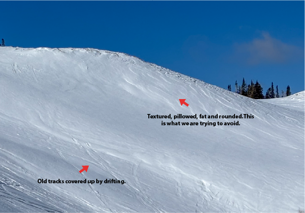
Fortunately, we can steer clear of this problem today... lose the wind and you lose the problem. Simply lose some elevation and hone in on wind sheltered terrain. In addition, look for and avoid fat, rounded pillows of snow on the leeward side of ridges, gully's, and cut banks, particularly if they look textured or sound hollow like a drum. And finally, stomp around on small test slopes like road cuts similar to what you wanna ride and see how they're reacting before pulling the trigger on a big slope.

Above is an example of a leeward slope that has been previously wind loaded and has all the right visual warning signs to observe.

General Announcements

We have some upcoming classes and events that we'd be stoked to see you at -- Please reach out with any questions and check out below for more details!

We are always looking for snow and avalanche observations or just general riding conditions. Reach out to us with questions, concerns, or if you see anything in your travels! Contact us directly through the info below:

This forecast is from the U.S.D.A. Forest Service, which is solely responsible for its content. This forecast describes general avalanche conditions, and local variations always occur. This forecast was issued on Wednesday, January 28th at 0300 AM and expires 24 hours after it was issued. We'll update this information by 07:00 AM tomorrow