Forecast for the Uintas Area Mountains

Craig Gordon
Issued by Craig Gordon for
Tuesday, January 25, 2022
In general, you'll find LOW avalanche danger throughout the range and human triggered avalanches are unlikely. Remember... LOW danger... ain't NO DANGER, so if you're getting into steep, technical terrain, think about your exit strategy beforehand and have a plan prior to sending a big, committing line.

Low
Moderate
Considerable
High
Extreme
Learn how to read the forecast here
Weather and Snow
NOWCAST-
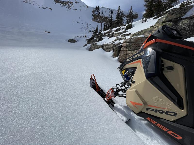
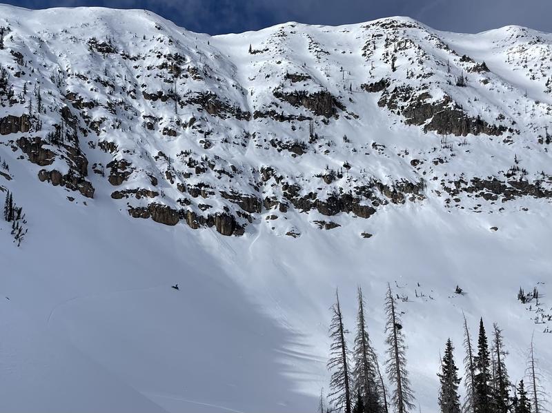
Mother Nature worked her magic overnight, squeezing an inch of snow out of the clouds that continue to drape our mountains this morning. In the wake of yesterday's cold front, temperatures are in the teens and west-northwest winds blow 15-25 mph near the high peaks. Recent winds raked the alpine zones above treeline and our big open bowls are taking a bit of a hit, where the snow surface is a little scratchy near wind exposed ridges. But don't let your hearts be troubled, there's a go-anywhere base and it's a brilliant day to go exploring.
FORECAST-
Clouds linger over the range this morning, but should thin out as the day wares on. Winds switch to the north and northeast and stay rather reasonable throughout the day, blowing in the 20's along the high ridges. Temperatures climb into the mid and upper 20's while dipping into the teens overnight under clear skies.
FUTURECAST-
Slightly warmer and continued dry for Wednesday with another cool front sliding into the region Thursday. Computer models suggest a pattern change to kick off the Lunar New Year, which, if my math is correct, should be right around February 1st :)

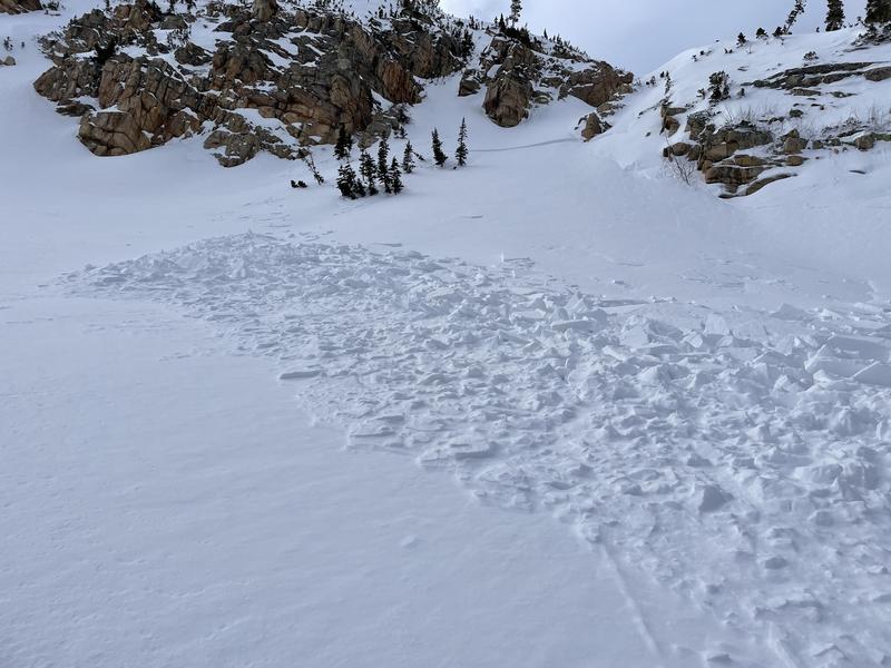
Recycled powder is found on top of a structurally sound basement.... travel is easy.

Looking for real-time temps, snow, or wind?
Click HERE and then on the "western Uinta" tab for western Uinta specific, weather station network.
Recent Avalanches
Yesterday, Mark and Weston D discovered a couple hard slabs around Haystack and the Middle Fork of the Weber, that were triggered naturally this weekend as a result of recent northwest winds. Mark's insight on this slide as well as overall riding conditions and snow quality is found HERE

Click HERE for a list of recent avalanches.
A list of all other observations is found HERE

Your input is vital and we're interested in what you're seeing. Please contribute to this great community resource and go here to fill out an observation.
Ad
Avalanche Problem #1
Normal Caution
Type
Location
Likelihood
Size
Description
The snowpack is a lot like people and right now it's trending towards the mid portion of its life span. In most cases it's fat (but in a good way :), happy, and getting comfortable in its own skin, but more importantly it's grown solid, predictable, and reliable. What this means for us is... the pack is stable, there's no shortage of "Green Light" terrain, and it's time to take advantage of Low avalanche danger.
A couple things to keep in mind as we start stepping into big, committing terrain-
  • Recent northerly winds created dense, hard drifts on upper elevation leeward slopes and around terrain features like chutes and gullies.
  • Carefully evaluate each steep slope on an individual basis
  • Consider the consequences of triggering an avalanche and remember that even a small slide that knocks you off your feet, board(s), or sled can instantly ruin your day.
Additional Information
While we're waiting patiently for winter to return from its hiatus, take a few minutes and visit one of our beacon parks and test your rescue skills. Ted installed a Beacon Basin at the Bear River Trailhead and there's another park found at the northeast corner of the Nobletts Trailhead.
Your observations are important, so please let me know what you're seeing... click HERE and contribute to this amazing community based program
General Announcements
The information in this forecast expires 24 hours after the day and time posted, but will be updated by 07:00 Wednesday January 26th.
Before it gets too crazy, now is the time to book an avalanche awareness presentation for your group, club, or posse. You can reach me directly at 801-231-2170 or [email protected]
This forecast is from the U.S.D.A. Forest Service, which is solely responsible for its content. This forecast describes general avalanche conditions and local variations always occur.