UDOT PLANNED AVALANCHE CLOSURES!!

Forecast for the Uintas Area Mountains

Craig Gordon
Issued by Craig Gordon for
Monday, January 24, 2022
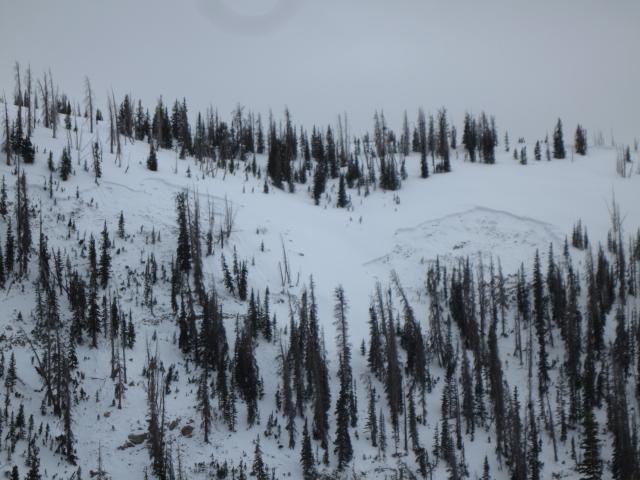
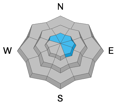
In general, you'll find LOW avalanche danger throughout the range and human triggered avalanches are unlikely. Remember... LOW danger... ain't NO DANGER, so if you're getting into steep, technical terrain, think about your exit strategy beforehand and have a plan prior to sending a big, committing line.

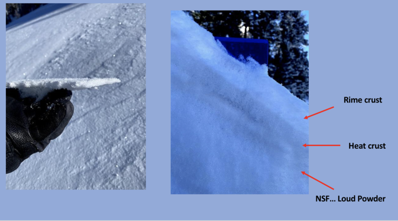
Even though it's been a minute or two since our last significant storm, soft snow is still found on slopes sheltered from the sun and wind.
Low
Moderate
Considerable
High
Extreme
Learn how to read the forecast here
Special Announcements
Huge thanks to everyone who stopped by our avy awareness tents Saturday at Nobletts and big high fives to Christian, Cal, and Matt for taking time out of their busy lives and helping to save lives by sharing the Utah Avalanche Center Gospel... Amen!
Weather and Snow
NOWCAST-
Clear skies with temperatures registering in the teens and low 20's await your arrival in the mountains this morning, whilst northwest winds blowing in the 30's add a bite to the air along the high ridges. No new snow to report and our big open bowls in the alpine are taking a bit of a hit, where the snow surface is a little scratchy near wind exposed ridges. But don't let your hearts be troubled, there's a go-anywhere base and it's a brilliant day to go exploring.
FORECAST-
As seen in the graphic above, a dry, cold front slides through the region late in the day and we can expect increasing clouds as the day wares on. High temperatures climb into the upper 20's and northwest winds blowing 30-50 mph are gonna be a nuisance along the high ridges. Along with temperatures dipping into the single digits overnight, we might see a snowflake or two.
FUTURECAST-
Slightly warmer and continued dry through midweek. Computer models suggest a pattern change for the Lunar New Year, which, if my math is correct, should be right around February 1st :)

The recent string of clear, cool nights and warm days significantly weakened and faceted the snow surface. In snow-geek-speak this process morphed the surface snow into near surface facets or NSF for short. You might also hear it referred to as loud powder. In any case, Friday's few inches of snow along with a thin rime crust, capped and preserved this weak snow.... not a big deal until we start stacking dense, heavy snow on top. Snowpro and avy forecaster Bill Nalli was in upper Chalk Creek Saturday, captured this combo in the image above, and has a great observation from that zone found HERE.
Mark found similar conditions during his travels in Soapstone last Wednesday.

Looking for real-time temps, snow, or wind?
Click HERE and then on the "western Uinta" tab for western Uinta specific, weather station network.
Recent Avalanches
A bit of an outlier, Ted found this avalanche in the Mill Creek zone last Thursday. Triggered on a north-facing slope near 10,000', the avalanche appeared a day old when Ted rolled up to investigate, but it's still a bit unclear what provoked the slide.
Regardless of the exact details, it is a great reminder that even though the danger is LOW, avalanches can still occur. This is why we always carry avalanche rescue gear, keep a close eye on our partners, and only expose one person at a time to risk when we're traveling in avalanche terrain.

Click HERE for a list of recent avalanches.
A list of all other observations is found HERE

Your input is vital and we're interested in what you're seeing. Please contribute to this great community resource and go here to fill out an observation.
Ad
Avalanche Problem #1
Persistent Weak Layer
Type
Location
Likelihood
Size
Description
While trending towards dormancy, a persistent weak layer (PWL) of faceted, sugary snow still exists near the ground. In fact, it's the problem child that conspired with dense, heavy snow on top to produce avalanches through much of mid December into early January. Since then, the PWL has gained a lot of strength and it's unlikely that you'll trigger an avalanche on this layer. But remember... anything persistent in the snowpack doesn't magically heal overnight, it slowly strengthens over time, and that's exactly what we've been seeing throughout much of the range. And while unlikely, the recent avalanche Ted spotted Thursday in Mill Creek is a great reminder that this layer still exists, it can still produce an avalanche, and we definitely don't want to let our guard down.
What to do? We're not particularly concerned about this problem below treeline where the snowpack is deep and uniform. Steep, rocky terrain above treeline with a more variable snowpack is where I wanna be on my toes. Tee off with a little mini-golf and ride parts of a slope with the deepest snow, before committing to a steep, technical line, especially if you're threading the needle in rocky terrain. Always carry avalanche rescue gear, expose only one person at at time, and consider where a slide will take you even if you trigger a small piece of snow.
Additional Information
While we're waiting patiently for winter to return from its hiatus, take a few minutes and visit one of our beacon parks and test your rescue skills. Ted installed a Beacon Basin at the Bear River Trailhead and there's another park found at the northeast corner of the Nobletts Trailhead.
Your observations are important, so please let me know what you're seeing... click HERE and contribute to this amazing community based program
General Announcements
The information in this forecast expires 24 hours after the day and time posted, but will be updated by 07:00 Tuesday January 25th.
Before it gets too crazy, now is the time to book an avalanche awareness presentation for your group, club, or posse. You can reach me directly at 801-231-2170 or [email protected]
This forecast is from the U.S.D.A. Forest Service, which is solely responsible for its content. This forecast describes general avalanche conditions and local variations always occur.