UDOT PLANNED AVALANCHE CLOSURES!!

Forecast for the Skyline Area Mountains

Brett Kobernik
Issued by Brett Kobernik for
Friday, April 15, 2022
The overall avalanche danger is MODERATE today.
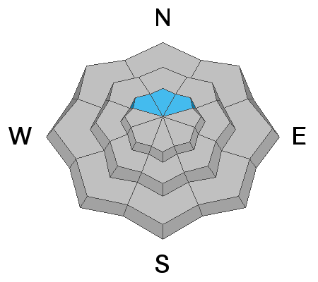
Use caution along the steeper northeast facing slopes where fresh drifts have formed right underneath the ridgelines. These drifts may crack out with the weight of a person.
I'm still recommending that people avoid the steepest most radical northerly facing terrain above 10,000' where there is a slight chance that a person could trigger a large avalanche that breaks deep into our mid winter layer of loose sugary snow.
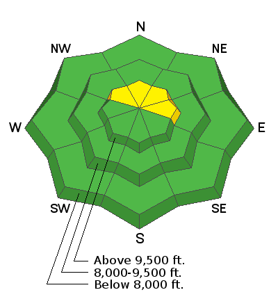
Low
Moderate
Considerable
High
Extreme
Learn how to read the forecast here
Weather and Snow
Current Conditions
Temperatures stayed cool enough on Thursday to keep the snow dry on northerly facing slopes above about 9500'. Below that and on southerly facing slopes you'll find a thin melt/freeze crust. Overnight temperatures hovered around freezing. Southwest wind remains in the moderate speed range along the upper ridges.
Mountain Weather
We'll have partly cloudy skies today with high temperatures in the low 40s. Southwest wind will probably feel a little gusty along the ridges. Saturday starts out cloudy and a minor storm system moves through Saturday afternoon that might bring a couple inches of new snow. Sunday looks sunny and warmer.
Ad
Avalanche Problem #1
Persistent Weak Layer
Type
Location
Likelihood
Size
Description
I speculate that the old Persistent Weak Layer that formed mid winter may actually be mostly stable now. Places I've dug down to inspect it show that it's gained strength and test results are very stubborn to produce failure. That said, it still makes me a bit nervous and I don't think I'd feel comfortable on the steepest northerly facing slopes above 10,000'. It seems pretty unlikely at this point that someone would trigger an avalanche that breaks deep into this layer but I guess it can't be totally ruled out.
Avalanche Problem #2
Wind Drifted Snow
Type
Location
Likelihood
Size
Description
Wind has formed some drifts with the most recent snow. The most notable places are on northeast facing slopes right below the ridgelines. I noted a few that broke naturally a few days ago. When I was out on Thursday these seemed like they were all staying in place. That said, don't be surprised if you trigger a shallow wind slab on the steeper northeast facing slopes right under the ridgelines.
General Announcements
This forecast is from the U.S.D.A. Forest Service, which is solely responsible for its content. This forecast describes general avalanche conditions and local variations always occur.