Forecast for the Skyline Area Mountains

Issued by Brett Kobernik on
Saturday morning, March 9, 2019
Saturday morning, March 9, 2019
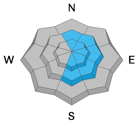
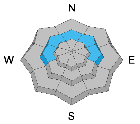
The avalanche danger is mostly MODERATE but there remains a CONSIDERABLE danger in some areas today. The most likely places to trigger avalanches today are on steep slopes that face southeast through north above 8000 feet. Continue to avoid these steep slopes until the new snow settles and stabilizes.

Low
Moderate
Considerable
High
Extreme
Learn how to read the forecast here