Forecast for the Skyline Area Mountains

Brett Kobernik
Issued by Brett Kobernik for
Sunday, March 10, 2019
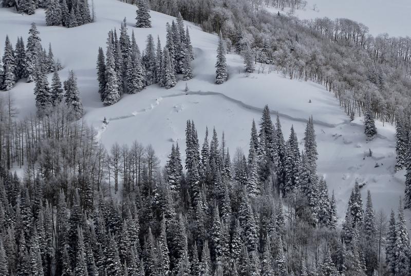
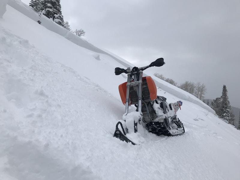
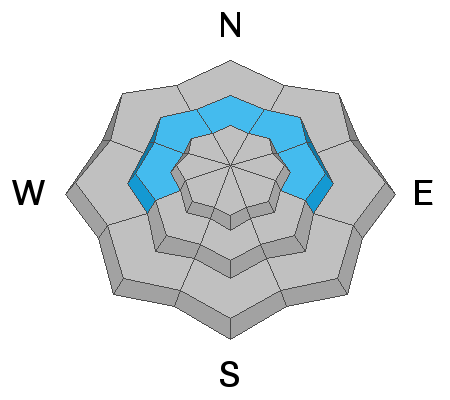
The avalanche danger is mostly MODERATE. This means human triggered avalanches are possible. The snow should be fairly well behaved again today but there may be a location with recent wind drifted snow that could be triggered.
Make sure everyone is carrying a beacon, shovel and probe and knows how to use them. Only put one person on a steep slope at a time and don't regroup at the bottom of steep slopes.
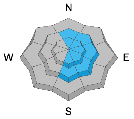
Low
Moderate
Considerable
High
Extreme
Learn how to read the forecast here
Weather and Snow
Light snow showers on Saturday produced a trace to an inch of new snow. Temperatures stayed fairly cool in the higher terrain and the snow quality remains excellent in many locations. Overnight, the temperatures dipped into the teens once again. Southwest wind is very light in speed.
We'll see clouds and the possibility for snow during the day today. Wind should remain light. The weather pattern remains unsettled through the week. You gotta love when the National Weather Service forecast looks like the images below! While there are lots of upcoming chances for snow, none of the periods look real significant as far as accumulations. I'm thinking we could see around 10 inches of more snow by Thursday.
Recent Avalanches
I stumbled onto one avalanche right at the end of my day on Saturday. MORE DETAILS HERE. It released naturally late Thursday during a slight increase in wind speed. It was in an odd location in Meadow Fork that I haven't seen avalanche before on a NNW facing slope. It took out all the snow from the past week which was about 3 feet deep. This is the only natural avalanche that I've seen in the higher terrain this week. I don't believe that this is a significant indicator of other possible avalanches today. I think this avalanche is more of an "outlier" as I haven't seen others like it. That said, poor visibility has limited travel during the week and it's possible there are others similar to this.
Ad
Avalanche Problem #1
Wind Drifted Snow
Type
Location
Likelihood
Size
Description
The most likely place to trigger an avalanche today is on a very steep slope that has had wind drifted snow loaded onto it recently. Most of these drifts will have stabilized by today but there could be a few that might be sensitive to a person or machine still. The most likely places are along the east sides of the upper ridgelines. However, watch for wind drifted snow just below ridgelines on any aspect. The avalanche detailed above is a prime example of a place you normally wouldn't expect to find an avalanche.
Avalanche Problem #2
Persistent Weak Layer
Type
Location
Likelihood
Size
Description
There is a slight chance that a person could trigger an avalanche that breaks into old weak sugary snow near the ground. The most likely places where this could happen is in areas with a shallow snowpack in the 4 foot total depth range. Mid elevations between 8000 and 9500 feet are also where you might find this problem. All the new snow over the last week has certainly added stress to these layers. In areas with a deeper snowpack, this is not such a concern.
Additional Information
FORECASTER'S CORNER:
Two items for today -
Terrain and terrain traps: note that some terrain is forgiving (nice open runout zones) and some is not. This must be part of the calculus if the snow doesn't agree with your assessment of it. Will you get carried over a cliffband, buried more deeply in a gulley or slope transition, or bashed through the trees? Use terrain to your advantage.
This forecast is from the U.S. Forest Service, which is solely responsible for its content. This forecast describes general avalanche conditions and local variations always occur.