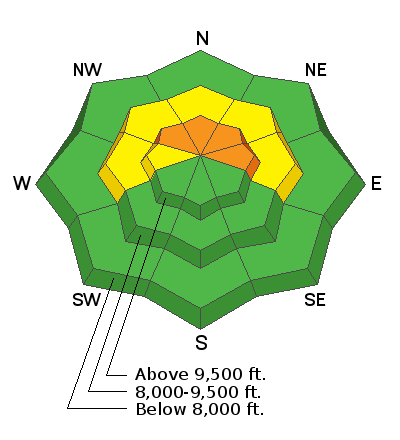
Forecast for the Skyline Area Mountains

Issued by Brett Kobernik on
Sunday morning, March 6, 2022
Sunday morning, March 6, 2022
There is a CONSIDERABLE avalanche danger in the upper elevation more northerly facing terrain.
Human triggered slab avalanches are likely.
If you avoid steep upper elevation northerly facing terrain, the avalanche danger is dramatically lower.
Low
Moderate
Considerable
High
Extreme
Learn how to read the forecast here