Current Conditions
Thursday was another very warm day and temperatures again stayed mild overnight with most stations above freezing. This is the third night in a row with above freezing temperatures. Southerly wind has been light over the last 24 hours. There is still some cold dry powder on the highest north facing slopes. Be careful though, this is the exact spot where a person is most likely to trigger an avalanche.
Mountain Weather
A prolonged and complex winter storm system is moving into our area that'll bring periods of snow through Monday. Accumulations will slowly stack up and we should end up with 12 to 18" of snow. We'll see clouds today and the chance for light snow. Temperatures shouldn't warm a whole lot. Southerly wind will start out light and increase in speed slightly this afternoon. Tonight looks like a decent chance for snow and we should pick up a 4 to 6 inches.
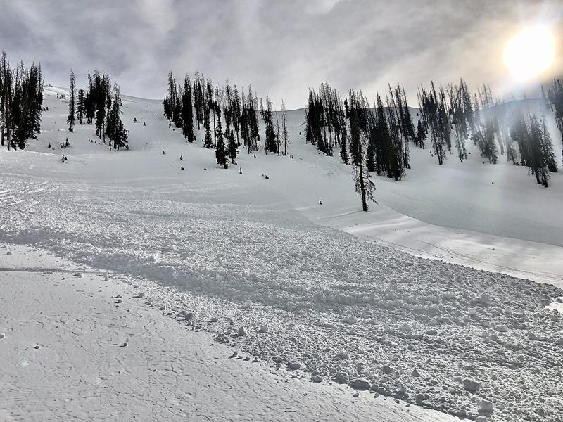
There was a fairly large snowmobile triggered avalanche on Thursday. The riders were intending to avoid the steep slope but still remotely triggered it from a distance below. This was in upper elevation northerly facing terrain. Photo - Brian Osborne, Blue Slide Fork: