Forecast for the Skyline Area Mountains

Brett Kobernik
Issued by Brett Kobernik for
Tuesday, March 14, 2023
The overall danger rating is LOW.
There are still things to look out for today:
  1. Avoid cornices and steep slopes that have recent deposits of wind drifted snow.
  2. If the snow becomes wet to the point where you are punching deep into loose wet snow (especially at lower elevations) stay off of and out from underneath steep slopes, gullies and ravines.
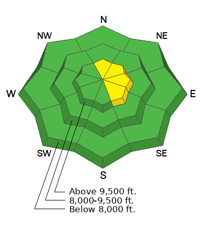
Low
Moderate
Considerable
High
Extreme
Learn how to read the forecast here
Special Announcements
HUNTINGTON CANYON REMAINS CLOSED AS UDOT ROAD CREWS CONTINUE TO DIG AVALANCHE DEBRIS THAT IS BLOCKING THE ROAD. IT IS CLOSED FROM MILLER FLAT DOWN TO CRANDALL CANYON STILL THIS MORNING.
Weather and Snow
Current Conditions: Temperatures warmed into the low 30s on Monday. Some clearing mid day made the snow surface become damp on all aspects up to at least 9500'. This took a toll on riding conditions. Wind has been light from the southwest. Temperatures were in the mid 20s overnight with some clear skies.

Mountain Weather: We have a short lived break in the clouds this morning then clouds will move in with the chance for snow later today. Southwest wind will increase in speed some but shouldn't get all that strong. Temperatures will get into the low to mid 30s. More snow is expected on Wednesday as the brunt of this storm moves through. By the time it's done we should see 6 to 10 inches of dense snow. I'm expecting this snow to contain about 1" of water. Temperatures cool down a bit following the storm and we'll have a break in the snow for a few days. It still looks pretty active through the end of the month.
Ad
Avalanche Problem #1
Normal Caution
Type
Location
Likelihood
Size
Description
The snowpack is mostly stable this morning. The things I'll be watching for today are large drifts and slabs on steep slopes near the ridgelines. Most of these will be stable but this is the most likely place to find trouble today. Cornices are huge right now and should be avoided.
Cold temperatures overnight should've frozen up the snowpack pretty good. This helps stabilize wet snow avalanche problems we saw over the weekend. However, it's spring and we need to start watching out for wet snow avalanches on a regular basis now.
General Announcements
This forecast is from the U.S.D.A. Forest Service, which is solely responsible for its content. This forecast describes general avalanche conditions and local variations always occur.