Forecast for the Skyline Area Mountains

Brett Kobernik
Issued by Brett Kobernik for
Monday, March 13, 2023
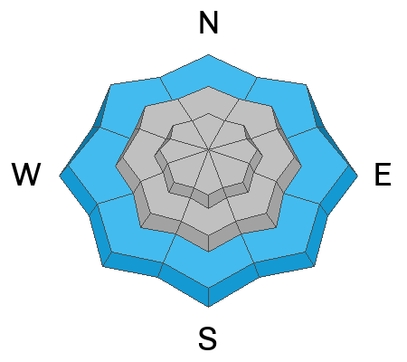
The snowpack is stabilizing there are still avalanche concerns. The overall danger rating is MODERATE.
Human triggered avalanches are possible.
The most likely places to trigger an avalanche are:
  1. High elevation steep slopes near the ridgelines on more east facing terrain.
  2. Lower elevation very steep slopes where the snowpack is wet, punchy and shallow.
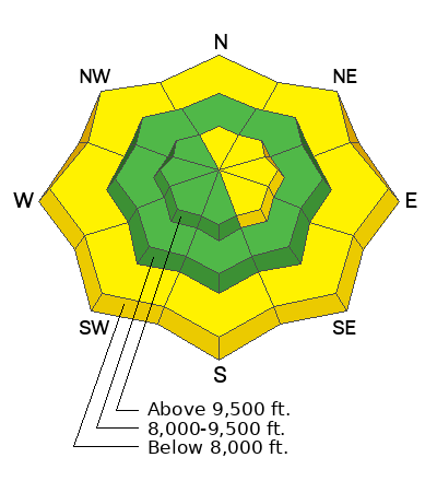
Low
Moderate
Considerable
High
Extreme
Learn how to read the forecast here
Special Announcements
THERE HAVE BEEN MORE AVALANCHES IN HUNTINGTON CANYON. IT IS CLOSED FROM MILLER FLAT DOWN TO CRANDALL CANYON AND MOST LIKELY WILL REMAIN CLOSED THROUGH WEDNESDAY.
Weather and Snow
Current Conditions: A few more inches of snow accumulated over the last 24 hours. This brings the total up to 16 to 18". The density remains high. The new snow is quite spongy and not our usual deep powder. Riding conditions are quite good. Temperatures are as cool as they've been for the last 48 hours. Most stations are right around 20˚F. The wind has been light in speed from the west.

Mountain Weather: It looks like another day of unsettled weather with the chance for snow later on. I'm not expecting more than a trace to a couple of inches of new snow. Temperatures will get into the low 30s. Wind should stay fairly light from the west shifting more southwest later on. Tuesday morning may actually be clear but clouds will move back in with snow in the afternoon which will last through Wednesday. We could see another foot of dense snow by Thursday.
Ad
Avalanche Problem #1
New Snow
Type
Location
Likelihood
Size
Description
The new snow is behaving in the mid and upper elevations for the most part. Visibility did not allow for widespread travel on Sunday but I did not see any concerns in areas I did travel. Here's what I know:
  • We've received 16 to 18 inches of snow containing 2 to 3 inches of water since Thursday. That is a lot of water in a short period of time - red flag.
  • There was strong wind Friday that drifted snow - red flag.
  • The new snow does not seem sensitive to tests or slope cuts at this time.
My only concern with the new snow at this point would be in areas that received large amounts of wind drifted snow on Friday. The most likely places to trigger a wind drifted snow avalanche today would be on very steep upper elevation slopes that face north through southeast. It's tricky to spot the drifts and slabs from Friday since they've been covered up by new snow without any wind.
Avalanche Problem #2
Wet Snow
Type
Location
Likelihood
Size
Description
Cooler temperatures overnight should help stabilize the wet snow at the lower elevations. However, it's going to get warm again today which will melt snow and make things unstable. You will want to avoid steep slopes, ravines and gullies anywhere the snowpack is wet and unconsolidated. Unconsolidated means areas where you are punching through loose wet snow
General Announcements
This forecast is from the U.S.D.A. Forest Service, which is solely responsible for its content. This forecast describes general avalanche conditions and local variations always occur.