Forecast for the Skyline Area Mountains

Brett Kobernik
Issued by Brett Kobernik for
Wednesday, March 15, 2023
DANGEROUS CONDITIONS EXIST IN THE LOWER ELEVATIONS!!
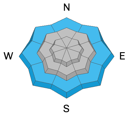
The danger rating is CONSIDERABLE in the lower elevations. Wet snow natural avalanches are likely.
The avalanche danger is rated MODERATE in the mid and upper elevations. Human triggered avalanches are possible in this terrain but won't be all that widespread.
Low
Moderate
Considerable
High
Extreme
Learn how to read the forecast here
Special Announcements
HUNTINGTON CANYON REMAINS CLOSED AS UDOT ROAD CREWS CONTINUE TO DIG AVALANCHE DEBRIS THAT IS BLOCKING THE ROAD. IT IS CLOSED FROM MILLER FLAT DOWN TO CRANDALL CANYON.
Weather and Snow
Current Conditions: 2 to 3 inches of new dense snow fell Tuesday afternoon. Temperatures have remained quite warm with most stations hovering right around freezing. Southwest wind has increased in speed slightly but still remains mostly moderate.

Mountain Weather: We'll see snow today with continued warm temperatures until around noon. Then things start to cool off dramatically. I'm thinking we should see .5" to .8" of water in the higher terrain. Snow amounts might not be all that much because the new snow is going to be very dense. Rain/snow level will be around 8000' this morning and dropping during the day. Southwest wind should slow and gradually shift around to the northwest. It actually looks like we're going to get a little break with sunshine over the next few days and into the weekend. It looks like more storms through the end of the month.
Recent Avalanches
More avalanches released late in the day Tuesday in Huntington Canyon. The video describes the situation. (YouTube: https://www.youtube.com/watch?v=cZjZMGs20Wc)
Ad
Avalanche Problem #1
Wet Snow
Type
Location
Likelihood
Size
Description
It appears that the most dangerous situation is in lower elevation terrain. Wet snow avalanches continue to release in lower elevations especially in areas where the snowpack is shallow. All you can do right now is avoid being on or below steep slopes in the lower elevations to stay safe.
Avalanche Problem #2
Normal Caution
Type
Location
Likelihood
Size
Description
In the mid and upper elevations, avalanche conditions are not as dangerous but you'll still want to use some caution if you're getting out today. My guess is that the new snow won't be all that sensitive. As always though, watch for cracking within the new snow. Hit lots of small steep test slopes to try to initiate cracking. If you experience cracking, don't get onto big steep slopes.
The biggest threat will be if the wind picks up and drifts snow. Freshly drifted snow is always suspect. It is the most sensitive while the drifts and slabs are forming and directly afterward. Simply avoid areas where the wind is drifting snow and you probably won't find trouble today.
General Announcements
This forecast is from the U.S.D.A. Forest Service, which is solely responsible for its content. This forecast describes general avalanche conditions and local variations always occur.