Forecast for the Skyline Area Mountains

Brett Kobernik
Issued by Brett Kobernik for
Saturday, March 12, 2022
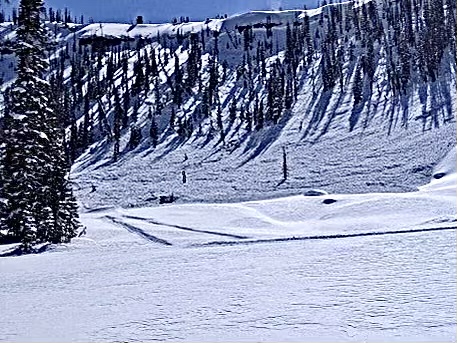
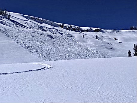
DEADLY AVALANCHES ARE LIKELY TODAY!
There is a CONSIDERABLE avalanche danger on the Manti Skyline.
Upper elevation northwest, north, northeast and east facing slopes are the most dangerous.
AVOID BEING ON OR BELOW ANY OF THESE STEEP SLOPES!!
Low
Moderate
Considerable
High
Extreme
Learn how to read the forecast here
Special Avalanche Bulletin
The Utah Avalanche Center is issuing a SPECIAL AVALANCHE BULLETIN for Saturday, March 12, 2022. We are very worried that a serious avalanche accident could occur this weekend. A CONSIDERABLE avalanche danger exists across northern and central Utah -THIS IS WHEN WE SEE THE MOST ACCIDENTS AND FATALITIES.
DANGEROUS AVALANCHE CONDITIONS combined with great powder and beautiful weather make accidents likely. There have been many close calls this week, but luck eventually runs out. We commonly see a string of close calls leading up to serious accidents.
Two key messages:
  • Ensure everyone has and knows how to use an avalanche beacon, shovel, and probe.
  • Avoid being on, near or under all steep slopes and avalanche terrain. There is great riding and great powder on slopes less than 30 degrees in steepness where avalanches don’t occur.
Weather and Snow
Current Conditions
Direct sun on Friday made the snow damp and you'll find a thin melt freeze crust on many slopes. Northerly facing slopes hold cold powder. Wind on Friday was slightly breezy along the ridges and has slowed. Temperatures on Friday made it to around 20˚F and pretty much remained there overnight.
Mountain Weather
It's going to be a gorgeous day in the mountains today with sun, light wind and high temperatures into the low 30s. Clouds move in on Sunday with the chance for snow Sunday night. This is a weak storm that will probably only bring a trace to a few inches of snow. The next chance for snow looks a little better for around Wednesday.
Recent Avalanches
There were three large snowmobile triggered avalanches on the Skyline Friday. These were all triggered remotely from below. The largest one in Bulger Canyon almost caught a rider. Very close call!
Bulger Canyon:
Manti Canyon:
Bacon Rind Canyon:
Ad
Avalanche Problem #1
Persistent Weak Layer
Type
Location
Likelihood
Size
Description
The large avalanches triggered from a distance tells you everything you need to know. The buried Persistent Weak Layer is still quite active and is producing avalanches. This will continue today. Do not screw around on or below steep slopes above 9500' that face northwest, north, northeast or east.
General Announcements
This forecast is from the U.S.D.A. Forest Service, which is solely responsible for its content. This forecast describes general avalanche conditions and local variations always occur.