Forecast for the Skyline Area Mountains

Brett Kobernik
Issued by Brett Kobernik for
Friday, March 10, 2023
HEADS UP!! WE HAVE INCREASING AVALANCHE DANGER TODAY AND INTO THE WEEKEND.
The avalanche danger may reach CONSIDERABLE today during the storm.
BE PREPARED FOR LINGERING AVALANCHE DANGER ON SATURDAY.
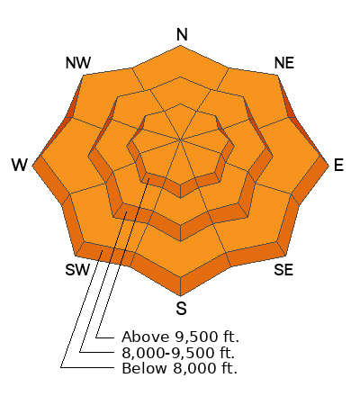
Low
Moderate
Considerable
High
Extreme
Learn how to read the forecast here
Special Announcements
The Utah Avalanche Center is sad to report that two skiers were caught and buried in a large avalanche in Upper Weber Canyon in the Uintas yesterday. One skier was successfully rescued and survived. Sadly, the other skier was buried deeper and did not survive. A preliminary report is available HERE.
Please consider DONATING TO THE SPRING CAMPAIGN to help our team implement innovative tools and better provide you with the information you rely on.
Weather and Snow
Current Conditions: An intense storm is upon us. We picked up 4 to 5 inches of snow so far this morning. Temperatures have been hovering in the mid 20s overnight. Wind from the southwest has been light to moderate in speed overnight.

Mountain Weather: We'll see snow today, heavy at times. It's going to be dense. We could see a foot of snow or more. Weather models are advertising 1.5 to 2 inches of water associated with this storm by Saturday morning. Temperatures are going to be quite warm with readings around 30˚ in the higher terrain. The rain/snow level might be as high as 8000 feet or perhaps higher. Strong southwest wind will develop this afternoon.
Recent Avalanches
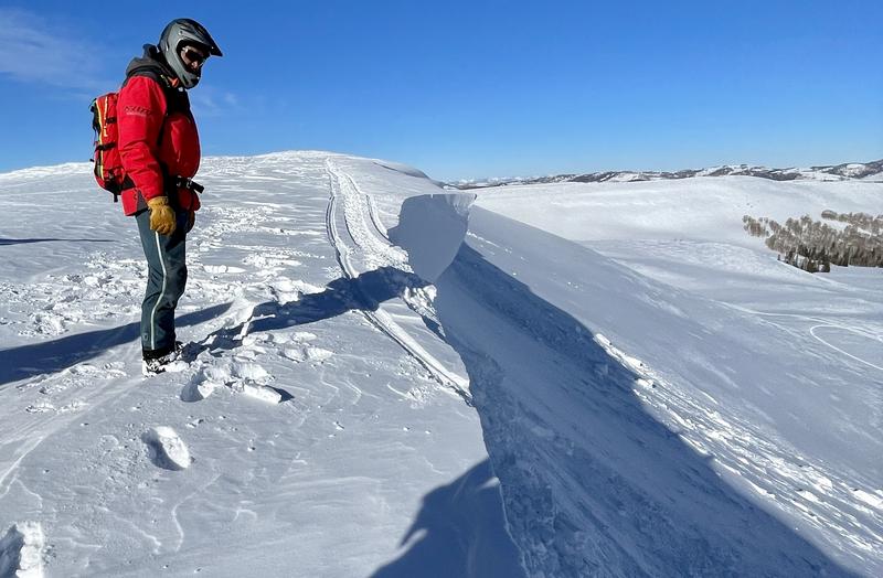
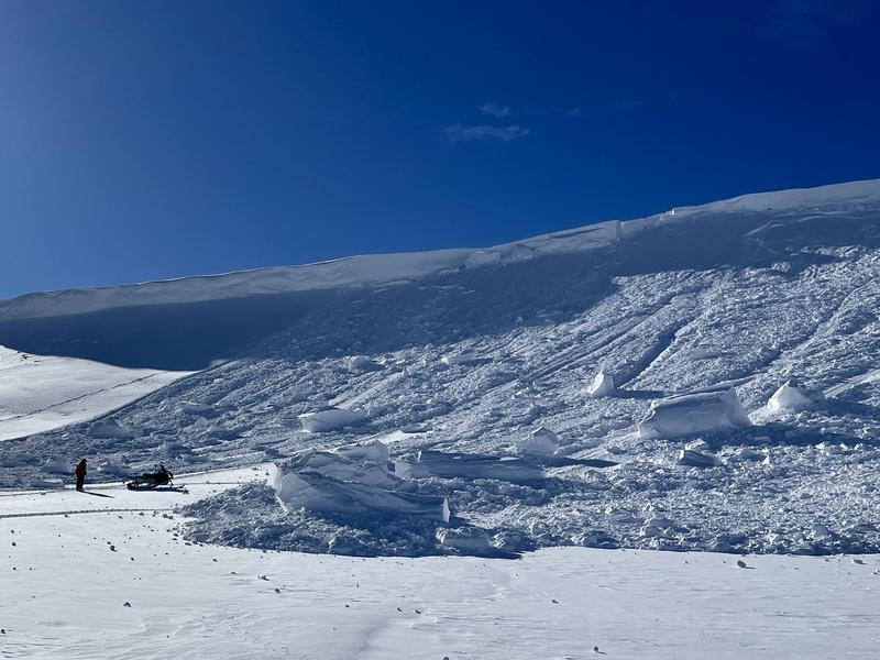
There was a close call on the Skyline Thursday when a snowmobiler was riding too close to a cornice that broke off and took the rider down with it. He deployed his airbag and ended up partially buried but without serious injuries. MORE DETAILS HERE
Ad
Avalanche Problem #1
New Snow
Type
Location
Likelihood
Size
Description
To be honest, I'm unsure how today's storm will affect the avalanche conditions. Several factors point to unstable conditions:
  • High precipitation intensity. Anytime snow or rain falls rapidly for several hours; things can become unstable.
  • Strong wind. Wind drifted snow almost always causes unstable conditions.
  • Rain on snow. This could happen at lower elevations and make that terrain become unstable.
HERE'S THE TAKE HOME: This is a much different storm system than what we've had recently. We've had mostly stable avalanche conditions for a long time now. This potentially intense storm could produce dangerous conditions, and we must adjust our habits accordingly. Ratchet things back a bit until the dust settles. You'll want to use caution if you're considering getting into the hills on Saturday.
General Announcements
This forecast is from the U.S.D.A. Forest Service, which is solely responsible for its content. This forecast describes general avalanche conditions and local variations always occur.