Forecast for the Skyline Area Mountains

Brett Kobernik
Issued by Brett Kobernik for
Friday, February 23, 2024
The avalanche danger rating for the Skyline is MODERATE today.
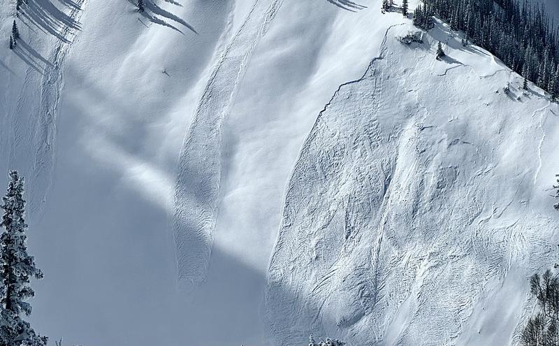
There are areas where lingering unstable snow still exists today.
Scattered human triggered avalanches are possible especially in areas that were exposed to the wind.
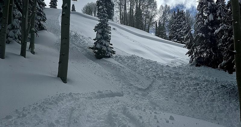
There may be some minor wet avalanche activity on sunny facing slopes and at lower elevations.
Low
Moderate
Considerable
High
Extreme
Learn how to read the forecast here
Weather and Snow
Current Conditions: The new snow from Wednesday was quite dense. It became wet on many slopes on Thursday and you'll find crusts there today. High elevation north facing terrain still holds dry new snow. Temperatures got into the mid to upper 20s on Thursday and dropped into the teens overnight. The wind was light from the west on Thursday and remains fairly light this morning.
Mountain Weather: We have a mostly clear day ahead with temperatures getting into the mid 20s to low 30s. Wind should remain light from the west. Saturday and Sunday look similar. The next storm rolls through Monday night into Tuesday. It looks fairly decent right now.
Recent Avalanches
There was some natural avalanche activity during the storm on Wednesday involving the new snow. These avalanches were on upper elevation steep slopes just below ridges where the wind had been drifting and loading the slopes. Photo below: Pleasant Creek, Wally
There was also a small snowmobile triggered avalanche on Thursday involving the new snow. This was interesting to me because it was lower in a canyon amongst trees where you would not expect the wind to have drifted snow. Photo below: North Creek, Cade Beck
Ad
Avalanche Problem #1
Wind Drifted Snow
Type
Location
Likelihood
Size
Description
All the drifts and slabs that formed during Wednesday's storm are becoming more stable. However, the glue isn't totally dry and you may still find an area where you could trigger something today. It's a little tricky because these will be quite scattered and not all that likely. The good thing is that they are not all that deep. That said, any avalanche that is a foot deep can be dangerous given the right circumstances. If you're getting into steeper terrain today, don't be surprised if you trigger something. The most likely spots are on steep slopes just below ridges and terrain features where the wind has drifted snow into slabs.
General Announcements
This forecast is from the U.S.D.A. Forest Service, which is solely responsible for its content. This forecast describes general avalanche conditions and local variations always occur.