Current Conditions: Conditions are stagnant. We're in a gradual warming trend. High temperatures yesterday were into the mid 20s and overnight lows were in the teens. Wind from the northwest has been decreasing in speed and is generally light.
Mountain Weather: High pressure continues through the end of the week with gradually warming temperatures. We'll see sunny skies today with high temperatures into the upper 20s and light wind from the northwest. Weather looks similar for the rest of the week with a few clouds added in. Unfortunately, the long range outlook is similar to the pattern we've been in. A ridge of high pressure is the prominent feature with the occasional closed low pressure system that attempts to break through. We might see some light snow around New Year's Day as one of these weak storm systems slides through.
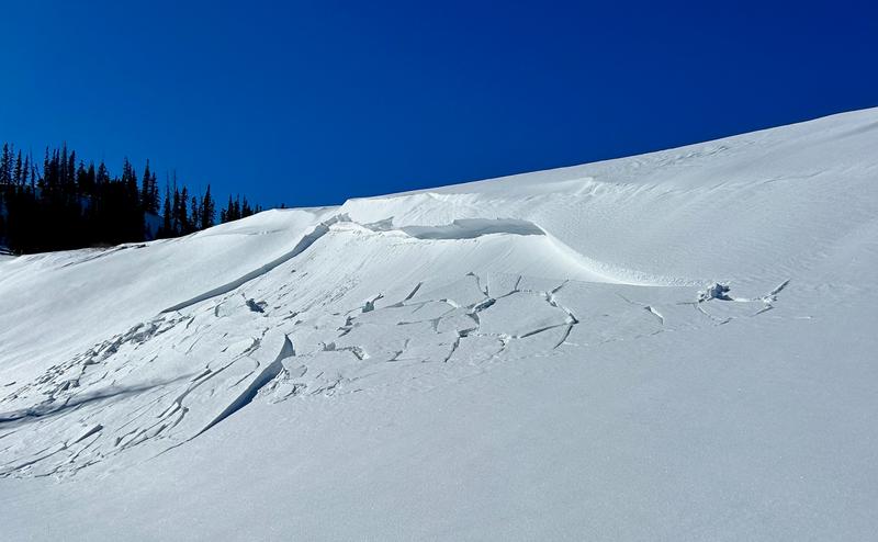
There was a small avalanche reported that most likely released Dec 24 or 25 during a period of stronger wind speeds. It was in the Meadows of Ephraim Canyon. It's a high elevation steep east facing slope just below a ridgeline and is very prone to wind loading. The weak layer is unknown but there's a good chance that this broke into faceted sugary snow. I'll go visit the location today to glean some info.
Photo: Cole Nielson


