Forecast for the Skyline Area Mountains

Issued by Brett Kobernik on
Friday morning, November 30, 2018
Friday morning, November 30, 2018
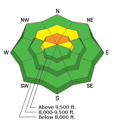
The avalanche danger is CONSIDERABLE on steep slopes above 9500' that face northwest, north and northeast. Old weak snow near the ground may collapse and cause avalanches with the new snow we're receiving. Human triggered avalanches are likely in this terrain.
Outside of the high north facing terrain the avalanche danger is LOW to MODERATE.

Low
Moderate
Considerable
High
Extreme
Learn how to read the forecast here


