Forecast for the Skyline Area Mountains

Issued by Brett Kobernik on
Thursday morning, November 29, 2018
Thursday morning, November 29, 2018
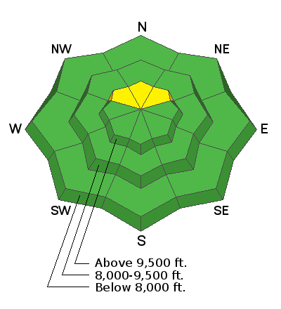
ANTICIPATE A RISING AVALANCHE DANGER THROUGH THE WEEKEND! The danger will be most pronounced on steep slopes above 9500' in elevation that face northwest, north and northeast. These are slopes that have weak snow near the ground from October and early November.
Today the avalanche danger is MODERATE in the high north facing terrain. Outside of the high north facing terrain the avalanche danger is LOW.

Low
Moderate
Considerable
High
Extreme
Learn how to read the forecast here


